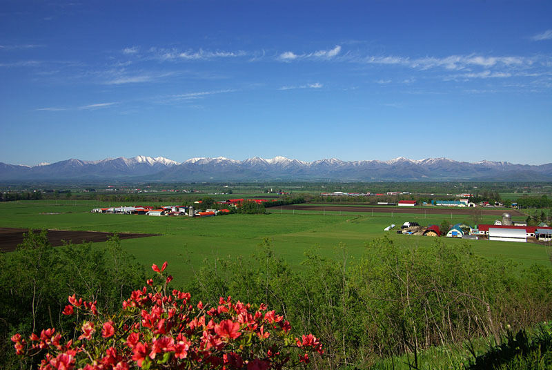
Hokkaido, Japan’s northernmost island, is known for its vast agricultural lands, where crops such as rice, wheat, corn, and potatoes are cultivated. The region experiences a distinct climate, with long, cold winters and short, cool summers, which influence farming practices. To optimize agricultural output in this challenging environment, farmers in Hokkaido are increasingly turning to satellite data to monitor crop health, soil conditions, and environmental factors. In this article, we explore how satellite data is used to enhance farming practices in Hokkaido.
Crop Monitoring and Disease Detection with Satellite Data
Hokkaido’s farmers face challenges in managing crop health, particularly given the region’s unique climatic conditions. Satellite data helps monitor crop conditions from planting to harvest by providing high-resolution imagery. Using vegetation indices such as NDVI (Normalized Difference Vegetation Index), farmers can assess the health of their crops and detect early signs of disease or pest infestations. This is particularly important in Hokkaido, where the short growing season leaves little room for crop recovery. By detecting problems early, farmers can implement targeted interventions, such as pesticide applications or soil amendments, to mitigate the impact of pests or diseases on crop yields.
Precision Farming with Soil Moisture and Temperature Data
Soil moisture and temperature are critical factors influencing crop growth, especially in Hokkaido, where variations in weather conditions can lead to inconsistent rainfall patterns. Satellite-based sensors can provide real-time data on soil moisture levels, helping farmers optimize irrigation schedules and prevent water waste. This precision farming technique ensures that crops receive the right amount of water at the right time, leading to better crop performance and resource management.
Additionally, temperature data from satellites helps farmers track the microclimates within their fields. This is important in Hokkaido, where temperature differences between valleys and mountains can significantly affect crop growth. By understanding these variations, farmers can adapt their farming practices to local conditions, selecting the best crops for each area and adjusting planting times to maximize yields.
Monitoring Seasonal Changes and Crop Timing
Hokkaido’s agricultural success depends heavily on timing, especially considering its short growing season. Satellite data helps farmers track seasonal changes, including the onset of spring thaw and the arrival of frost, which are crucial for determining planting and harvest times. For example, by analyzing satellite images, farmers can determine when the soil has warmed sufficiently for planting or when frost is likely to affect sensitive crops like potatoes or corn.
Additionally, satellite data enables farmers to track the development of crops over time, providing insights into the optimal harvesting period. With this information, farmers can make more accurate decisions regarding the timing of their harvest, which is crucial for maximizing crop quality and yield.
Yield Prediction and Supply Chain Optimization
Satellite data is also valuable for predicting crop yields, a crucial aspect of farm management in Hokkaido. By using satellite imagery to monitor crop growth and development, farmers can estimate the expected yield for different crops well before harvest. This information helps farmers make informed decisions about crop management, such as when to start harvesting or how to allocate resources.
Accurate yield predictions also benefit the broader agricultural supply chain, from transportation and storage to market pricing. By providing advance insights into expected harvests, satellite data helps farmers, cooperatives, and distributors plan more efficiently, reducing the risk of overproduction or shortages.
Assessing the Impact of Climate Change on Agriculture
Hokkaido is experiencing changes in climate patterns, such as warmer winters and more unpredictable weather, which can have significant impacts on agriculture. Satellite data is crucial for assessing these changes and understanding their impact on farming practices. By tracking long-term changes in vegetation patterns, soil moisture, and temperature, satellite data provides valuable insights into how climate change is affecting crop growth and agricultural productivity in Hokkaido.
Farmers can use this information to adapt their farming practices, such as adjusting planting dates, changing irrigation schedules, or selecting new crop varieties that are better suited to the changing climate. Additionally, satellite data allows for monitoring of extreme weather events such as floods or droughts, which can have devastating effects on crops. By providing early warnings, satellite data helps farmers prepare for and mitigate the impacts of these events.
Conclusion
In Hokkaido, satellite data is revolutionizing agriculture by providing farmers with valuable insights into crop health, soil conditions, climate changes, and yield predictions. By harnessing this technology, farmers can make data-driven decisions that improve productivity, optimize resource use, and enhance sustainability. As climate change and environmental factors continue to influence agriculture in the region, satellite data will play an increasingly important role in helping Hokkaido’s farmers adapt to these challenges and ensure food security for the future.