The Chugoku region, located in western Honshu, is known for its diverse agricultural landscape, from the fertile plains of Okayama to the mountainous areas of Tottori and Shimane. The region is home to various specialty crops such as Okayama white peaches, Hiroshima oysters, Yamaguchi pufferfish, Tottori pears, and high-quality rice.
With the challenges of climate change, labor shortages, and the need for higher efficiency, satellite data is playing a crucial role in supporting sustainable and precision agriculture in the Chugoku region. This article explores how satellite technology is transforming the production of Chugoku’s specialty agricultural products.
Monitoring Okayama White Peaches for Quality Control
Okayama Prefecture is famous for its white peaches, which are highly valued for their sweetness and delicate texture. These peaches require specific growing conditions, including well-regulated soil moisture, optimal temperature, and protection from extreme weather events.
Satellite data is helping farmers monitor their orchards by analyzing soil moisture levels, vegetation health, and temperature variations. By using NDVI (Normalized Difference Vegetation Index) and thermal imaging, farmers can identify areas in need of irrigation or shade adjustments.
Additionally, early detection of heat stress or disease outbreaks through remote sensing allows for timely interventions, ensuring that the peaches maintain their premium quality.
Optimizing Tottori Pear Orchards with Remote Sensing
Tottori is known for its high-quality pears, particularly the Nijisseiki (20th Century) pear, which is a crisp and juicy variety. To maintain consistent fruit quality, precision agriculture techniques are being integrated with satellite data to monitor tree health and fruit development.
Satellite imagery helps track chlorophyll content in leaves, indicating nutrient levels and potential deficiencies. Additionally, multispectral data assists in optimizing irrigation schedules, preventing over- or under-watering, which can impact fruit size and sweetness.
By combining satellite data with on-the-ground sensors, farmers can better manage their orchards, reducing waste and improving harvest yields.
Enhancing Rice Production in the Chugoku Region
Rice farming is a significant part of agriculture in Chugoku, with areas like the San’in region producing high-quality rice varieties. With the increasing risk of climate variability, satellite technology is being used to monitor water availability and soil health in rice paddies.
Radar-based satellite imagery, such as from Sentinel-1, can track water levels in flooded rice fields, ensuring optimal conditions for growth. Additionally, remote sensing can detect early signs of pests and diseases, allowing for targeted pesticide applications that minimize environmental impact.
By utilizing real-time satellite monitoring, farmers can adapt to changing weather patterns and optimize their rice yields while maintaining sustainable farming practices.
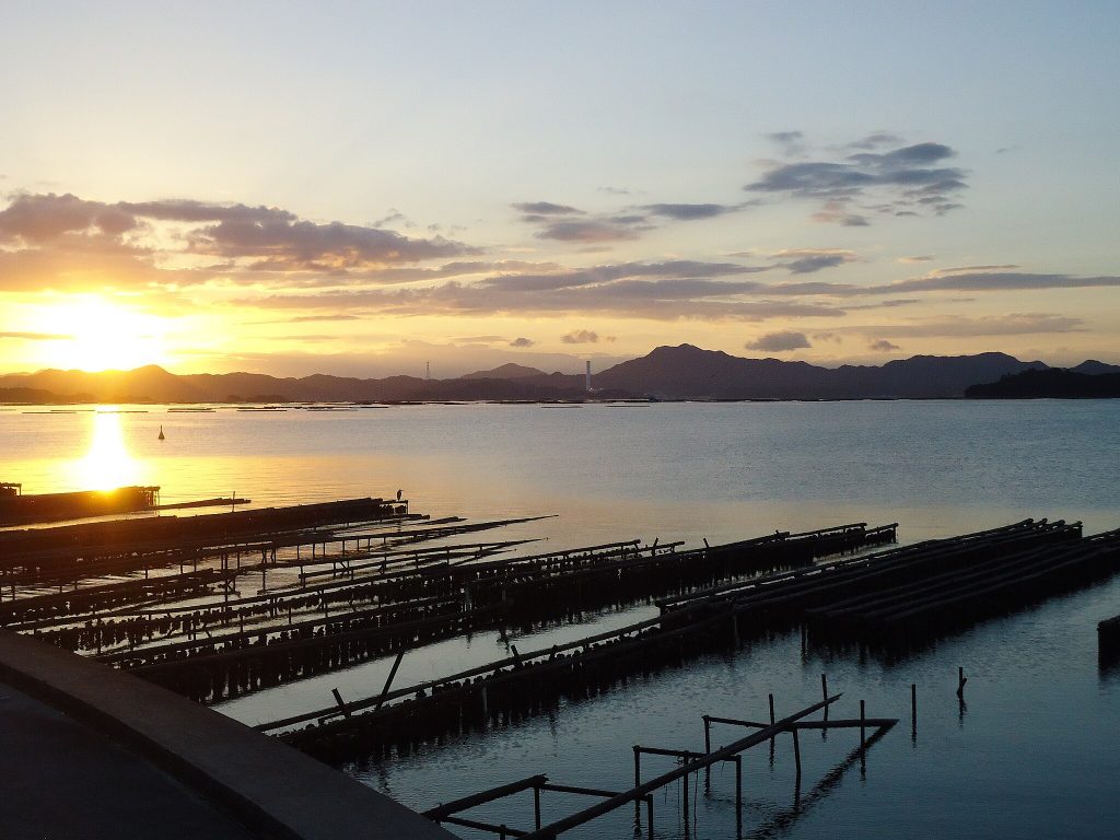
Supporting Oyster Farming in Hiroshima Bay
While not a crop in the traditional sense, oyster farming in Hiroshima Bay is an important part of the region’s aquaculture industry. Satellite data is playing a role in monitoring sea surface temperatures, water quality, and algal bloom occurrences, all of which affect oyster growth and health.
Using satellite-based chlorophyll concentration maps, oyster farmers can predict when algae levels may become harmful. Additionally, real-time temperature tracking helps optimize harvesting times, ensuring the best flavor and texture for Hiroshima oysters.
By integrating satellite data with traditional aquaculture practices, Hiroshima’s oyster industry can maintain its high standards and sustainability.
Managing Climate Change Challenges with Satellite Data
The Chugoku region faces various climate-related challenges, including typhoons, heavy rainfall, and periods of drought. These weather events can severely impact specialty crops and agricultural productivity.
Satellite-based weather forecasting allows farmers to anticipate extreme weather and take preventive measures, such as reinforcing protective nets for fruit orchards or adjusting irrigation systems before drought conditions set in.
Additionally, long-term climate trend analysis using satellite data can help policymakers and farmers develop adaptation strategies, such as shifting planting seasons or selecting more resilient crop varieties.
Conclusion
The integration of satellite data into Chugoku’s agricultural sector is revolutionizing how specialty crops are cultivated. From optimizing Okayama’s white peach orchards and Tottori’s pear farms to improving rice production and supporting Hiroshima’s oyster industry, remote sensing technology is enhancing efficiency, sustainability, and resilience.
As climate challenges and resource constraints continue to impact farming, leveraging satellite-based precision agriculture will be key to ensuring the long-term success of Chugoku’s agricultural heritage. By combining traditional knowledge with cutting-edge satellite analytics, the region can continue to thrive in the modern agricultural landscape.