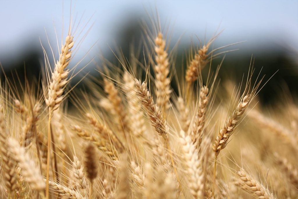
Wheat is one of the world’s most important staple crops, crucial for food security and economic stability across the globe. With the increasing pressures of climate change, soil degradation, and the growing demand for higher productivity, modernizing wheat farming practices has become essential. One of the most promising innovations in agricultural technology is the use of satellite data. By leveraging satellite imagery and remote sensing, wheat farmers can gain critical insights into their crops, optimize resource use, and enhance yield prediction. This article explores how satellite data is revolutionizing wheat cultivation.
Monitoring Wheat Health with Vegetation Indices
One of the primary ways satellite data benefits wheat farming is through the monitoring of crop health. Vegetation indices, such as the Normalized Difference Vegetation Index (NDVI), are commonly used to assess the health of crops from space. NDVI measures the amount of green vegetation, which can provide valuable insights into the crop’s vigor and growth stage.
For wheat farmers, monitoring NDVI helps identify areas of the field where crops may be underperforming due to factors such as nutrient deficiencies, pest infestations, or water stress. Early detection of these issues allows farmers to take corrective actions promptly, leading to healthier crops and optimized yields. This satellite-driven approach can reduce the need for labor-intensive field surveys and help farmers focus their resources where they are most needed.
Optimizing Irrigation with Soil Moisture Data
Water is a critical resource for wheat cultivation, and efficient irrigation is key to maximizing yields. However, over-irrigation or under-irrigation can negatively impact crop growth and waste valuable water resources. Satellite data can provide accurate information about soil moisture levels across vast fields, allowing farmers to optimize their irrigation strategies.
By combining satellite-based soil moisture data with ground-based sensors, farmers can precisely determine when and where to irrigate. This precision irrigation minimizes water usage and ensures that wheat crops receive the ideal amount of water at the right time. Satellite data also enables farmers to monitor soil conditions over large areas, making it easier to manage water resources effectively, especially in regions prone to drought or inconsistent rainfall.
Enhancing Yield Prediction and Forecasting
Accurate yield prediction is crucial for both farmers and supply chain stakeholders. Traditional methods of yield estimation, such as visual field inspections or historical yield data, can be unreliable and labor-intensive. Satellite data offers a more accurate and scalable solution for predicting wheat yields.
By analyzing satellite images throughout the growing season, including key growth stages such as germination, tillering, flowering, and maturation, farmers can assess the overall health of the crop and make more informed predictions about the harvest. Satellite data, when combined with advanced machine learning algorithms, can also help forecast yields at the regional or national level, providing valuable insights for market planning and food security assessments.
Detecting Pests and Diseases Early
Wheat crops are susceptible to various pests and diseases, including wheat rust, aphids, and other pathogens that can devastate yields if left unchecked. Early detection of pest and disease outbreaks is crucial for mitigating damage and minimizing the need for pesticides.
Satellite-based remote sensing can help identify early signs of pest or disease infestations by detecting changes in crop color, texture, and temperature. For example, areas affected by disease may exhibit discoloration or stunted growth, which can be picked up by multispectral imaging. By regularly monitoring crops from space, farmers can identify these issues before they spread, allowing for more targeted pesticide applications and reducing the overall chemical use on farms.
Managing Soil Health with Satellite Data
Soil health is a critical factor in ensuring sustainable wheat production. Healthy soils support strong root development, enhance water retention, and provide essential nutrients to crops. However, soil degradation, erosion, and nutrient depletion are common challenges that can impact wheat yields.
Satellite data can help farmers monitor soil conditions, including organic matter content, soil texture, and moisture levels. By combining satellite imagery with soil health data, farmers can identify areas of the field that require additional soil treatments or amendments, such as fertilization or lime application. This targeted approach to soil management not only enhances wheat productivity but also promotes sustainable farming practices by reducing the need for excessive chemical inputs.
Monitoring Weather Patterns and Climate Change Impact
Climate change is having a profound impact on global agriculture, and wheat cultivation is no exception. Rising temperatures, unpredictable rainfall patterns, and the increased frequency of extreme weather events such as droughts or floods pose significant challenges for wheat farmers. Satellite data plays a crucial role in helping farmers understand and adapt to these changing conditions.
By analyzing long-term weather patterns and tracking real-time data on temperature, precipitation, and other climate variables, satellite technology can provide valuable insights into how climate change is affecting wheat cultivation. Farmers can use this information to adjust planting schedules, select more resilient wheat varieties, or modify irrigation practices to cope with changing conditions. Furthermore, satellite data can help predict extreme weather events, giving farmers a chance to implement preventative measures before significant damage occurs.
Improving Fertilizer Efficiency and Reducing Environmental Impact
The use of fertilizers is essential for maximizing wheat yields, but excessive application can lead to environmental pollution, soil degradation, and increased production costs. Satellite data can help optimize fertilizer use by identifying areas of the field that require more nutrients and those that do not.
By monitoring the crop’s nitrogen content and comparing it to satellite imagery of vegetation health, farmers can determine the most effective fertilizer application rates for different sections of the field. This approach minimizes over-fertilization, reduces environmental impacts such as runoff and water pollution, and lowers input costs. Satellite data-driven precision farming practices are an essential tool for achieving sustainable wheat production in the face of rising environmental concerns.
Conclusion
The integration of satellite data into wheat cultivation offers significant benefits for farmers, providing them with valuable insights into crop health, soil conditions, irrigation needs, and pest management. By embracing remote sensing technologies, wheat farmers can optimize their practices, reduce resource usage, and improve overall productivity.
As the agricultural industry continues to face challenges such as climate change, water scarcity, and the need for higher yields to feed a growing global population, satellite data will play an increasingly important role in ensuring that wheat farming remains efficient, sustainable, and resilient. The continued advancement of satellite technology and its applications in agriculture promises to revolutionize wheat cultivation and contribute to global food security.