Canterbury, located on the South Island of New Zealand, is one of the country’s most important agricultural regions. Known for its fertile soils and temperate climate, Canterbury has a strong reputation for producing a wide variety of crops, including wheat. As one of the top wheat-producing areas in New Zealand, the region’s farmers face unique challenges and opportunities that can be addressed using satellite data to optimize wheat production. This article delves into the specific role of Canterbury in wheat farming and how satellite technology is being utilized to improve productivity and sustainability in the region.
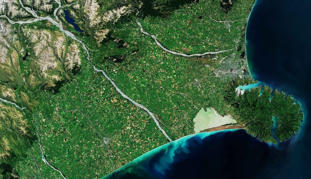
Canterbury’s Wheat Growing Environment
Canterbury is known for its flat, expansive plains, which are ideal for large-scale farming. The region benefits from a temperate climate, characterized by moderate rainfall and relatively mild winters. However, it also faces some challenges, particularly in the areas of water management, wind erosion, and variable weather patterns that can impact the timing of planting and harvesting.
Key Features of Wheat Farming in Canterbury:
- Irrigation: Canterbury relies heavily on irrigation for crop production, with water sourced from rivers and underground aquifers. Efficient water management is crucial for maintaining healthy crops, particularly during dry spells in the summer months.
- Soil Health: The region has fertile soils, but there are ongoing concerns about maintaining soil health, particularly in terms of moisture retention and erosion.
- Climate: While Canterbury benefits from a relatively mild climate, the region is not immune to extreme weather events, such as droughts or unseasonal frosts, which can affect the timing of wheat cultivation.
With these challenges in mind, satellite data has become an essential tool for farmers in Canterbury, helping them to monitor various environmental factors and make informed decisions throughout the wheat-growing season.
Satellite Data for Irrigation Management
In Canterbury, irrigation plays a critical role in maintaining healthy wheat crops, especially in dry years. Satellite data is invaluable for helping farmers manage water use efficiently, ensuring that crops receive the right amount of water at the right time.
Key Applications for Irrigation:
- Soil Moisture Monitoring: Satellites equipped with remote sensing technology provide real-time data on soil moisture levels across large areas. This helps farmers monitor the water status of their wheat fields and make more accurate decisions about when and where to irrigate.
- Precision Irrigation: Satellite imagery helps identify areas within the wheat field that may be over-irrigated or under-irrigated. By using this data, farmers can adjust irrigation schedules and focus water resources on the areas that need it most, leading to water conservation and reduced costs.
- Water Stress Detection: Satellite-based vegetation indices, such as the Normalized Difference Vegetation Index (NDVI), can detect early signs of water stress in wheat crops. Farmers can use this information to address irrigation needs before crop yields are impacted.
By utilizing satellite data, Canterbury’s wheat farmers can optimize irrigation, reduce water waste, and improve crop health, even in the face of variable weather conditions.
Monitoring Wheat Crop Health and Growth
Canterbury’s wheat farmers need to carefully monitor their crops throughout the growing season to identify any signs of stress or disease that could impact yields. Satellite data offers a powerful tool for monitoring crop health, allowing farmers to detect problems early and take corrective actions.
Key Applications for Crop Health Monitoring:
- Vegetation Indices: Satellites can capture vegetation indices, such as NDVI, which provide a snapshot of the overall health of wheat crops. NDVI measures the amount of green vegetation, helping farmers assess whether the crops are thriving or showing signs of stress due to factors such as drought, pests, or disease.
- Disease and Pest Detection: Early detection of diseases like wheat rust or pest infestations (e.g., aphids) is essential to minimizing damage. Satellite imagery allows farmers to monitor subtle changes in crop color or canopy density that may indicate the presence of pests or diseases.
- Nutrient Deficiencies: Satellite data can also be used to identify areas of the field with potential nutrient deficiencies, which can manifest in changes to the color and density of the crop. By using this data, farmers can apply fertilizers more efficiently and target areas with specific nutrient needs.
By tracking crop health with satellite technology, farmers in Canterbury can ensure their wheat crops are well-managed throughout the growing season, resulting in healthier, higher-yielding crops.
Assessing Soil Conditions and Erosion Risks
Soil health is a major concern for wheat farmers in Canterbury, especially when it comes to erosion. With its flat terrain, Canterbury is vulnerable to wind and water erosion, which can degrade soil quality and reduce agricultural productivity. Satellite data provides farmers with valuable insights into soil conditions, allowing them to address erosion risks and maintain long-term soil fertility.
Key Applications for Soil Monitoring:
- Soil Moisture and Texture: Satellite data can help monitor soil moisture levels and texture across large areas. This information allows farmers to assess whether the soil is prone to compaction or erosion and take action to mitigate these risks.
- Erosion Detection: Using satellite imagery, farmers can identify areas of the field that are most susceptible to erosion, particularly along field edges or in regions with little vegetation cover. This helps farmers implement soil conservation measures, such as planting cover crops or creating windbreaks, to prevent further erosion.
- Soil Health Assessment: Regular satellite monitoring of soil conditions enables farmers to track changes in soil health over time. By identifying trends in soil moisture or texture, farmers can adopt practices such as crop rotation or cover cropping to improve soil quality.
By using satellite data to monitor soil health and erosion risks, farmers in Canterbury can protect their land and maintain sustainable wheat production for the long term.
Yield Forecasting and Market Planning
In Canterbury, as in other agricultural regions, accurate yield forecasting is essential for effective planning, logistics, and marketing. By using satellite data to track the growth and health of wheat crops throughout the season, farmers can predict yields more accurately and plan accordingly.
Key Applications for Yield Forecasting:
- Growth Stage Monitoring: Satellites can track the growth stages of wheat crops, providing valuable information about the timing of flowering, grain filling, and maturity. This data allows farmers to predict harvest timing with greater precision, improving planning and logistics.
- Biomass Estimation: Satellite data can also be used to estimate crop biomass, which is directly correlated with yield potential. By monitoring biomass accumulation, farmers can estimate expected yields and make more informed decisions about harvest timing and resource management.
- Market Planning: Accurate yield forecasting through satellite data helps farmers align their harvest schedules with market demand. By predicting the amount of wheat they are likely to produce, farmers can better negotiate contracts with buyers and ensure that their product is in demand.
Satellite-based yield forecasting enables farmers in Canterbury to optimize their harvest planning and ensure they can meet market demand, improving their profitability and supply chain management.
Conclusion
Canterbury plays a crucial role in New Zealand’s wheat production, and satellite data is transforming the way wheat farmers in the region manage their crops. From optimizing irrigation and monitoring crop health to assessing soil conditions and predicting yields, satellite technology helps Canterbury’s wheat farmers make data-driven decisions that improve efficiency, conserve resources, and increase profitability.
As the agricultural industry faces increasing challenges due to climate change, satellite data will continue to be an invaluable tool for ensuring the sustainability and success of wheat production in Canterbury. By adopting advanced technologies like remote sensing and satellite-based monitoring, Canterbury’s wheat farmers can maintain high yields, preserve soil health, and contribute to the region’s long-term agricultural success.