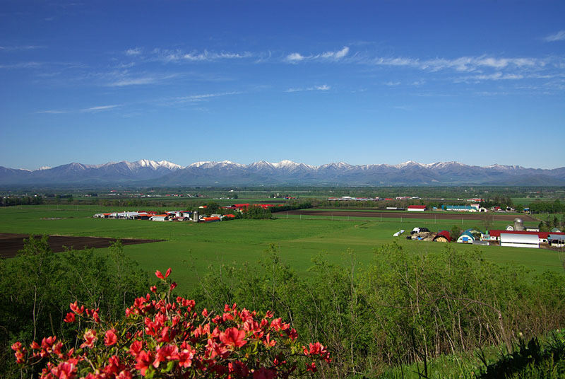
Hokkaido, Japan’s northernmost island, is known for its vast agricultural lands, where crops such as rice, wheat, corn, and potatoes are cultivated. The region experiences a distinct climate, with long, cold winters and short, cool summers, which influence farming practices. To optimize agricultural output in this challenging environment, farmers in Hokkaido are increasingly turning to satellite data to monitor crop health, soil conditions, and environmental factors. In this article, we explore how satellite data is used to enhance farming practices in Hokkaido.
Crop Monitoring and Disease Detection with Satellite Data
Hokkaido’s farmers face challenges in managing crop health, particularly given the region’s unique climatic conditions. Satellite data helps monitor crop conditions from planting to harvest by providing high-resolution imagery. Using vegetation indices such as NDVI (Normalized Difference Vegetation Index), farmers can assess the health of their crops and detect early signs of disease or pest infestations. This is particularly important in Hokkaido, where the short growing season leaves little room for crop recovery. By detecting problems early, farmers can implement targeted interventions, such as pesticide applications or soil amendments, to mitigate the impact of pests or diseases on crop yields.
Precision Farming with Soil Moisture and Temperature Data
Soil moisture and temperature are critical factors influencing crop growth, especially in Hokkaido, where variations in weather conditions can lead to inconsistent rainfall patterns. Satellite-based sensors can provide real-time data on soil moisture levels, helping farmers optimize irrigation schedules and prevent water waste. This precision farming technique ensures that crops receive the right amount of water at the right time, leading to better crop performance and resource management.
Additionally, temperature data from satellites helps farmers track the microclimates within their fields. This is important in Hokkaido, where temperature differences between valleys and mountains can significantly affect crop growth. By understanding these variations, farmers can adapt their farming practices to local conditions, selecting the best crops for each area and adjusting planting times to maximize yields.
Monitoring Seasonal Changes and Crop Timing
Hokkaido’s agricultural success depends heavily on timing, especially considering its short growing season. Satellite data helps farmers track seasonal changes, including the onset of spring thaw and the arrival of frost, which are crucial for determining planting and harvest times. For example, by analyzing satellite images, farmers can determine when the soil has warmed sufficiently for planting or when frost is likely to affect sensitive crops like potatoes or corn.
Additionally, satellite data enables farmers to track the development of crops over time, providing insights into the optimal harvesting period. With this information, farmers can make more accurate decisions regarding the timing of their harvest, which is crucial for maximizing crop quality and yield.
Yield Prediction and Supply Chain Optimization
Satellite data is also valuable for predicting crop yields, a crucial aspect of farm management in Hokkaido. By using satellite imagery to monitor crop growth and development, farmers can estimate the expected yield for different crops well before harvest. This information helps farmers make informed decisions about crop management, such as when to start harvesting or how to allocate resources.
Accurate yield predictions also benefit the broader agricultural supply chain, from transportation and storage to market pricing. By providing advance insights into expected harvests, satellite data helps farmers, cooperatives, and distributors plan more efficiently, reducing the risk of overproduction or shortages.
Assessing the Impact of Climate Change on Agriculture
Hokkaido is experiencing changes in climate patterns, such as warmer winters and more unpredictable weather, which can have significant impacts on agriculture. Satellite data is crucial for assessing these changes and understanding their impact on farming practices. By tracking long-term changes in vegetation patterns, soil moisture, and temperature, satellite data provides valuable insights into how climate change is affecting crop growth and agricultural productivity in Hokkaido.
Farmers can use this information to adapt their farming practices, such as adjusting planting dates, changing irrigation schedules, or selecting new crop varieties that are better suited to the changing climate. Additionally, satellite data allows for monitoring of extreme weather events such as floods or droughts, which can have devastating effects on crops. By providing early warnings, satellite data helps farmers prepare for and mitigate the impacts of these events.
Conclusion
In Hokkaido, satellite data is revolutionizing agriculture by providing farmers with valuable insights into crop health, soil conditions, climate changes, and yield predictions. By harnessing this technology, farmers can make data-driven decisions that improve productivity, optimize resource use, and enhance sustainability. As climate change and environmental factors continue to influence agriculture in the region, satellite data will play an increasingly important role in helping Hokkaido’s farmers adapt to these challenges and ensure food security for the future.
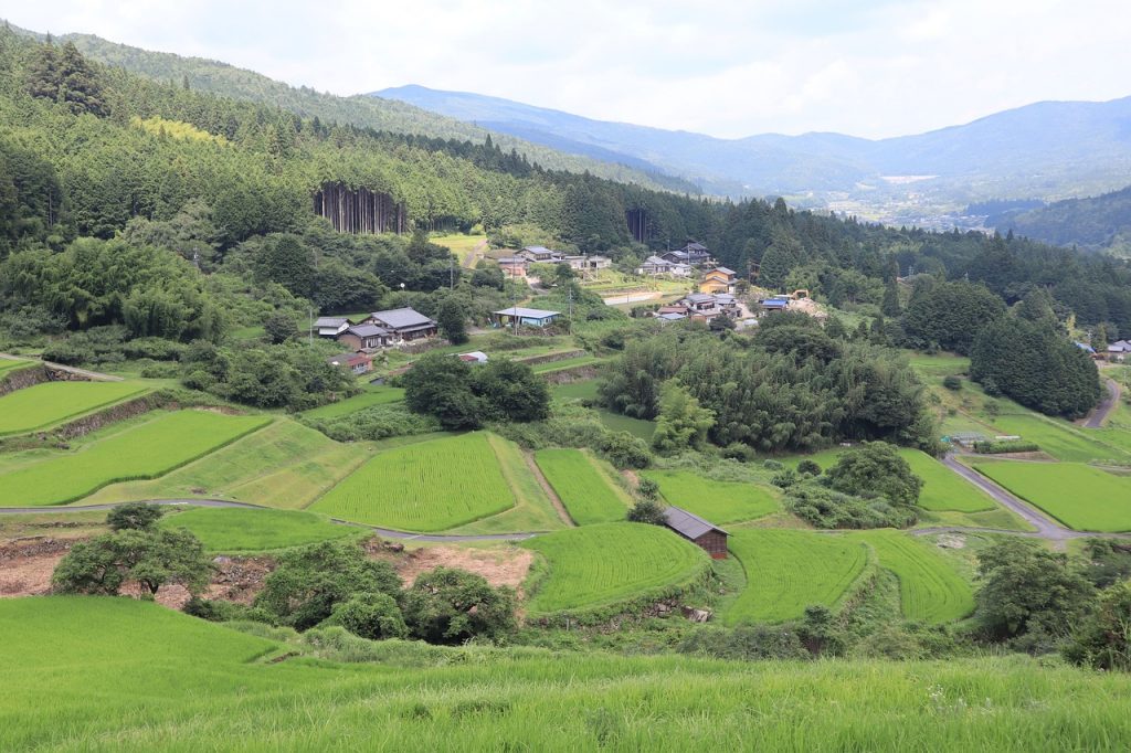
Satellite data has become a crucial tool in modern agriculture, enabling farmers to make better decisions, optimize resources, and improve yields. In Japan, where land is limited and environmental conditions can be challenging, satellite data offers valuable insights into crop health, soil moisture, weather patterns, and more. This article explores the use of Remotely sensed data in Japanese agriculture and how it benefits both farmers and stakeholders in the agricultural sector.
Monitoring Crop Health with Satellite Data
Satellite imagery, such as data from Landsat or Sentinel-2, provides a comprehensive view of crop health across vast areas. In Japan, where rice and other crops are cultivated in regions with varied topographies, monitoring crop health from space allows farmers to detect issues like nutrient deficiencies, pest infestations, or diseases at an early stage. Vegetation indices like NDVI (Normalized Difference Vegetation Index) are used to assess the health and vitality of crops, providing valuable information for precision farming practices.
Optimizing Irrigation Practices
Water management is a critical issue for farmers, especially in dry regions or areas with inconsistent rainfall patterns. By using remotely sensed data on soil moisture and weather conditions, farmers can optimize irrigation schedules. The Japan Meteorological Agency (JMA) uses satellite-based observations to track weather and predict droughts or heavy rainfall, allowing farmers to adjust irrigation systems accordingly. This reduces water wastage and ensures that crops receive the right amount of water at the right time.
Crop Yield Estimation
Estimating crop yields before harvest is essential for agricultural planning and market forecasting. Satellite data enables accurate crop yield predictions based on variables such as weather, soil conditions, and crop growth patterns. In Japan, this information can be used by farmers, government agencies, and market analysts to predict harvests and manage supply chains effectively. Accurate yield estimates can also help prevent market volatility and ensure food security.
Disaster Management and Risk Assessment
Japan is prone to natural disasters such as typhoons, earthquakes, and floods, which can have devastating effects on agriculture. Satellite data plays a crucial role in disaster management by providing real-time information about damage to crops and infrastructure. For example, after a typhoon, satellite images can be analyzed to assess the extent of crop loss and guide recovery efforts. Furthermore, satellite data is used in risk assessment models to predict the likelihood of future disasters and prepare farmers for potential risks.
Enhancing Sustainability in Agriculture
Sustainability is a key focus in Japanese agriculture, especially with concerns about climate change and environmental degradation. Satellite data can help farmers implement sustainable practices by providing insights into soil health, crop rotation, and land use. By monitoring changes in vegetation and land cover over time, satellite data can inform decisions about sustainable farming practices that reduce the environmental impact and promote long-term agricultural productivity.
Conclusion
The use of satellite data in agriculture is transforming farming practices in Japan. By providing detailed insights into crop health, water usage, yield predictions, and disaster management, satellite data empowers farmers to make data-driven decisions that enhance productivity and sustainability. As technology continues to advance, the potential for satellite data to revolutionize agriculture in Japan is vast, helping to ensure food security and environmental resilience in the face of growing challenges.
Gisborne, located on the northeastern coast of New Zealand’s North Island, is known for its lush farmlands, fertile soils, and its significant role in the country’s horticulture and agriculture industries. With its ideal climate for growing crops such as kiwifruit, grapes, and avocados, Gisborne has become a key player in New Zealand’s agriculture sector. As the industry faces the challenges of climate variability, sustainability, and increasing demand, satellite data is emerging as a powerful tool to help farmers in Gisborne optimize their operations and secure a prosperous future.
Enhancing Kiwifruit Production with Satellite Data
Kiwifruit is one of the key exports from Gisborne, and the region is a significant contributor to New Zealand’s kiwifruit industry. Satellite data is revolutionizing how kiwifruit growers manage their orchards by providing real-time information on crop health, irrigation needs, and pest management.
Crop Health Monitoring: Using satellite imagery, farmers can monitor the health of their kiwifruit vines by analyzing vegetation indices like NDVI. This enables the detection of stress early on, whether it’s from diseases, nutrient deficiencies, or water stress. This proactive approach helps farmers take timely action, ensuring that their crops thrive and are ready for harvest.
Pest and Disease Control: Gisborne’s warm climate can be conducive to the growth of pests and diseases that affect kiwifruit production. Satellite data, when combined with ground-based monitoring systems, can help track pest activity and disease outbreaks, enabling farmers to apply pest control measures only when necessary, reducing the use of chemicals and minimizing their environmental impact.
Optimizing Vineyard Management
Gisborne is also known for its vineyards, particularly its production of white wines such as Chardonnay. With the region’s rapidly changing climate and growing demand for high-quality wines, vineyard managers are turning to satellite data to make more informed decisions about their crops.
Precision Viticulture: Satellite imagery allows vineyard managers to monitor the condition of their vines throughout the growing season. By examining factors like soil moisture, vegetation density, and plant health, farmers can identify the best times to irrigate, prune, or harvest. This data-driven approach ensures that vines receive the right care at the right time, improving the quality of the wine.
Climate Adaptation: With the effects of climate change becoming more pronounced, Gisborne’s wine growers are increasingly focused on adapting their practices to changing weather patterns. Satellite data provides valuable insights into temperature trends, rainfall patterns, and other climatic factors that influence grape production. By analyzing this data, vineyard managers can adjust planting schedules, select appropriate grape varieties, and even manage the microclimates within their vineyards to maintain consistent wine quality.
Sustainable Avocado Farming
The avocado industry has exploded in recent years, and Gisborne’s warm and sunny climate makes it a prime location for growing this popular fruit. Satellite data is helping avocado farmers in the region adopt more sustainable farming practices that enhance productivity while minimizing environmental impact.
Water Management: Avocados are highly sensitive to water stress, and efficient irrigation is essential for maintaining healthy crops. Satellite data provides farmers with detailed insights into soil moisture levels across their orchards, helping them optimize irrigation schedules. By applying water only where and when it’s needed, farmers can reduce water waste and ensure that their trees are consistently healthy.
Nutrient Management: Satellite imagery can also be used to assess the nutrient levels in avocado orchards. By identifying areas with nutrient deficiencies, farmers can apply fertilizers more efficiently, ensuring that their trees receive the right nutrients for optimal growth. This targeted approach helps to reduce the environmental impact of fertilizer use while improving crop yields.
Reducing Environmental Impact with Satellite Monitoring
Sustainability is a key concern for many farmers in Gisborne, particularly as the agricultural industry faces increasing pressure to minimize its environmental footprint. Satellite data is playing a significant role in helping farmers track and manage their environmental impact.
Erosion Control: Gisborne’s hilly terrain can make the region vulnerable to soil erosion, particularly after heavy rainfall. Satellite data allows farmers to monitor soil conditions and identify areas at risk of erosion. This information can be used to implement erosion control measures such as planting cover crops or creating terracing, which help to prevent soil degradation and maintain productive land.
Biodiversity Monitoring: The use of satellite imagery in Gisborne is also aiding in biodiversity conservation. By monitoring land use changes, deforestation, and habitat loss, satellite data helps farmers assess the impact of their agricultural practices on local ecosystems. This can lead to more informed decisions about land management, including the preservation of natural habitats and the integration of biodiversity-friendly practices into farming operations.
Precision Irrigation and Resource Optimization
Efficient use of resources is critical in Gisborne, where water availability can vary throughout the year. Satellite data, combined with ground-based sensors, is enabling farmers to manage irrigation and other resources more efficiently.
Targeted Irrigation: Satellite-based soil moisture monitoring provides farmers with the information they need to apply water precisely, reducing waste and ensuring that crops receive the right amount of irrigation. This approach not only conserves water but also improves crop yields by ensuring that plants are well-watered throughout their growth cycle.
Resource Allocation: Satellite data can also help farmers make more informed decisions about how to allocate resources across their farms. Whether it’s deciding where to plant crops or how to distribute fertilizer, satellite data provides insights that help farmers optimize resource use and reduce costs. This is particularly important in Gisborne, where maximizing the efficiency of farming practices can help support the region’s growing agricultural industry.
Supporting Resilience to Climate Change
Gisborne, like many agricultural regions, faces challenges related to climate change. Satellite data plays a crucial role in helping farmers adapt to these changes and build resilience into their operations.
Extreme Weather Forecasting: With changing weather patterns, farmers in Gisborne are increasingly at risk of extreme events such as droughts, floods, and heatwaves. Satellite-based weather forecasting tools provide early warnings of such events, allowing farmers to take preventive measures, such as adjusting irrigation schedules or protecting vulnerable crops.
Long-Term Climate Data: Satellite data also provides long-term insights into climatic trends, such as shifting rainfall patterns and rising temperatures. This allows farmers to adapt their practices to changing conditions, whether it’s selecting more resilient crop varieties, adjusting planting and harvest schedules, or investing in climate-resilient infrastructure.
Conclusion
Satellite data is transforming agriculture in the Gisborne region by enabling farmers to optimize crop management, conserve resources, and adopt sustainable practices. Whether it’s enhancing kiwifruit production, improving vineyard management, or supporting avocado farmers in their water and nutrient management, the applications of satellite data are diverse and powerful. As climate change continues to impact agriculture globally, satellite data will be an essential tool in helping farmers in Gisborne navigate these challenges, ensuring that the region remains a key player in New Zealand’s agricultural industry for years to come.
The Bay of Plenty, located on the North Island of New Zealand, is one of the country’s most agriculturally productive regions, known for its temperate climate and fertile soil. This area is particularly famous for its horticultural output, including kiwifruit, avocados, and citrus fruits. As climate change and evolving agricultural practices present new challenges, farmers in the Bay of Plenty are increasingly turning to satellite data to optimize their operations, enhance sustainability, and ensure long-term productivity. In this article, we explore various ways in which satellite data is being utilized to revolutionize agriculture in the Bay of Plenty.
Optimizing Kiwifruit Production with Satellite Imagery
The Bay of Plenty is the epicenter of New Zealand’s kiwifruit industry, contributing a significant share to global exports. Kiwifruit is a delicate crop that requires precise management to maintain high quality and yield. Satellite data is becoming an essential tool in helping kiwifruit growers manage their orchards more effectively.
Monitoring Orchard Health: Satellite images can help detect early signs of plant stress, such as water deficits, nutrient deficiencies, or pest damage. By using vegetation indices like NDVI (Normalized Difference Vegetation Index), farmers can spot stressed areas within the orchard and apply targeted interventions, such as localized irrigation or pest control, to address specific problems before they spread.
Yield Prediction: Accurate yield forecasting is crucial for managing inventory and meeting market demand. Satellite data enables farmers to assess the size and health of their kiwifruit crop, providing valuable insights into expected yields. By analyzing growth patterns and canopy coverage, satellite data helps farmers anticipate harvest timing, allowing them to optimize labor, storage, and transportation logistics.
Advancing Avocado Farming with Satellite Technology
The Bay of Plenty is also a key player in New Zealand’s rapidly growing avocado industry. Avocado trees require a lot of care and attention, particularly when it comes to water and nutrient management. Satellite data offers a powerful solution to meet these demands efficiently.
Water Efficiency: Avocado trees are highly sensitive to water stress, which can impact fruit yield and quality. Satellite-based remote sensing allows farmers to monitor soil moisture levels across large orchards, helping to optimize irrigation practices. By providing real-time data on moisture content, satellite systems ensure that water is applied only where and when it’s needed, reducing waste and promoting sustainable farming.
Nutrient Management: Satellite imagery can also help track nutrient deficiencies or imbalances in avocado orchards. Identifying these issues early enables farmers to apply fertilizers precisely where they are needed, promoting healthier trees and higher yields. This approach minimizes the overuse of fertilizers, which is both environmentally friendly and cost-effective.
Precision Horticulture: Enhancing Crop Growth and Disease Control
Horticultural crops in the Bay of Plenty, such as citrus fruits, blueberries, and persimmons, benefit significantly from the insights provided by satellite data. Farmers can make informed decisions about crop management, pest control, and disease prevention using satellite-based tools.
Disease and Pest Monitoring: By analyzing satellite data, farmers can identify areas in their orchards that are more vulnerable to pest infestations or disease outbreaks. Satellite imagery allows for the detection of subtle changes in crop health, such as reduced chlorophyll levels or changes in plant canopy structure, which could indicate the presence of pests or pathogens. Early identification allows for targeted pest control and prevents the spread of disease.
Optimizing Planting and Harvesting: Satellite data also helps farmers plan crop planting and harvesting schedules. By monitoring temperature, soil conditions, and moisture levels, farmers can identify the best planting times to optimize growth and maximize yields. Likewise, by tracking the growth stages of crops, satellite technology can assist with precise harvest timing to ensure peak ripeness and fruit quality.
Managing Environmental Sustainability with Satellite Data
As sustainability becomes a growing priority for the agricultural industry, satellite data is playing an essential role in helping Bay of Plenty farmers manage their environmental impact. From water usage to soil health, satellite monitoring provides a clearer picture of the ecosystem and helps farmers adopt more sustainable practices.
Water Conservation: The Bay of Plenty is home to a range of crops that require significant water inputs. Satellite data, when combined with ground-based sensors, allows farmers to track water usage and assess soil moisture levels with great precision. This helps in reducing water wastage, improving irrigation practices, and ensuring that crops receive just the right amount of water, which is particularly important in times of drought.
Soil Health Monitoring: Soil health is crucial for sustainable farming, and satellite data can be used to monitor soil conditions across large areas. By tracking soil moisture, temperature, and vegetation health, farmers can detect early signs of soil erosion or degradation. This information enables farmers to take action, such as rotating crops, adding organic matter, or implementing conservation practices to preserve the soil’s long-term fertility.
Land Use and Biodiversity Monitoring: Satellite data also aids in tracking changes in land use and monitoring biodiversity in agricultural areas. By detecting land cover changes, such as deforestation or urban expansion, farmers and policymakers can make informed decisions about land management that promote biodiversity conservation and habitat protection.
Climate Change Adaptation and Risk Management
The Bay of Plenty is not immune to the impacts of climate change, with rising temperatures, shifting rainfall patterns, and extreme weather events affecting the region’s agricultural productivity. Satellite data provides farmers with the tools needed to better understand and adapt to these changes.
Weather Forecasting and Extreme Events: Satellite-based weather monitoring systems help farmers prepare for extreme weather events such as heavy rainfall, flooding, or drought. By analyzing weather patterns and providing early warnings, satellite data allows farmers to adjust irrigation schedules, protect crops from storm damage, or harvest crops before adverse weather conditions hit.
Long-Term Climate Trends: Satellite data also provides valuable insights into long-term climate trends, including temperature shifts, changes in precipitation, and rising sea levels. Farmers can use this information to assess the long-term viability of certain crops, choose more resilient varieties, and adjust farming practices to mitigate the risks associated with climate change.
Supply Chain Efficiency and Logistics
In an area as agriculturally rich as the Bay of Plenty, optimizing supply chain logistics is critical for ensuring that produce reaches market efficiently and with minimal waste. Satellite data is helping farmers streamline their operations from farm to table.
Transportation and Storage Optimization: Satellite data helps farmers track crop health and growth stages, enabling them to predict harvest volumes and timing with greater accuracy. This information helps optimize storage facilities and transportation logistics, ensuring that produce is handled efficiently and that waste is minimized. By planning ahead, farmers can avoid oversupply or spoilage, leading to better profitability and sustainability.
Supply Chain Transparency: Satellite data can be used to track produce throughout the supply chain, from the farm to the final consumer. This transparency is crucial for maintaining product quality and ensuring that the produce meets industry standards. It also allows farmers to demonstrate their commitment to sustainable practices, building trust with consumers and enhancing brand reputation.
Conclusion
Satellite data is becoming an indispensable tool for farmers in the Bay of Plenty, helping them optimize their agricultural practices, enhance sustainability, and adapt to the challenges posed by climate change. From improving kiwifruit yields to optimizing irrigation for avocados and managing environmental sustainability, the benefits of satellite data are far-reaching. As technology continues to evolve, farmers in the Bay of Plenty will be able to access even more precise and detailed insights that will empower them to make better decisions, reduce their environmental footprint, and maintain the region’s position as a key player in New Zealand’s agricultural industry.
The Waikato region, located in the central North Island of New Zealand, is one of the country’s most important agricultural areas. Known for its dairy farming, crop production, and pastoral farming, the region relies heavily on innovative technologies to maintain its agricultural output. Satellite data is playing an increasingly significant role in optimizing agricultural practices in Waikato, providing insights that enhance productivity, sustainability, and resource management. In this article, we’ll explore the ways satellite technology is transforming agriculture in the Waikato region.
Satellite Data for Precision Agriculture for Dairy Farming
Waikato is the heart of New Zealand’s dairy industry, home to numerous dairy farms that produce high-quality milk and dairy products. Satellite data is helping farmers improve dairy farming practices by offering detailed insights into pasture health, irrigation management, and herd management.
Pasture Health Monitoring: Satellite imagery can track the condition of pastures across vast dairy farms. By using vegetation indices such as NDVI, farmers can assess the quality of their pastures and determine areas that require more attention. Healthy pastures are crucial for maintaining high milk yields, and early detection of pasture stress can help farmers take timely action to address issues such as soil nutrient deficiencies, pests, or disease.
Efficient Grazing Management: With satellite data, farmers can optimize grazing patterns by analyzing pasture growth and distribution. This allows for better rotation of grazing areas, reducing overgrazing and helping to maintain soil fertility. By tracking grazing pressure and identifying underutilized or overgrazed areas, satellite data supports sustainable pasture management practices that can improve long-term productivity.
Crop Management and Yield Estimation
While Waikato is famous for its dairy farming, the region also has a thriving crop production sector, including maize, wheat, and various vegetables. Satellite data is proving to be a game-changer in crop management, providing valuable information for crop monitoring, yield prediction, and precision agriculture.
Crop Health Monitoring: Satellite imagery allows farmers to monitor the health of crops throughout their growth cycle. By assessing the level of chlorophyll in plants, farmers can detect early signs of nutrient deficiencies, water stress, or pest damage. This enables them to take corrective actions, such as adjusting fertilization or applying pesticides, before problems become widespread and affect yield.
Yield Estimation: Accurate yield forecasting is essential for planning harvests, managing supply chains, and minimizing waste. Satellite data provides valuable insights into crop development stages, which can be used to predict potential yields. By combining satellite imagery with ground-truth data, such as soil moisture readings and historical yield records, farmers can refine their yield predictions and make more informed decisions.
Water Management and Irrigation
Water is a critical resource for agriculture, and Waikato’s farmers face the challenge of ensuring optimal irrigation practices while preserving water resources. Satellite data is making it easier for farmers to monitor soil moisture levels and manage irrigation more efficiently.
Soil Moisture Monitoring: Satellite sensors can detect variations in soil moisture across different fields, providing farmers with a detailed picture of moisture distribution. This allows for better irrigation planning and ensures that crops receive the right amount of water at the right time. By reducing water wastage and improving crop growth, satellite-based moisture monitoring helps enhance both productivity and sustainability.
Precision Irrigation: Satellite data can be integrated with precision irrigation systems, enabling farmers to apply water only where it’s needed most. This targeted approach reduces water usage, lowers costs, and improves crop yields. Additionally, it helps farmers comply with environmental regulations by ensuring that irrigation practices are sustainable and efficient.
Environmental Monitoring and Sustainability
Sustainability is a key focus for farmers in the Waikato region, as the agricultural sector faces increasing pressure to reduce its environmental impact. Satellite data is helping farmers monitor environmental factors such as land use, water quality, and carbon emissions, promoting more sustainable farming practices.
Monitoring Land Use and Erosion: Satellite imagery can be used to monitor land use changes, identify areas at risk of erosion, and track soil health over time. This allows farmers to implement erosion control measures, such as planting cover crops or establishing riparian buffers, which help protect the environment while maintaining productivity.
Water Quality and Pollution: Satellite sensors can detect water quality parameters, such as turbidity and algae blooms, in nearby rivers, lakes, and groundwater sources. By monitoring these indicators, farmers can better understand the environmental impact of their practices, ensuring that they are not contributing to water pollution. This data can also inform water management strategies to protect local ecosystems and comply with regulatory requirements.
Climate and Weather Forecasting
New Zealand’s climate can be unpredictable, and farmers in the Waikato region must be prepared for varying weather conditions, such as droughts, frosts, and heavy rainfall. Satellite data plays a crucial role in providing accurate climate and weather forecasts, helping farmers plan for extreme weather events and adapt their practices accordingly.
Early Warning Systems for Extreme Weather: Satellites can detect and track the development of severe weather events, such as cyclones or storms, allowing farmers to take precautionary measures in advance. For example, satellite-based weather data can alert farmers to the potential for frosts, enabling them to protect sensitive crops or adjust planting schedules.
Long-Term Climate Trends: Satellite data can also be used to monitor long-term climate trends, such as shifts in temperature and precipitation patterns. This information helps farmers make strategic decisions, such as adjusting crop rotation schedules, selecting more resilient crop varieties, or investing in climate-adaptive infrastructure.
Supporting Sustainable Livestock Farming
In addition to dairy farming, livestock farming is another important sector in the Waikato region. Satellite data is helping farmers manage their livestock operations more efficiently by providing insights into pasture availability, herd health, and resource allocation.
Herd Health Monitoring: While not directly related to satellite imagery, the integration of satellite data with IoT (Internet of Things) sensors allows for real-time tracking of herd health. Satellite data can help farmers identify patterns in grazing behavior or detect areas of the farm where livestock might be experiencing health issues, such as respiratory problems or reduced feed intake.
Sustainable Resource Management: Satellite data allows farmers to optimize the use of land for both grazing and cropping, ensuring that resources are used efficiently. By analyzing land use patterns and pasture quality over time, farmers can make informed decisions about where to allocate their resources, improving overall sustainability.
Conclusion
Satellite data is transforming agriculture in the Waikato region by providing valuable insights that enhance productivity, sustainability, and resource management. From precision irrigation and crop monitoring to environmental sustainability and climate forecasting, the use of satellite technology is helping farmers navigate the challenges of modern agriculture. As technology continues to evolve, the potential for satellite data to further revolutionize farming in Waikato is immense, offering new opportunities for improving yields, reducing environmental impact, and ensuring the long-term viability of the region’s agricultural industries.
In the age of digital transformation, satellite data is revolutionizing the agricultural sector. Its ability to provide comprehensive and real-time insights into crop health, weather conditions, and soil moisture has become invaluable for farmers and producers around the world. One notable example is Hawke’s Bay, New Zealand, a renowned wine-producing region where satellite data is being utilized to optimize vineyard management and enhance wine quality. This article explores how satellite technology is shaping agriculture in Hawke’s Bay, specifically focusing on its impact on wine production.
Understanding Hawke’s Bay: A Hub for Wine Production
Hawke’s Bay, located on the North Island of New Zealand, is one of the country’s most significant wine regions. The region benefits from a temperate climate with long, sunny days and cool nights, creating ideal conditions for growing a variety of grapes. The region is known for its exceptional wines, particularly those produced from Cabernet Sauvignon, Merlot, and Chardonnay grapes. Given the large number of vineyards spread across the region, managing crops efficiently is essential to ensuring high-quality wine production.
How Satellite Data Is Enhancing Agricultural Practices
Monitoring Crop Health: Satellite imagery allows vineyard managers to closely monitor the health of their crops. High-resolution images captured by satellites such as those with multispectral sensors can detect variations in vegetation health. By analyzing these images using vegetation indices like the Normalized Difference Vegetation Index (NDVI), farmers can identify areas in the vineyard that are experiencing stress due to factors such as drought, disease, or pest infestation. Early identification of issues allows for timely intervention, minimizing damage and optimizing yields.
Precision Irrigation: Water management is crucial for vineyards, particularly in regions where water resources may be limited. Satellite data, in conjunction with ground-based sensors, can provide detailed insights into soil moisture levels across different parts of a vineyard. This enables farmers to apply water more efficiently, reducing waste and ensuring that crops receive the right amount of irrigation for optimal growth. Satellite data helps to identify areas with excessive moisture or those that may be under-irrigated, allowing for precise adjustments.
Weather Forecasting and Climate Analysis: Weather patterns play a significant role in determining the quality and quantity of grape harvests. Satellite data provides accurate weather forecasting and climate analysis, offering insights into temperature variations, rainfall patterns, and extreme weather events such as frosts or heatwaves. By understanding long-term climate trends and real-time weather data, vineyard managers can make informed decisions about harvest timing, vineyard practices, and resource management.
Crop Yield Estimation: Yield forecasting is an essential aspect of agricultural planning. Satellite data can help estimate the potential yield of vineyards by analyzing crop health, plant growth, and development stages. By integrating satellite data with advanced machine learning models, vineyard managers can predict harvest outcomes with greater accuracy. This allows for better supply chain planning, marketing, and financial forecasting, ensuring that wineries can meet demand while maintaining quality.
Soil Health and Fertilization: Soil health is a critical factor in determining the success of a vineyard. Satellite data, when combined with ground-based soil sensors, can provide information about soil composition, pH levels, and nutrient content. By analyzing this data, vineyard managers can tailor their fertilization strategies to ensure that the soil conditions are optimal for grape production. Precision fertilization techniques reduce the overuse of fertilizers, which can lead to environmental degradation, while promoting sustainable agricultural practices.
Sustainable Wine Production and Environmental Monitoring
As sustainability becomes an increasingly important factor in the global wine industry, satellite data plays a vital role in helping vineyards adopt eco-friendly practices. For example, satellite data can be used to monitor the impact of vineyards on surrounding ecosystems, including nearby rivers, forests, and wildlife habitats. By tracking land use changes and monitoring water usage, vineyards can ensure they are adhering to sustainable farming practices and minimizing their environmental footprint.
Additionally, satellite data helps in monitoring and managing the effects of climate change. By tracking temperature fluctuations, changes in precipitation patterns, and rising sea levels, vineyard managers in Hawke’s Bay can adapt their practices to mitigate the risks posed by climate change. This includes selecting more resilient grape varieties, adjusting vineyard layouts, or implementing new farming practices to cope with changing conditions.
The Future of Satellite Data in Wine Production
The use of satellite data in wine production is still evolving, with advancements in technology continuing to open up new possibilities for vineyard management. As more sophisticated satellites with higher resolution and more advanced sensors are launched, the accuracy and depth of data available to farmers will only increase. Additionally, the integration of satellite data with artificial intelligence (AI) and machine learning models will enable even more precise predictions and recommendations for vineyard managers.
In the future, satellite data could also be used for tracking the entire supply chain of wine production, from grape cultivation to bottling and distribution. This could help ensure the authenticity of wines and support sustainable practices throughout the industry.
Conclusion
The integration of satellite data into agricultural practices in Hawke’s Bay, particularly in wine production, is transforming how vineyards are managed. By leveraging real-time data on crop health, soil conditions, weather patterns, and more, vineyard managers can optimize their operations for better yields, quality, and sustainability. As the technology continues to evolve, satellite data will play an increasingly pivotal role in shaping the future of agriculture, enabling farmers and producers to meet the challenges of a rapidly changing environment while maintaining the excellence for which Hawke’s Bay wines are known.
Auckland, New Zealand’s largest city, is often associated with its urban skyline and bustling ports. However, the region also boasts a surprisingly vibrant agricultural sector that extends from the rolling pastures of Franklin to the horticultural hubs of Pukekohe. In this unique intersection of urban and rural landscapes, satellite technology is playing a pivotal role in driving innovation and sustainability.
Satellite Technology in Auckland’s Agricultural Landscape
The Auckland region’s diverse agricultural activities—from vegetable farming to boutique vineyards—are benefiting from the integration of satellite data. Here’s how these technologies are making an impact:
Enhancing Horticultural Productivity Pukekohe, known as New Zealand’s “food bowl,” produces a significant portion of the country’s vegetables. Satellite imagery is helping farmers monitor crop health, soil moisture, and nutrient levels in real time. This precision management ensures higher yields and reduces waste, particularly in crops like onions, potatoes, and carrots.
Supporting Sustainable Practices in Vineyards Boutique vineyards around Auckland’s periphery, including Waiheke Island, are leveraging satellite data to monitor vine health and optimize irrigation. By analyzing microclimates, winemakers can craft premium wines that reflect the unique terroir of the region.
Urban-Rural Integration Auckland’s proximity to urban markets creates unique opportunities for farmers to integrate technology. Satellite tools provide detailed insights into supply chain logistics, helping growers coordinate harvests and deliveries to meet the demands of city consumers efficiently.
Climate Resilience in the Face of Urban Growth As Auckland’s urban sprawl encroaches on farmland, satellite data is being used to identify high-value agricultural areas and prioritize them for conservation. Additionally, climate-monitoring satellites are helping farmers adapt to changing weather patterns, ensuring long-term resilience.
Success Stories in Auckland’s Agricultural Innovation
Vegetable Growers Embracing Precision Farming Farmers in Pukekohe have adopted satellite-guided tools to manage their fields with remarkable accuracy. By tracking soil conditions and plant growth, they’ve been able to reduce water and fertilizer usage while maintaining high productivity.
Boutique Vineyards Leading Sustainability On Waiheke Island, several vineyards are using satellite insights to create targeted irrigation schedules, reducing water consumption during dry summers. These efforts are helping to balance sustainability with premium wine production.
Collaboration Between Tech and Agriculture Startups based in Auckland are partnering with local farmers to develop user-friendly platforms that integrate satellite data with farm management systems. These collaborations are fostering innovation and making high-tech solutions accessible to smaller operations.
Overcoming Challenges in Urban-Adjacent Farming
While the potential for satellite technology in Auckland’s agriculture is immense, certain challenges remain:
Balancing Urban Development and Farmland Preservation: As the city grows, maintaining a balance between development and agricultural needs requires careful planning informed by satellite data.
Cost Barriers for Small Farmers: Access to advanced technology can be prohibitive for small-scale growers, necessitating subsidies or cooperative models.
Data Integration: Merging satellite insights with traditional farming methods and local knowledge takes time and training.
Government initiatives and private sector collaborations are addressing these challenges by offering financial support, education programs, and platforms tailored to Auckland’s unique agricultural environment.
The Future of Agriculture in Auckland
As Auckland continues to evolve, its agricultural sector is poised to thrive by embracing satellite technology. Emerging tools like AI-powered analytics and drone-satellite integration promise even greater precision and efficiency in farming practices.
For a region that bridges the gap between urban vibrancy and rural tradition, satellite-driven agriculture represents a path forward. It ensures that Auckland’s farmers can continue to provide fresh, high-quality produce and premium wines to both local and international markets, all while safeguarding the environment and adapting to the challenges of a changing world.
In the deep south of New Zealand, Southland’s vast plains and rugged beauty have long supported thriving agricultural communities. Known for its dairy farms, sheep pastures, and burgeoning arable farming, Southland is turning to satellite technology to meet modern challenges while staying true to its roots. This quiet adoption of cutting-edge tools is transforming the way Southland’s farmers work the land, blending tradition with innovation.
Transforming Southland’s Agriculture with Satellite Data
Southland’s diverse agricultural landscape offers unique opportunities for satellite technology to make a difference. From monitoring sprawling dairy pastures to optimizing crop yields, satellite data is becoming an indispensable resource:
Maximizing Dairy Farm Efficiency Dairy farming is at the heart of Southland’s economy, and satellite data is enhancing productivity across the region. By providing detailed vegetation maps, farmers can identify areas of their pastures that need reseeding or fertilization. This targeted approach reduces input costs and improves feed quality for livestock.
Improving Soil Health and Fertilizer Use Southland’s soils, while fertile, are prone to nutrient leaching due to the region’s high rainfall. Satellite technology helps track soil moisture and nutrient levels, allowing farmers to apply fertilizers precisely where needed. This not only boosts crop health but also protects Southland’s waterways from runoff pollution.
Supporting Arable Farming Expansion Arable farming, including crops like barley and oats, is on the rise in Southland. Satellites provide real-time insights into crop health, enabling farmers to detect stress caused by pests or weather conditions early. This proactive approach ensures healthier crops and higher yields.
Weather Monitoring for Resilience Southland’s unpredictable weather can be challenging for farmers. Satellite-based weather forecasting offers real-time updates and long-term predictions, helping farmers plan planting, harvesting, and grazing schedules more effectively. This is especially critical during Southland’s harsh winters.
Sustainability in Land Management With its rolling hills and extensive wetlands, Southland’s landscape requires careful stewardship. High-resolution satellite imagery assists in identifying erosion-prone areas and monitoring wetland health. Farmers and conservationists can work together to protect these vital ecosystems while maintaining agricultural productivity.
Success Stories from Southland’s Fields
Dairy Farms Leading the Way Many of Southland’s large-scale dairy operations are using satellite data to monitor pasture growth and rotation. By integrating these insights into their management practices, they’re improving milk yields and reducing environmental impacts.
Precision in Crop Farming Arable farmers in areas like Gore and Invercargill have adopted satellite-based tools to refine their irrigation and fertilization practices. These technologies are helping them produce more with less, ensuring sustainable growth for the sector.
Collaborative Conservation Efforts Partnerships between farmers and environmental groups are leveraging satellite imagery to protect Southland’s wetlands and waterways. These initiatives highlight how technology can align agricultural goals with ecological preservation.
Challenges and Opportunities in Southland
While satellite technology holds immense promise, certain barriers remain:
Accessibility for Small Farmers: Many of Southland’s farms are family-owned, and the costs of high-tech solutions can be prohibitive.
Adapting to Rapid Change: The integration of satellite data into traditional farming methods requires both technical training and a shift in mindset.
Connectivity in Remote Areas: Reliable internet access is essential for utilizing satellite tools, and some parts of Southland still face connectivity challenges.
To overcome these hurdles, local cooperatives, industry groups, and government programs are stepping in, offering subsidies, training, and infrastructure improvements to support farmers in adopting satellite technology.
The Future of Farming in Southland
As Southland’s agricultural sector continues to evolve, satellite technology will play an increasingly pivotal role. Advances in AI and machine learning promise even more tailored insights, while innovations like drone-satellite integration could provide on-demand data at unprecedented levels of detail.
For Southland’s farmers, embracing these tools isn’t just about improving yields—it’s about securing the future of their land and livelihoods. By blending cutting-edge technology with generations of farming expertise, Southland is carving out a model for sustainable, resilient agriculture that stays true to its heritage.
Manage Cookie Consent
We use technologies like cookies to store and/or access device information. We do this to improve browsing experience and to show personalized ads. Consenting to these technologies will allow us to process data such as browsing behavior or unique IDs on this site. Not consenting or withdrawing consent, may adversely affect certain features and functions.
Functional
Always active
The technical storage or access is strictly necessary for the legitimate purpose of enabling the use of a specific service explicitly requested by the subscriber or user, or for the sole purpose of carrying out the transmission of a communication over an electronic communications network.
Preferences
The technical storage or access is necessary for the legitimate purpose of storing preferences that are not requested by the subscriber or user.
Statistics
The technical storage or access that is used exclusively for statistical purposes.The technical storage or access that is used exclusively for anonymous statistical purposes. Without a subpoena, voluntary compliance on the part of your Internet Service Provider, or additional records from a third party, information stored or retrieved for this purpose alone cannot usually be used to identify you.
Marketing
The technical storage or access is required to create user profiles to send advertising, or to track the user on a website or across several websites for similar marketing purposes.