Water management is one of the most crucial factors influencing wheat production in Australia. Given that wheat is a vital crop in the country’s agricultural sector, the way in which farmers manage water resources has significant implications for crop yields and sustainability. South Australia (SA), like other wheat-producing states, faces unique challenges in water management due to its distinct climate and geographical characteristics. In this article, we will explore the role of water management and irrigation in wheat production in South Australia, focusing on how it differs from the practices in other major wheat-producing states such as New South Wales, Victoria, and Western Australia.
Water Availability and Climate in South Australia
1. Climate and Rainfall Patterns
South Australia has a predominantly semi-arid to Mediterranean climate, with hot, dry summers and mild, wet winters. The rainfall distribution is uneven, with most of the precipitation occurring in the winter months. In the wheat-producing areas of the state, such as the Upper and Lower North, the Murray Mallee, and the Eyre Peninsula, rainfall is often insufficient to fully support wheat crops without supplementary irrigation.
This is in contrast to states like Queensland, where rainfall tends to be more abundant, especially in the northern regions. In New South Wales and Victoria, wheat-growing regions receive more reliable rainfall during the growing season, reducing the need for irrigation compared to South Australia. The lack of consistent rainfall in SA means that irrigation plays a more significant role in ensuring optimal wheat growth.
2. Access to Water Resources
Unlike states such as New South Wales, where surface water from rivers and reservoirs is more readily available, South Australia faces more limited access to surface water. The state’s reliance on river systems such as the Murray River, which flows through both SA and other states, creates competition for water resources, particularly during drought years. The allocation of water from the Murray-Darling Basin has become a source of tension, and farmers often face uncertainty in securing enough water for irrigation.
In contrast, states like Queensland have access to more extensive river systems and groundwater resources, which may provide greater flexibility for irrigation. Western Australia, with its reliance on groundwater, experiences its own set of challenges, particularly in terms of water sustainability, but has less competition for surface water than South Australia.
Irrigation Systems for Wheat Production in South Australia
1. Flood and Furrow Irrigation
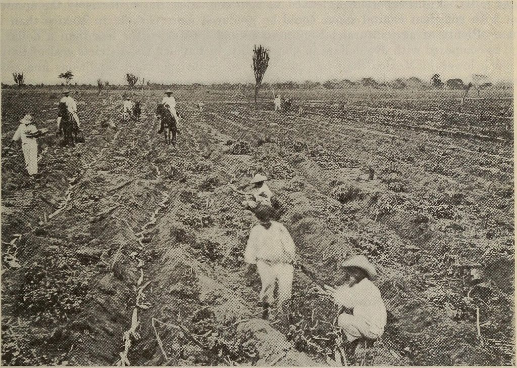
In South Australia, flood and furrow irrigation methods have traditionally been used in some areas of wheat production, particularly on the fertile floodplains along the Murray River. This system involves flooding the field with water or channeling it into furrows between the crop rows. While this method is more common in the irrigated agriculture of fruit and vegetables, it has been utilized in wheat production, especially in regions with access to surface water.
However, this method is less water-efficient compared to more modern irrigation systems. As water availability becomes more limited, there is an increasing shift towards more efficient techniques, such as centre pivot and drip irrigation systems, to conserve water and reduce wastage.
2. Centre Pivot and Lateral Move Irrigation Systems
Centre pivot and lateral move irrigation systems are becoming increasingly common in South Australia for large-scale wheat production. These systems are more efficient at distributing water evenly across the field compared to flood and furrow irrigation, making them better suited to the region’s water scarcity issues. The centre pivot system is particularly effective in large, flat areas like the northern parts of the state, where wheat is grown on wide expanses of land.
These systems use a rotating sprinkler system mounted on a long pipe that is supported by wheels, which allows for uniform water application. The use of centre pivot systems reduces water wastage, improves water distribution, and enhances crop yield consistency. While these systems are common in Western Australia, South Australia is increasingly adopting them, as they provide a more sustainable approach to irrigation compared to traditional methods.
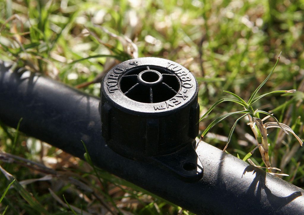
3. Drip Irrigation
In some high-value wheat production areas, particularly where water conservation is a top priority, drip irrigation is used. This system delivers water directly to the base of each plant through a network of tubes and emitters, reducing water waste from evaporation and runoff. Though drip irrigation is not widely used in large-scale wheat production, it is gaining traction in regions where water management is particularly critical.
Drip irrigation is more commonly associated with horticultural crops, but its application in wheat farming in South Australia is growing as farmers seek more efficient ways to manage their limited water resources. Compared to other states, such as Victoria or New South Wales, where wheat farmers may rely more heavily on surface water systems, South Australian farmers are increasingly looking at innovative irrigation techniques to combat water scarcity.
Water Management and Sustainability Practices in South Australia
1. Efficient Water Use and Scheduling
Water efficiency is paramount in South Australia due to the state’s relatively low rainfall and competition for water resources. Farmers in SA often use advanced water management technologies to ensure they use water efficiently. Irrigation scheduling, which involves monitoring weather forecasts, soil moisture levels, and crop water needs, helps farmers apply the right amount of water at the right time. This minimizes water waste and improves crop performance.
In comparison, states like Victoria and New South Wales have more predictable rainfall patterns and thus do not need to rely as heavily on advanced irrigation scheduling, although these practices are still used in certain areas to improve crop outcomes.
2. Use of Water-Smart Farming Techniques
Farmers in South Australia have adopted a variety of water-smart farming techniques to improve water-use efficiency and ensure that crops grow optimally despite water constraints. These techniques include reduced tillage, which helps conserve moisture in the soil, and the use of cover crops to prevent soil erosion and retain water. Additionally, soil moisture monitoring technology enables farmers to track water levels in the soil and adjust irrigation practices accordingly.
In other states like Queensland, New South Wales, and Victoria, while water-smart practices are also utilized, the reliance on these techniques is less pronounced due to greater rainfall and access to water resources.
3. Recycling and Desalination
In some parts of South Australia, especially in regions close to the coast, desalination and water recycling are gaining traction as alternative sources of water for irrigation. Desalination plants convert seawater into freshwater, while water recycling involves reusing treated wastewater for agricultural purposes. These practices help mitigate water scarcity by providing farmers with additional water resources.
In contrast, other states, such as New South Wales, have not yet adopted desalination for agricultural irrigation on a large scale, although water recycling is becoming more common in urban agriculture. In South Australia, where water is often more scarce, the use of desalination and recycling may offer a solution to the challenges posed by climate variability and limited freshwater resources.
Conclusion
Water management and irrigation for wheat production in South Australia are distinctly shaped by the state’s semi-arid climate and reliance on limited surface water. While irrigation is not as commonly used in Queensland or New South Wales due to more consistent rainfall, South Australian wheat farmers face the challenge of managing water efficiently to optimize yields.
The use of centre pivot irrigation systems, along with flood and furrow irrigation, is prevalent in the state, with a growing emphasis on water-smart farming techniques to ensure water efficiency. As water availability continues to be a concern, South Australia is also exploring innovative solutions such as desalination and water recycling to meet the demands of agricultural irrigation.
In comparison to other states, South Australia’s focus on efficient water management practices is more pronounced due to its more variable and limited water resources. As climate change continues to impact rainfall patterns across Australia, the adoption of advanced irrigation technologies and water-smart farming practices will become increasingly crucial for maintaining sustainable wheat production in South Australia.


![fir0002 flagstaffotos [at] gmail.com Canon 20D + Tamron 28-75mm f/2.8](https://commons.wikimedia.org/wiki/File:Irrigation_dripper.jpg)
.jpg)