小麦生産における土壌の概要

小麦生産における土壌の概要

小麦は世界中で広く栽培されている作物の一つであり、その生育は土壌の種類と品質に大きく依存しています。土壌は小麦の成長において重要な役割を果たし、必要な栄養素や水分を供給し、健康的な根の発達をサポートします。土壌のタイプ、質感、pH、肥沃度、排水条件などが小麦の収量や作物の品質に影響を与えます。この記事では、小麦生産に適した土壌の主要な要素について概説します。

1. 土壌の質感と構造

土壌の質感は、砂、シルト、粘土の割合によって決まり、これが水分保持能力、栄養素保持能力、耕作のしやすさに影響を与えます。小麦の最適な成長には、土壌の質感が適度にバランスの取れたローム質土壌が理想的です。この土壌は、十分な水分保持能力を持ちながら、良好な排水性も確保でき、必須の栄養素が豊富に含まれており、根の成長を促進します。

砂質土壌

砂質土壌は、砂の割合が高いため、排水性が良好ですが水分保持能力が低いです。これらの土壌は乾燥期に十分な水分を保持できないことがありますが、作業がしやすく、春に温まりやすい特徴があります。降水量が少ない地域や灌漑が可能な地域では、砂質土壌が小麦の栽培に使用されることがよくあります。

粘土質土壌

粘土質土壌は細かい粒子が多いため、水分保持能力が高い一方で、排水性が遅くなります。粘土質土壌は、乾燥期間中に安定した環境を提供しますが、排水が不十分な場合は根腐れや他の病気が発生しやすく、収量に悪影響を及ぼすことがあります。粘土質土壌では、適切な耕作や排水が重要です。

ローム質土壌

ローム質土壌は砂、シルト、粘土がバランスよく混ざった土壌で、通常、小麦栽培に最適とされています。これらの土壌は、十分な排水性を持ちながらも水分保持能力があり、栄養が豊富で、根の成長を促進します。ほとんどの小麦栽培地域では、ローム質土壌が理想的とされ、最も良いバランスを提供します。

2. 土壌のpH

土壌のpHは、その酸性またはアルカリ性を示し、植物に対する栄養素の可用性に大きな影響を与えます。小麦はpH6.0〜7.5の範囲で最良の成長を見せ、これは中性からややアルカリ性とされています。pHが低すぎる(酸性)と、リンやカルシウム、マグネシウムなどの必須栄養素が利用できにくくなり、逆に高すぎる(アルカリ性)と微量元素が不足する可能性があります。

酸性土壌では石灰を使ってpHを上げ、アルカリ性土壌では硫黄を使ってpHを下げることが必要な場合があります。

3. 土壌の肥沃度

土壌の肥沃度は、作物が必要とする栄養素を供給する能力を示します。小麦は、窒素、リン、カリウム、および亜鉛、鉄、マンガンなどの微量元素を含むさまざまな栄養素を必要とします。特に窒素は、小麦の成長において重要な役割を果たし、活発な成長を促進し、高い収量を確保します。

肥料の使用

多くの小麦栽培地域では、土壌が小麦の最適な成長に必要な十分な栄養素を提供しないことがあり、肥料を使用してこれを補う必要があります。特に、窒素肥料は小麦の成長初期に使用されることが多く、リンやカリウムも根の発達や植物全体の健康を促進するために施肥されます。

有機物

堆肥やカバークロップなどの有機物を土壌に加えることで、その肥沃度を大幅に向上させることができます。有機物は栄養素の可用性を高め、土壌構造を改善し、微生物の活動を促進します。有機物の使用は、土壌の水分保持能力を高め、小麦の成長に必要な健康的な土壌生態系を維持します。

4. 土壌の排水

適切な排水は、水はけが悪いことによる根の病気や悪影響を防ぐために非常に重要です。良好な排水性の土壌は、余分な水分が排出される一方で、小麦植物が十分な水分を吸収できる状態を保ちます。降水量が多い地域では、タイル排水や表面排水などの排水システムを実施することで、水分の蓄積を防ぎ、根の発達を確保することができます。

乾燥地域では、土壌の水分保持能力も同様に重要です。砂質土壌では、適切な灌漑が必要な場合がありますが、粘土質土壌では水の排水性を改善するために有機物や砂を加える必要があることがあります。

5. 土壌保全の実践

土壌の侵食は小麦栽培における重大な懸念事項であり、特に強い雨や風、または不適切な農業方法によって表土が流出する可能性があります。土壌保全の実践としては、無耕作農法、輪作、カバークロップの使用などがあります。これらの方法は土壌の質を保ち、侵食を防ぎ、持続可能な小麦生産を促進します。

小麦生産における土壌の重要性

土壌は小麦生産の成功において非常に重要な要素です。小麦に最適な土壌は、質感、pH、肥沃度、排水条件のバランスに依存しています。ローム質土壌は中性のpHと良好な肥沃度を持っており、小麦栽培に理想的とされていますが、農業者は適切な管理方法を採用することでさまざまな土壌タイプに適応することができます。土壌の特性を理解し、適切な方法を用いることで、収量を最大化し、環境への影響を減らし、小麦生産の持続可能性を確保できます。

Overview of Soils for Wheat Production

Overview of Soils for Wheat Production

Wheat is one of the most widely cultivated crops in the world, and its successful cultivation is heavily influenced by the type and quality of the soil. Soil plays a critical role in wheat growth by providing essential nutrients, water, and structure for healthy root development. The soil type, texture, pH, fertility, and drainage conditions all impact wheat yields and the overall quality of the crop. This article provides an overview of the key factors that influence soil suitability for wheat production.

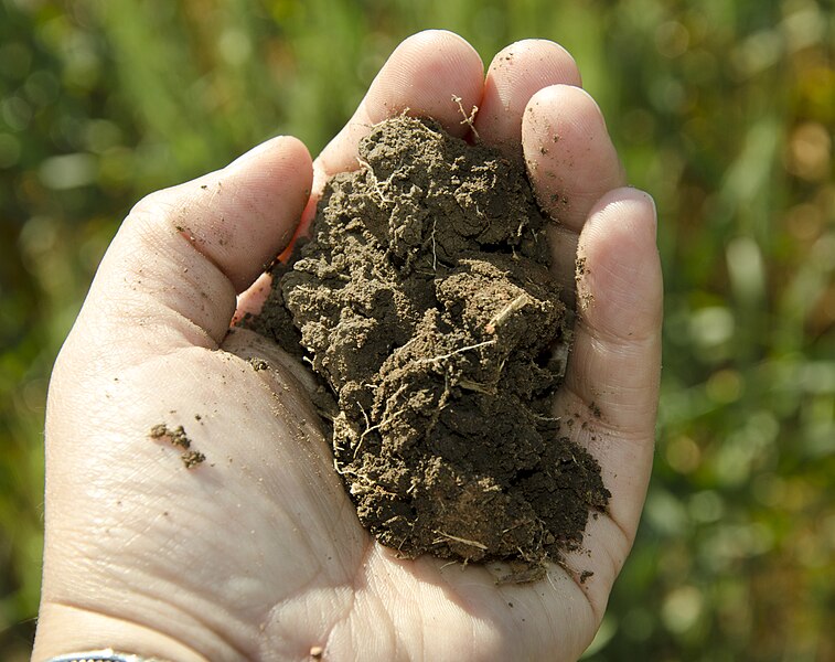
1. Soil Texture and Structure

Soil texture refers to the proportion of sand, silt, and clay particles in the soil, which affects its water retention, nutrient-holding capacity, and ease of tillage. For optimal wheat growth, soils with a loamy texture are ideal, as they provide a balance of water-holding capacity and good drainage. Loamy soils are rich in essential nutrients and offer sufficient aeration for roots, which is important for healthy wheat growth.

Sandy Soils

Sandy soils have a high proportion of sand particles, which results in good drainage but poor water retention. While these soils may not retain enough moisture during dry periods, they are easier to work with and warm up faster in the spring. They are often used for wheat production in regions with moderate to low rainfall, where irrigation is available to supplement water needs.

Clay Soils

Clay soils have a higher proportion of fine particles, which leads to better water retention but slower drainage. While clay soils can provide a stable environment for wheat during dry spells, they are prone to waterlogging and poor aeration if not properly managed. Proper tillage and drainage are essential in clay soils to prevent root rot and other diseases that can negatively affect wheat yields.

Loamy Soils

Loam soils, with a balanced mix of sand, silt, and clay, are generally considered the best for wheat production. They provide adequate drainage while maintaining sufficient moisture retention and are nutrient-rich, promoting healthy growth. Loam soils are ideal for most wheat-growing regions as they offer a good balance between water retention and aeration.

2. Soil pH

The pH level of soil indicates its acidity or alkalinity and has a significant impact on the availability of nutrients to plants. Wheat grows best in soils with a pH range of 6.0 to 7.5, which is considered neutral to slightly alkaline. Soils that are too acidic (below 6.0) can limit the availability of essential nutrients like phosphorus, calcium, and magnesium, while highly alkaline soils (above 7.5) can lead to micronutrient deficiencies.

Farmers may need to adjust soil pH levels using lime to raise pH in acidic soils or sulfur to lower pH in alkaline soils, depending on the local conditions.

3. Soil Fertility

Soil fertility is the ability of the soil to provide essential nutrients for plant growth. Wheat requires a variety of nutrients, including nitrogen, phosphorus, potassium, and trace elements such as zinc, iron, and manganese. Nitrogen, in particular, is critical for wheat development, as it promotes vigorous vegetative growth and ensures a high yield.

Fertilization

In many wheat-growing regions, soils may not provide sufficient levels of nutrients for optimal crop production, necessitating the use of fertilizers. Nitrogen fertilizers are commonly applied to wheat crops to support growth during the early stages, while phosphorus and potassium are often added to promote root development and improve overall plant health.

Organic Matter

Incorporating organic matter such as compost or cover crops into the soil can significantly improve its fertility by increasing nutrient availability, enhancing soil structure, and promoting microbial activity. Organic matter helps maintain soil moisture and supports a healthy ecosystem for wheat growth.

4. Soil Drainage

Proper soil drainage is essential for preventing waterlogging, which can lead to root diseases, poor aeration, and reduced yields. Soils with good drainage allow excess water to escape while retaining enough moisture for the wheat plants to thrive. In regions with heavy rainfall, farmers often implement drainage systems, such as tile drainage or surface drains, to prevent water accumulation and ensure proper root development.

In dry regions, proper soil moisture retention is equally important. Soils that are too sandy may require irrigation to maintain adequate moisture levels for wheat growth, while soils with excessive clay content may need to be amended with organic matter or sand to improve water drainage.

5. Soil Conservation Practices

Soil erosion is a major concern in wheat farming, particularly in areas where heavy rainfall, strong winds, or improper farming practices may lead to the loss of topsoil. Soil conservation practices, such as no-till farming, crop rotation, and the use of cover crops, help preserve soil quality, prevent erosion, and promote sustainable wheat production.

Soil for Wheat Production

Soil is a fundamental factor that influences the success of wheat production. The ideal soil for wheat farming depends on a balance of texture, pH, fertility, and drainage conditions. Loamy soils with a neutral pH and good fertility are generally the best for wheat, although farmers can adapt to various soil types through proper management practices. By understanding the specific soil requirements for wheat and adopting appropriate techniques, farmers can optimize yields, reduce environmental impacts, and ensure the long-term sustainability of wheat production.

日本における小麦の品種と収穫量

日本における小麦の品種と収穫量

小麦は日本の重要な作物の一つで、国内で消費されるパンや麺類などの食品に欠かせない原材料です。日本は米の生産で有名ですが、小麦の栽培も重要な役割を果たしており、特にうどんやラーメン、パンなどの需要が高いです。日本で栽培される小麦の品種は、気候や栽培地域によって異なり、それぞれの用途に適した特性を持っています。この記事では、日本で栽培される主要な小麦の品種とその特徴、栽培地域について紹介します。

1. ソフトホワイト冬小麦 (SWW)

特徴

ソフトホワイト冬小麦(SWW)は、日本で最も広く栽培されている小麦の品種です。低いたんぱく質含量と柔らかい白い穀粒が特徴で、うどんやパンケーキ、ペストリーなどの食品に使われます。SWWは、低たんぱく質がもたらす柔らかい食感が、麺類や生地に適しているため、麺類や軽い焼き菓子の生産に最適です。

また、SWWは比較的穏やかな風味を持ち、水分をよく吸収するため、特にうどんなどの麺類製造において重宝されています。

収穫量

ソフトホワイト冬小麦の収穫量は地域や気象条件により異なりますが、一般的に他の小麦品種と比較して中程度の収量となり、1ヘクタールあたり2〜4トン程度です。気温、土壌の質、害虫や病気の影響などが収量に影響を与えることがあります。

主な栽培地域

ソフトホワイト冬小麦は主に日本の北部、特に北海道で栽培されています。北海道の冷涼な気候と長い冬が、この品種の栽培に適しています。また、東北地方や近畿地方の一部でも栽培されていますが、北海道が主要な生産地であり、栽培面積の大部分を占めています。

2. ハードレッド冬小麦 (HRW)

特徴

ハードレッド冬小麦(HRW)は、日本でも栽培されているもう一つの小麦品種ですが、ソフトホワイト冬小麦ほど広くは栽培されていません。HRW小麦はたんぱく質含量が高く、硬い穀粒が特徴で、主にパンの製造に使用されます。HRW小麦は、パン用小麦粉として強いグルテンを必要とするため、その高たんぱく質が重要な要素となります。

この品種の穀粒は赤みを帯びており、ソフトホワイト冬小麦よりも硬いです。パン製造やグルテンを必要とする製品に適しています。

収穫量

ハードレッド冬小麦の収穫量はソフトホワイト冬小麦よりも低く、1ヘクタールあたり2〜3トン程度です。この品種は特定の気候条件を必要とし、冬季の寒さに影響を受けやすいため、収量が安定しないこともあります。

主な栽培地域

ハードレッド冬小麦は、日本でも北海道や本州北部の一部地域で栽培されていますが、ソフトホワイト冬小麦に比べると栽培面積は限られています。そのため、HRW小麦の生産量は少なく、主にパン製造向けに使われます。

3. デュラム小麦

特徴

デュラム小麦は、高いたんぱく質含量と硬い穀粒が特徴で、主にパスタの製造に使用されます。この小麦はセモリナ粉として知られ、パスタの生産に欠かせない素材です。デュラム小麦は金色がかった黄色をしており、その特有の硬さと高たんぱく質が、パスタの形状と食感を維持するために重要です。

デュラム小麦は日本では主に高品質なスパゲッティやマカロニなどのパスタの生産に使用されます。

収穫量

デュラム小麦の収穫量は他の小麦品種に比べて少なく、一般的に1ヘクタールあたり1〜2トン程度です。この品種は温暖な生育条件と特定の土壌が必要で、栽培地域が限られています。

主な栽培地域

デュラム小麦は日本での生産量が少なく、主に北海道で栽培されています。北海道の乾燥した気候と温暖な生育季節が、デュラム小麦の栽培に適しています。ただし、デュラム小麦の生産量は小麦全体の中でも小さいため、主にパスタ製造向けに使用されます。

4. 春小麦 (SWW, HRW)

特徴

春小麦は、ソフトホワイト春小麦やハードレッド春小麦を含む品種で、春に播種され、夏または初秋に収穫されます。日本での春小麦の栽培面積は比較的小さいものの、パンや麺類の生産において重要な役割を果たします。春小麦は冬小麦よりも高いたんぱく質を含み、パン製造における強いグルテンを必要とする製品に適しています。

春小麦の品種は、ソフトホワイト冬小麦よりも硬い食感を持っており、グルテンが強いことから、パンやパスタの製造に向いています。

収穫量

春小麦の収穫量は、日本では一般的に冬小麦品種よりも低く、1ヘクタールあたり2〜3トン程度です。春小麦は天候の変動に敏感で、気温や降水量が収穫量に影響を与えることがあります。

主な栽培地域

春小麦は主に北海道の冷涼な地域で栽培されています。短い栽培期間と比較的穏やかな気温が、春小麦の栽培に適しており、本州の一部地域でも栽培されることがありますが、栽培面積は冬小麦に比べて少ないです。

日本の小麦の品種

日本における小麦生産は主にソフトホワイト冬小麦が中心で、うどんやパンなどの食品製造に重要な役割を果たしています。ハードレッド冬小麦やデュラム小麦も栽培されていますが、これらは比較的少量で、特定の用途に使われます。日本の小麦栽培は、主に北海道を中心に行われ、北海道の冷涼な気候が小麦栽培に適しているため、北部地域が主要な生産地となっています。日本における小麦の栽培面積は他の国々と比較して小さいですが、国内の農業経済において重要な役割を果たしています。

Wheat Types and Yields in Japan

Wheat Types and Yields in Japan

Wheat is a staple crop in Japan, playing an important role in the country’s agricultural production. While Japan is better known for its rice production, wheat cultivation is significant due to the demand for wheat in food products such as bread, noodles, and other processed foods. The wheat varieties grown in Japan differ from those cultivated in other countries, with specific types being chosen based on their suitability for Japan’s climate and the types of food products being produced. This article provides an overview of the primary wheat types grown in Japan, their characteristics, and the regions where they are cultivated.

1. Soft White Winter (SWW)

Characteristics

Soft White Winter (SWW) is the most widely cultivated wheat variety in Japan. It is characterized by its low protein content and soft, white kernels. This type is commonly used to produce flour for products like udon noodles, pancakes, and pastries. SWW is ideal for soft-textured baked goods and noodle production due to its lower protein content, which results in a more delicate and tender texture.

SWW has a relatively mild flavor and is preferred for its ability to absorb water, which is important for the production of noodles and other dough-based products.

Yields

The yield of Soft White Winter in Japan varies depending on the region and weather conditions. In general, yields are moderate compared to other wheat types, with typical yields ranging from 2 to 4 tons per hectare. The yield can be influenced by factors such as temperature, soil quality, and the presence of pests and diseases.

Primary Growing Regions

Soft White Winter is primarily grown in the northern regions of Japan, particularly in Hokkaido. Hokkaido’s cooler climate and longer winters make it an ideal location for growing winter wheat. Other regions where SWW wheat is cultivated include parts of Honshu, especially in the colder areas of Tohoku and Kinki. However, Hokkaido remains the primary wheat-growing area in Japan due to its favorable growing conditions.

2. Hard Red Winter (HRW)

Characteristics

Hard Red Winter (HRW) is another wheat variety that is grown in Japan, though it is less common than Soft White Winter. HRW has a higher protein content and a firmer texture, making it suitable for bread production. The high protein content of HRW wheat makes it ideal for producing bread flour, which requires strong gluten for dough structure.

HRW is used for bread-making and other products that require more gluten strength. The wheat kernels are hard and reddish-brown, which distinguishes them from the softer, lighter kernels of SWW.

Yields

The yield of Hard Red Winter in Japan is generally lower than Soft White Winter, with typical yields ranging from 2 to 3 tons per hectare. HRW requires specific growing conditions and is more susceptible to weather extremes, such as cold temperatures during the winter months.

Primary Growing Regions

Hard Red Winter is cultivated in smaller quantities compared to SWW, and its production is generally concentrated in the colder regions of Japan. Areas in Hokkaido and parts of northern Honshu are the primary regions for HRW cultivation. However, the production volume remains limited due to the specific climate requirements and the competition with SWW.

3. Durum Wheat

Characteristics

Durum Wheat, known for its high protein content and hard texture, is another wheat variety that is cultivated in Japan, though its cultivation is more specialized. Durum wheat is primarily grown for pasta production due to its strong gluten structure, which is necessary for pasta to retain its shape during cooking. Durum wheat has a golden-yellow color and is often used to produce semolina flour.

Durum wheat is highly valued in Japan for making pasta, particularly in the production of high-quality spaghetti, macaroni, and other pasta products.

Yields

Durum wheat yields in Japan are generally lower than those of other wheat types, typically ranging from 1 to 2 tons per hectare. Durum wheat requires a warm growing season and specific soil conditions to develop its characteristic hard texture and high protein content.

Primary Growing Regions

The cultivation of Durum wheat in Japan is relatively limited compared to Soft White Winter. It is mainly grown in parts of Hokkaido, where the climate is more suitable for the cultivation of wheat types with specific needs. However, Durum wheat’s overall production remains small due to its specialized nature and the competition from other wheat types.

4. Spring Wheat (SWW, HRW)

Characteristics

Spring wheat, which includes both Soft White Spring and Hard Red Spring, is planted in the spring and harvested in late summer or early fall. While the total acreage of spring wheat in Japan is relatively small, it is still an important wheat type used for bread and noodle production. Spring wheat varieties tend to have a higher protein content than soft winter wheat varieties, making them ideal for bread-making.

Spring wheat varieties have a firmer texture than soft winter wheat, which makes them more suitable for products that require stronger gluten, such as bread and pasta.

Yields

Spring wheat yields in Japan are generally lower than those of winter wheat varieties, with typical yields ranging from 2 to 3 tons per hectare. Spring wheat is more sensitive to weather fluctuations, and its yields can be impacted by temperature and rainfall.

Primary Growing Regions

Spring wheat is grown in Japan’s cooler regions, particularly in Hokkaido. Due to the short growing season and relatively mild temperatures, Hokkaido is the most suitable area for spring wheat cultivation. Other regions of Japan, including parts of Honshu, may also grow spring wheat, but it remains a minor crop compared to winter wheat.

Wheat Types in Japan

Wheat production in Japan is primarily focused on Soft White Winter, which is well-suited for the country’s food processing industry, especially for noodles, bread, and pastries. Other wheat varieties, such as Hard Red Winter and Durum Wheat, are also grown in smaller quantities, with each serving a specific role in the production of bread and pasta products. Japan’s wheat cultivation is concentrated in the northern regions, particularly in Hokkaido, where the climate is more favorable for growing winter wheat and specialized wheat varieties. Despite the relatively small acreage compared to other countries, Japan remains a significant player in the wheat market, with domestic wheat production contributing to the country’s agricultural economy.

衛星データを活用した九州の特産農業の革新

衛星データを活用した九州の特産農業の革新
MaedaAkihiko, CC BY-SA 4.0, via Wikimedia Commons

九州は、日本の主要な4つの島の中で3番目に大きい島で、多様な農産物を生産しています。特に甘藷(さつまいも)、イチゴ、そして鹿児島和牛などの高品質な特産品で有名です。近年、衛星データとリモートセンシング技術が九州の特産農業の持続可能性、生産性、そして気候変動への適応力を高めるために重要な役割を果たしています。本記事では、九州の農家がどのようにして衛星技術を導入し、地域の特産作物の生産最適化を進めているかを紹介します。

鹿児島の甘藷栽培とリモートセンシング

鹿児島県は、日本有数の甘藷の産地であり、特に「さつまいも」はその甘さと食感で広く知られています。甘藷は丈夫な作物ではありますが、収穫量を維持するためには精密な灌漑管理と土壌条件のモニタリングが求められます。

衛星画像は、広大な農地における土壌水分レベル、植生の健康状態、温度の変動を把握するために必要な情報を提供します。NDVI(正規化植生指数)などの解析を行うことで、作物の健康状態を評価し、追加灌漑や栄養分の投入が必要なエリアを特定できます。このデータ駆動型アプローチにより、鹿児島の甘藷農家は資源使用を最小限に抑えつつ、高品質な収穫を実現しています。

福岡のイチゴ栽培と衛星データ

福岡県は、高品質なイチゴの産地で、特に「甘王(あまおう)」という品種が有名です。甘王イチゴはその大きさと甘さで知られており、栽培には多大な労力と環境条件への配慮が必要です。

衛星データを利用した気象予測により、農家は極端な気象現象を事前に予測し、それに基づいた栽培方法の調整が可能になります。さらに、土壌健康と水分量のモニタリングを行うことで、灌漑スケジュールを正確に管理し、水の浪費を減らすことができます。この技術を導入することで、福岡のイチゴ農家は高品質な果実を安定的に生産し、持続可能な農業を進めています。

鹿児島和牛の生産性向上と衛星監視

鹿児島は、和牛、特に「鹿児島和牛」で非常に有名です。この地域の牛肉はその高品質と霜降りの美しさで高く評価されています。和牛の生産には、質の高い牧草地の維持と、牛の健康を管理することが不可欠です。

衛星データは、牧草地の状況を監視し、植生の成長具合や気象条件の影響を把握するために活用されています。このデータにより、農家は回転放牧を効果的に管理でき、牧草地が過度に使用されることを防ぎ、牛が栄養豊富な牧草を一年を通して利用できるようにします。また、衛星監視により、牛のストレスや病気の兆候を早期に発見することができ、健康を維持するための介入が可能になります。

宮崎の米作とリモートセンシング

宮崎県は、特に高品質なコシヒカリやヒトメボレなどの米作で知られています。宮崎の米作は豊富な降水量に恵まれていますが、過剰な水分や不均一な灌漑は作物にダメージを与える可能性があります。

リモートセンシング技術を利用することで、農家は土壌水分、冠水状態、植生の健康状態をリアルタイムで監視できます。衛星データと精密灌漑システムを組み合わせることで、農家は水使用量を最適化し、稲田が適切な水分を受け取るように調整することができます。これにより、過剰水分のリスクが減り、健康的で耐久性のある稲作が実現します。

熊本の柑橘栽培と衛星データ

熊本県は、スモウ柑橘やミカンなど、高品質な柑橘類の産地として知られています。柑橘栽培には害虫管理、土壌の肥沃度、気象の変動といった課題があり、これらが果実の品質に影響を与えます。

衛星データは、土壌の健康状態、作物のストレス、害虫の活動を監視するための貴重な情報を提供します。多波長衛星画像を活用することで、果樹園の問題を特定し、害虫対策、灌漑調整、土壌改良が必要な箇所を特定することができます。また、収穫時期を予測するためにも衛星データが活用され、農家は最適な収穫タイミングを見極め、果実の品質を最大限に高めることができます。

九州農業の気候変動への対応

九州の農業は、台風、熱波、干ばつなどの気象リスクにさらされています。衛星データは、これらの気候変動への対応を支援するための重要なツールです。

例えば、長期的な気象データを分析することで、気候変動に強い作物品種の選定が可能になります。また、異常気象の発生を事前に察知し、作業スケジュールを調整することで、収穫ロスを最小限に抑えることができます。

まとめ

衛星データは、九州の特産農業を革新し、作物の収量向上、資源使用の最適化、持続可能な農業の実現を可能にしています。甘藷、イチゴ、和牛、米、柑橘類など、地域特産品においてリモートセンシング技術を導入することで、収量の安定化と品質向上が達成されています。

気候変動の影響がますます顕著になる中で、衛星データを活用した農業技術の導入は、九州の農業が今後さらに持続可能で競争力のあるものになるための鍵となるでしょう。

Transforming Specialty Agriculture in Kyushu with Satellite Data

Transforming Specialty Agriculture in Kyushu with Satellite Data
MaedaAkihiko, CC BY-SA 4.0, via Wikimedia Commons

Kyushu, Japan’s third-largest island, is renowned for its diverse agricultural production. The region boasts unique crops such as sweet potatoes, strawberries, and high-quality beef like Kagoshima wagyu. Satellite data and remote sensing technologies are playing a crucial role in enhancing the sustainability, productivity, and climate resilience of Kyushu’s specialty agriculture. This article explores how farmers in Kyushu are integrating satellite technology to optimize production practices for their unique crops and improve overall agricultural efficiency.

Boosting Sweet Potato Production in Kagoshima with Remote Sensing

Kagoshima Prefecture is a major producer of sweet potatoes, particularly the satsumaimo variety, which is prized for its sweetness and texture. Sweet potatoes are a hardy crop, but they require precise irrigation management and monitoring of soil conditions to maintain high yields.

Satellite imagery provides essential insights into soil moisture levels, vegetation health, and temperature variations across large plots of land. By analyzing vegetation indices such as NDVI, farmers can assess the overall health of the crops and detect areas that need additional irrigation or nutrient inputs. This data-driven approach helps Kagoshima’s sweet potato farmers to optimize crop yield and quality while minimizing resource usage.

Supporting Strawberry Farming in Fukuoka with Satellite Data

Fukuoka Prefecture is famous for its high-quality strawberries, particularly the Amaou variety, which is known for its large size and sweet flavor. However, strawberry cultivation is labor-intensive and highly sensitive to environmental conditions, such as temperature and humidity.

By utilizing satellite-based weather forecasting, farmers can predict extreme weather events and adjust their cultivation practices accordingly. Remote sensing technologies also allow for monitoring of soil health and water content, enabling farmers to precisely manage irrigation schedules and reduce water wastage. The integration of these technologies ensures that Fukuoka’s strawberry farmers can produce top-tier fruit while enhancing sustainability.

Enhancing Kagoshima’s Wagyu Beef Production with Satellite Monitoring

Kagoshima is also known for its high-quality wagyu beef, including the renowned Kagoshima wagyu. The region’s cattle ranchers face the challenge of maintaining high-quality pastures and managing the herd’s health in a way that ensures optimal growth and marbling in the meat.

Satellite data helps farmers monitor pasture conditions, track vegetation growth, and assess the impact of weather conditions on grazing areas. With this data, ranchers can manage rotational grazing more effectively, ensuring that the pastures are not overused and that the cattle have access to nutritious forage throughout the year. Additionally, satellite monitoring assists in detecting signs of stress or disease in cattle, enabling early interventions to improve herd health.

Optimizing Rice Production in Miyazaki with Remote Sensing

Miyazaki Prefecture is well-known for its rice production, particularly the high-quality Koshihikari and Hitomebore varieties. Rice farming in Miyazaki benefits from the region’s abundant rainfall, but excessive water or inconsistent irrigation can lead to crop damage and reduced yields.

Remote sensing technologies enable farmers to monitor soil moisture levels, flooding conditions, and vegetation health in real-time. By combining satellite data with precision irrigation systems, farmers can optimize water usage and ensure that the rice paddies receive the right amount of water at the right time. This reduces the risk of waterlogging and promotes healthier, more resilient rice crops.

Managing Citrus Orchards in Kumamoto with Satellite Data

Kumamoto is another important citrus-growing region in Kyushu, known for its high-quality varieties such as sumo citrus and mikan. The region’s citrus farmers face challenges related to pest management, soil fertility, and weather variations, all of which impact the quality of their fruit.

Satellite data provides valuable insights into soil health, crop stress, and pest activity. With the help of multispectral imaging, farmers can identify areas of the orchard that may require attention, whether it be for pest control, irrigation adjustments, or soil amendments. Remote sensing also aids in predicting harvest times, helping farmers plan and execute harvesting strategies to achieve optimal fruit quality and minimize losses.

Addressing Climate Change Challenges in Kyushu’s Agriculture

Kyushu’s agriculture is highly susceptible to the effects of climate change, including typhoons, heatwaves, and droughts. Satellite data plays an essential role in helping farmers prepare for and respond to these climate challenges.

By providing real-time weather monitoring and long-term climate forecasts, satellite technology helps farmers make informed decisions about crop selection, irrigation schedules, and pest management. For example, the data can help predict extreme weather events, allowing farmers to take preventive measures, such as adjusting planting times or reinforcing crops against strong winds.

Conclusion

Satellite data is revolutionizing specialty agriculture in Kyushu, enabling farmers to improve crop yields, reduce resource usage, and increase sustainability. Whether it’s optimizing irrigation for sweet potatoes in Kagoshima, managing soil health for strawberries in Fukuoka, or enhancing the quality of rice and wagyu beef, the integration of remote sensing technologies is driving greater efficiency in agriculture.

As the region continues to face climate change challenges, the role of satellite data in enhancing agricultural resilience will become even more vital. By adopting these technologies, Kyushu’s agricultural sector can remain competitive and continue to produce some of Japan’s most beloved and high-quality specialty crops.

衛星データを活用した四国の特産農業の革新

衛星データを活用した四国の特産農業の革新
663highland, CC BY-SA 3.0, via Wikimedia Commons

四国は、日本の主要4島の中で最も小さいものの、多様な農産物を誇る地域です。温暖な気候と山岳地帯が共存し、柑橘類、オリーブ、和牛などの特産品が生産されています。しかし、地形や気象条件の影響を受けやすく、農業の効率化と気候変動への対応が課題となっています。

近年、衛星データを活用した精密農業が注目されており、四国の特産農業もこの技術の恩恵を受けています。本記事では、四国の特産品と衛星技術の活用について紹介します。

愛媛の柑橘栽培とリモートセンシング

愛媛県は、日本有数の柑橘類の産地であり、特にミカンや伊予柑が有名です。しかし、天候の変動や土壌条件によって品質が左右されるため、精密な管理が求められます。

衛星データを活用することで、土壌水分のモニタリング、病害の早期発見、灌水スケジュールの最適化が可能になります。NDVI(正規化植生指数)を用いた分析により、果樹園内のストレスを受けたエリアを特定し、適切な対策を講じることができます。

衛星画像と精密農業技術を組み合わせることで、愛媛の柑橘産業は持続可能性を高めつつ、高品質な果実を安定供給できます。

香川のオリーブ栽培と衛星データ

香川県は、日本で最も有名なオリーブの産地であり、特に小豆島では高品質なオリーブオイルが生産されています。オリーブは、水はけの良い土壌と適度な日照が必要なため、綿密な管理が不可欠です。

リモートセンシング技術により、土壌の状態をモニタリングし、害虫の発生を早期に検出することができます。また、衛星の熱画像を利用して、水ストレスの兆候を捉え、灌水スケジュールを調整することで、収量の安定化が可能になります。

さらに、多波長衛星データを用いることで、オリーブの油分含有量を予測し、最適な収穫時期を特定できます。

徳島のすだち栽培と精密農業

徳島県は、日本一のすだちの産地として知られています。すだちは山間地の気候に適しているものの、急な気温変化や台風の影響を受けやすい作物です。

衛星データを活用した天候予測により、強風や大雨が発生する前に防風対策や土壌補強を行うことができます。また、衛星によるキャノピー(樹冠)解析を利用して樹木の健康状態を監視し、肥料の最適化を図ることで、より持続可能な栽培が可能になります。

高知の柚子・生姜栽培とリモートセンシング

高知県は、柚子と生姜の一大生産地であり、これらの作物は特定の気候条件を必要とします。特に、高湿度や長雨による病害対策が大きな課題となっています。

衛星画像を活用することで、病害の発生を早期に察知し、適切な農薬散布の計画を立てることができます。また、リモートセンシング技術により、土地利用の最適化が可能となり、収量と品質の向上につながります。

生姜栽培では、衛星による土壌温度のモニタリングを活用することで、植え付けや収穫の最適なタイミングを見極め、より市場価値の高い生姜を生産できます。

四国和牛の放牧管理と衛星技術

四国には、徳島の阿波牛や高知の土佐牛など、高品質な和牛ブランドが存在します。和牛の生育には、良質な牧草と適切な環境管理が重要です。

衛星データを活用することで、放牧地の植生状態をモニタリングし、牧草の栄養バランスを管理することができます。また、気温や湿度の変化をリアルタイムで把握し、熱ストレスを軽減するための対策を講じることも可能です。

これにより、和牛の健康維持と品質向上が期待されます。

気候変動と衛星データを活用した農業対策

四国の農業は、台風、豪雨、干ばつなどの気象リスクにさらされています。衛星データを活用することで、これらの異常気象への対応が可能となります。

例えば、長期的な気象データを分析することで、気候変動に強い品種の選定が可能になります。また、異常気象の発生を事前に察知し、農作業のスケジュールを調整することで、収穫ロスを最小限に抑えることができます。

まとめ

四国の特産農業は、衛星技術の導入により、より持続可能で効率的なものへと進化しています。愛媛の柑橘、香川のオリーブ、徳島のすだち、高知の柚子・生姜、そして四国和牛といった農産物は、リモートセンシングを活用することで、収量の安定化と品質向上を実現しています。

今後、気候変動の影響がさらに顕著になる中で、衛星データを活用した精密農業は、四国の農業をより強靭で持続可能なものにする鍵となるでしょう。

Leveraging Satellite Data for Specialty Agriculture in Shikoku

Leveraging Satellite Data for Specialty Agriculture in Shikoku
663highland, CC BY-SA 3.0, via Wikimedia Commons

Shikoku, the smallest of Japan’s four main islands, is known for its diverse agricultural products, including citrus fruits, olives, and premium wagyu beef. The region’s mountainous terrain and coastal climate create both opportunities and challenges for farmers. By utilizing satellite data, agricultural producers in Shikoku can optimize cultivation practices, improve efficiency, and enhance climate resilience.

This article explores how remote sensing and satellite technology are transforming specialty agriculture across Shikoku.

Supporting Ehime’s Citrus Production with Remote Sensing

Ehime Prefecture is Japan’s leading producer of citrus fruits, particularly mikan (mandarin oranges) and iyokan. The region’s mild coastal climate is ideal for citrus farming, but fluctuating weather patterns and soil conditions can impact fruit quality.

Satellite-based monitoring allows farmers to track soil moisture levels, detect early signs of disease, and optimize irrigation. NDVI (Normalized Difference Vegetation Index) analysis helps identify areas of stress in citrus groves, enabling targeted interventions to maintain high yields.

By integrating satellite imagery with precision agriculture techniques, Ehime’s citrus industry can enhance sustainability while preserving its reputation for high-quality fruit.

Optimizing Kagawa’s Olive Farming with Satellite Data

Kagawa Prefecture is famous for its olive production, particularly in Shodoshima, where Japan’s first olive trees were planted. Olives require well-drained soil, ample sunlight, and careful water management to produce high-quality oil.

Remote sensing technology aids olive farmers by monitoring soil conditions, identifying pest infestations, and predicting optimal harvest times. Thermal imaging from satellites can detect water stress in olive groves, helping farmers adjust irrigation schedules to prevent yield losses.

Additionally, multispectral satellite data can be used to assess the oil content of olives before harvest, ensuring that the fruit is picked at peak quality.

Enhancing Tokushima’s Sudachi Cultivation with Precision Agriculture

Tokushima is known for producing sudachi, a small, aromatic citrus fruit widely used in Japanese cuisine. Sudachi thrives in Tokushima’s mountainous terrain, but sudden temperature changes and typhoons can affect production.

Satellite-based weather forecasting provides early warnings for extreme weather, allowing farmers to implement protective measures such as windbreaks and soil reinforcement. By using satellite data to monitor canopy health and soil conditions, farmers can optimize fertilization and reduce chemical inputs, leading to more sustainable farming practices.

Improving Kochi’s Yuzu and Ginger Production with Remote Sensing

Kochi Prefecture is a leading producer of yuzu and ginger, both of which require specific climate conditions for optimal growth. High humidity and frequent rainfall in the region make disease prevention a key challenge.

Satellite imagery can assist farmers in detecting disease outbreaks early by analyzing vegetation indices and temperature fluctuations. Remote sensing data also supports efficient land-use planning, ensuring that crops are grown in the most suitable locations to maximize yield and quality.

For ginger production, satellite monitoring of soil temperature helps determine the best planting and harvesting times, leading to improved consistency and marketability.

Managing Pastures for Shikoku Wagyu Production

Shikoku is home to high-quality wagyu breeds such as Awa Beef from Tokushima and Tosa Beef from Kochi. Maintaining lush, nutrient-rich pastures is essential for producing premium-grade beef.

Satellite data enables ranchers to assess pasture health, track seasonal vegetation changes, and plan rotational grazing strategies. By monitoring drought conditions and soil fertility levels from space, cattle farmers can ensure optimal grazing conditions while reducing reliance on supplemental feed.

Addressing Climate Challenges with Satellite Technology

Shikoku’s agriculture is highly vulnerable to climate change, including typhoons, heavy rainfall, and seasonal droughts. Satellite-based climate monitoring helps farmers adapt by providing real-time weather analysis and long-term climate projections.

With satellite-driven insights, farmers can make informed decisions about crop selection, irrigation, and soil conservation, reducing the risks associated with extreme weather.

Conclusion

From Ehime’s renowned citrus fruits to Kagawa’s olives and Tokushima’s prized sudachi, Shikoku’s specialty agriculture benefits significantly from satellite technology. By leveraging remote sensing for precision farming, farmers can enhance productivity, improve sustainability, and better withstand climate challenges.

As Japan’s agricultural sector continues to evolve, integrating satellite data into traditional farming practices will be key to maintaining high-quality production and ensuring the resilience of Shikoku’s unique crops.

衛星データで進化する近畿の特産農業

衛星データで進化する近畿の特産農業
Miya.m, CC BY-SA 4.0, via Wikimedia Commons

近畿地方は、京都の高級緑茶、奈良の柿、和歌山のミカン、神戸の高級和牛など、日本を代表する特産品が生産される地域です。平野部から山間部まで多様な地形が広がるため、精密農業の導入がますます重要になっています。

衛星データを活用することで、生産効率を向上させ、品質を維持しながら気候変動に適応することが可能になります。本記事では、近畿地方の特産品の生産における衛星技術の活用について解説します。

京都の宇治茶栽培とリモートセンシングの活用

京都の宇治茶は、その豊かな香りと深い味わいで世界的に有名です。しかし、高品質な茶葉を生産するには、土壌管理、気温調整、適切な日よけの管理が不可欠です。

衛星データを活用することで、土壌水分や葉のクロロフィル含有量を監視し、最適な灌水や施肥のタイミングを特定できます。また、熱画像データを使用することで、気温の変動を検出し、日よけの調整を行うことで茶葉の品質を保つことができます。

さらに、NDVI(正規化植生指数)解析を用いることで、茶園内のストレスのかかっている区域を特定し、適切な対策を講じることが可能になります。

和歌山のミカン農園の最適化

和歌山県は、日本有数のミカン生産地であり、その甘みと酸味のバランスが特徴です。しかし、台風や干ばつなどの気象変動により、品質の維持が課題となっています。

衛星データを活用することで、土壌の水分状態や植物の健康状態、気候傾向をリアルタイムで把握できます。さらに、衛星による天候予測を活用することで、台風時の防風対策や干ばつ時の灌水スケジュールの調整が可能になります。

また、リモートセンシングを利用することで、柑橘類の病害を早期に発見し、化学農薬の使用を最小限に抑えながら持続可能な農業を実現できます。

奈良の柿栽培と衛星モニタリング

奈良県は、日本屈指の柿の産地として知られ、特に「渋柿(しぶがき)」と呼ばれる種なし柿が有名です。柿の最適な生育には、特定の温度・湿度条件が求められます。

衛星データは、柿畑の微気候を監視し、干し柿(ほしがき)などの加工用柿の乾燥プロセスを最適化するのに役立ちます。また、リモートセンシングを活用することで、葉のクロロフィルレベルを分析し、適切な施肥管理を行うことで品質の向上が可能になります。

これらの技術と伝統的な栽培方法を組み合わせることで、奈良の柿の生産者は安定した収穫量を確保し、ブランド価値を維持することができます。

近畿地方の稲作と衛星技術

近畿地方は日本最大の米産地ではありませんが、滋賀県や兵庫県では高品質な米が生産されています。衛星データは、水管理、栄養状態の監視、収穫時期の予測などに活用されています。

例えば、Sentinel-1などの合成開口レーダー(SAR)を使用することで、水田の冠水状況を把握し、適切な水管理を行うことができます。また、マルチスペクトル画像を利用することで、病害虫の兆候を早期に発見し、農薬の使用を減らすことが可能になります。

これにより、収穫量の安定化と持続可能な米作りが実現します。

神戸・近江和牛の放牧管理と衛星データ

神戸牛や近江牛など、近畿地方は日本有数の高級和牛の産地として知られています。和牛の品質を維持するためには、適切な牧草管理と環境制御が不可欠です。

衛星データを利用することで、放牧地の植生状態をモニタリングし、栄養バランスの取れた牧草が維持されているかを確認できます。また、気温や湿度の変動を監視し、牛の熱ストレスを防ぐ対策を講じることも可能です。

これにより、和牛の品質向上と生産性の最適化が期待されます。

気候変動への対応とスマート農業

近畿地方は、台風や集中豪雨、気温の急変などの気象リスクが高い地域です。衛星データを活用することで、これらの気候変動に対応し、農業の安定化を図ることができます。

例えば、長期的な気象データを分析することで、耐寒性・耐暑性に優れた作物の品種選定が可能になります。また、異常気象の発生を早期に察知し、適切な農業計画を立てることで、収穫ロスを最小限に抑えることができます。

まとめ

近畿地方の特産農業は、衛星データを活用することでさらなる発展を遂げています。京都の宇治茶の品質管理、和歌山のミカンの最適栽培、奈良の柿の生産向上、滋賀・兵庫の稲作の水管理、神戸牛の放牧地管理など、多くの分野でリモートセンシング技術が活用されています。

今後、気候変動の影響がさらに顕著になる中で、精密農業の導入がより重要になるでしょう。伝統的な栽培技術と最先端の衛星データを組み合わせることで、近畿地方の農業はより持続可能な形で発展し続けることが期待されます。

Advancing Specialty Agriculture in Kinki with Satellite Data

Advancing Specialty Agriculture in Kinki with Satellite Data
Miya.m, CC BY-SA 4.0, via Wikimedia Commons

The Kinki region (also known as the Kansai region) is home to some of Japan’s most famous specialty agricultural products, including Kyoto’s high-quality green tea, Nara’s persimmons, Wakayama’s mandarin oranges, and Kobe’s premium beef. Given the region’s varied landscapes—ranging from fertile plains to mountainous areas—precision farming has become increasingly essential.

With the help of satellite data, farmers in the Kinki region can enhance production efficiency, maintain crop quality, and adapt to climate change. This article explores how satellite technology is revolutionizing the cultivation of Kinki’s specialty products.

Enhancing Kyoto’s Green Tea Cultivation with Remote Sensing

Kyoto’s Uji tea is world-renowned for its rich aroma and flavor. However, producing high-quality green tea requires careful soil management, precise climate control, and optimal shading techniques.

Satellite data can assist tea farmers by monitoring soil moisture and chlorophyll content, helping them determine the best times for irrigation and fertilization. Additionally, thermal imaging from satellites can detect temperature fluctuations that may affect tea leaf growth, allowing farmers to adjust shading strategies accordingly.

With satellite-based NDVI (Normalized Difference Vegetation Index) analysis, tea farmers can also identify areas of stress in their plantations and take corrective actions to ensure a consistent, high-quality yield.

Optimizing Wakayama’s Mandarin Orange Orchards

Wakayama Prefecture is Japan’s leading producer of mandarin oranges, known for their balance of sweetness and acidity. However, unpredictable weather patterns, including typhoons and droughts, pose challenges to maintaining fruit quality.

Satellite technology helps monitor orchard conditions by providing real-time data on soil moisture, plant health, and climate trends. By using satellite-based weather forecasting, farmers can take preemptive measures, such as reinforcing protective coverings during storms or adjusting irrigation schedules during dry periods.

Furthermore, remote sensing allows for early detection of citrus diseases, reducing reliance on chemical treatments and improving overall orchard sustainability.

Supporting Nara’s Persimmon Industry with Satellite Monitoring

Nara Prefecture is famous for its persimmons, particularly the seedless variety known as “Shibu-gaki” (astringent persimmon). These fruits require specific temperature and humidity conditions for optimal ripening and drying.

Satellite data plays a critical role in monitoring microclimates within persimmon orchards, ensuring that the drying process for sun-dried persimmons (hoshi-gaki) proceeds smoothly. Additionally, remote sensing can track leaf chlorophyll levels, allowing farmers to fine-tune fertilization practices and improve fruit quality.

By integrating satellite imagery with traditional cultivation methods, persimmon growers can increase yields while maintaining the signature taste and texture of Nara’s renowned fruit.

Improving Rice Farming in the Kinki Region

While the Kinki region is not Japan’s largest rice-producing area, high-quality rice is cultivated in regions such as Shiga and Hyogo. Satellite data is enhancing rice production by monitoring water levels, detecting nutrient deficiencies, and predicting harvest timing.

Synthetic-aperture radar (SAR) data from satellites like Sentinel-1 can help track water levels in flooded rice fields, ensuring proper growth conditions. Additionally, multispectral imaging enables early detection of pest infestations, reducing the need for excessive pesticide use.

By leveraging remote sensing, rice farmers in Kinki can optimize their harvest cycles and improve overall yield stability.

Monitoring Pastures for Kobe and Omi Beef Production

Kobe and Omi beef, among the most prized wagyu varieties, require meticulous cattle rearing conditions. High-quality pasture management is crucial for raising premium cattle, and satellite data is assisting in this area.

Using vegetation indices derived from satellite images, farmers can monitor pasture conditions, ensuring that grazing lands maintain optimal nutrient levels. Additionally, temperature and humidity monitoring help prevent heat stress in cattle, which can impact meat quality.

By integrating satellite technology with traditional cattle farming techniques, Kinki’s wagyu industry can maintain its global reputation for excellence.

Addressing Climate Challenges with Satellite Data

The Kinki region frequently experiences extreme weather events, including typhoons, heavy rainfall, and temperature fluctuations. These conditions threaten crop production and require advanced planning.

Satellite-based climate analysis helps farmers anticipate and mitigate risks by providing early warnings of droughts, storms, and temperature shifts. Long-term climate trend analysis also supports the selection of resilient crop varieties and improved land-use planning.

Conclusion

From Kyoto’s premium green tea to Wakayama’s citrus orchards and Kobe’s world-famous wagyu, Kinki’s agriculture benefits greatly from satellite data. By integrating remote sensing technology with traditional farming practices, producers can enhance efficiency, ensure sustainability, and adapt to changing environmental conditions.

As the challenges of climate change and resource limitations grow, precision agriculture powered by satellite data will play an increasingly vital role in preserving Kinki’s agricultural heritage while improving productivity and quality.


Would you like me to translate this article into Japanese?

The Kinki region, also known as the Kansai region, is one of Japan’s most diverse agricultural areas. Despite its urban development, Kinki is home to a wide range of specialty crops, including Uji tea, Kobe beef, Nara persimmons, and Kyoto vegetables. These crops require precise cultivation techniques to maintain their high quality and reputation.

With climate change and increasing pressure on resources, satellite data is becoming an essential tool for optimizing agricultural practices in the region. This article explores how satellite technology supports the production of Kinki’s specialty agricultural products.

Monitoring Tea Plantations in Uji

Uji, located in Kyoto Prefecture, is famous for producing some of the highest-quality green tea in Japan. The growth and quality of tea leaves depend on precise climate conditions, including temperature, humidity, and soil moisture.

Satellite data, particularly from multispectral sensors, is helping tea farmers monitor their fields with unprecedented accuracy. By analyzing vegetation indices such as NDVI (Normalized Difference Vegetation Index), farmers can assess the health of their tea plants and detect signs of stress before they become visible to the naked eye.

Additionally, thermal imaging from satellites can help track soil and air temperatures, allowing farmers to optimize shading techniques, irrigation schedules, and harvest times. This ensures that the tea retains its distinctive aroma and taste.

Precision Agriculture for Kyoto Vegetables (Kyo-Yasai)

Kyoto vegetables, known as Kyo-Yasai, are traditional heirloom varieties prized for their unique flavors and textures. These include Kamo eggplant, Mibuna, and Kujo green onions. Since these vegetables are cultivated using specialized techniques, they require precise environmental monitoring.

Satellite data helps in soil moisture analysis, nutrient distribution, and climate adaptation strategies. For instance, remote sensing technology can identify variations in soil composition across different fields, allowing farmers to apply fertilizers and water more efficiently.

Moreover, by combining satellite data with AI-driven predictive models, farmers can anticipate the effects of weather changes on their crops. This is particularly useful for planning planting and harvesting schedules, reducing the risk of crop loss due to unexpected weather conditions.

Supporting the Kobe Beef Industry

Kobe beef is one of Japan’s most famous agricultural products, known for its marbled texture and rich flavor. While satellite data is not directly used in cattle breeding, it plays a crucial role in managing pastures and forage production.

Grass quality and quantity are critical for raising healthy Tajima cattle, the breed used for Kobe beef. Satellite imagery helps monitor pasture conditions, identifying areas with nutrient deficiencies or signs of drought stress. Farmers can then adjust grazing patterns, supplement feeding strategies, and optimize land use.

Additionally, weather monitoring via satellite data assists in preventing heat stress in cattle, which can impact their growth and overall meat quality. By using satellite-based climate models, ranchers can predict temperature shifts and make adjustments to cattle management strategies.

Protecting Nara Persimmons from Climate Variability

Nara Prefecture is well known for its high-quality persimmons, particularly the seedless Fuyu variety. However, like many fruit crops, persimmons are sensitive to climate variations, particularly temperature fluctuations and drought conditions.

Satellite data aids in tracking seasonal temperature trends, which are crucial for flowering and fruit development. It also helps in managing water resources more effectively by detecting soil moisture levels. This ensures that farmers can implement precise irrigation strategies to prevent fruit cracking, which is a common issue in persimmon production.

Another advantage of satellite technology is its ability to detect pest outbreaks early. By analyzing vegetation health and temperature anomalies, farmers can take preventive actions against common threats such as aphids and fungal infections.

Adapting to Climate Change with Smart Farming

The Kinki region’s agriculture is increasingly affected by unpredictable weather patterns, including typhoons, heavy rains, and heatwaves. Satellite data plays a vital role in adapting to these challenges by providing accurate weather forecasts and early warnings.

For example, remote sensing technologies help monitor flooding risks in agricultural areas, allowing farmers to prepare drainage systems in advance. Similarly, long-term climate data analysis enables policymakers and farmers to develop more resilient agricultural practices, such as selecting drought-resistant crop varieties or adjusting planting schedules.

Conclusion

The use of satellite data in Kinki’s agricultural sector is transforming the way farmers manage their specialty crops. From monitoring Uji tea plantations and optimizing Kyoto vegetable farming to improving pasture management for Kobe beef and protecting Nara persimmons, satellite technology is making agriculture more precise, efficient, and sustainable.

As climate change and resource constraints continue to impact farming, adopting satellite-based precision agriculture will be crucial for preserving the region’s unique agricultural heritage. By integrating advanced satellite analytics with traditional knowledge, the Kinki region can continue to produce high-quality specialty crops while ensuring long-term agricultural sustainability.