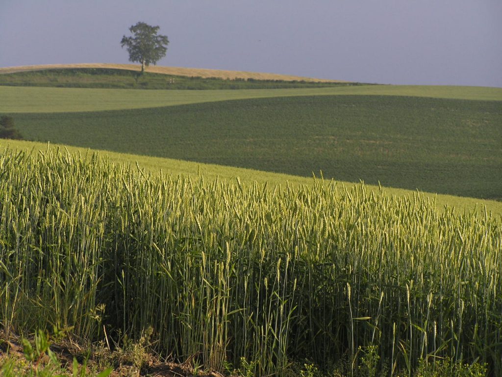
Wheat is a staple crop in Japan, playing an important role in the country’s agricultural production. While Japan is better known for its rice production, wheat cultivation is significant due to the demand for wheat in food products such as bread, noodles, and other processed foods. The wheat varieties grown in Japan differ from those cultivated in other countries, with specific types being chosen based on their suitability for Japan’s climate and the types of food products being produced. This article provides an overview of the primary wheat types grown in Japan, their characteristics, and the regions where they are cultivated.
1. Soft White Winter (SWW)
Characteristics
Soft White Winter (SWW) is the most widely cultivated wheat variety in Japan. It is characterized by its low protein content and soft, white kernels. This type is commonly used to produce flour for products like udon noodles, pancakes, and pastries. SWW is ideal for soft-textured baked goods and noodle production due to its lower protein content, which results in a more delicate and tender texture.
SWW has a relatively mild flavor and is preferred for its ability to absorb water, which is important for the production of noodles and other dough-based products.
Yields
The yield of Soft White Winter in Japan varies depending on the region and weather conditions. In general, yields are moderate compared to other wheat types, with typical yields ranging from 2 to 4 tons per hectare. The yield can be influenced by factors such as temperature, soil quality, and the presence of pests and diseases.
Primary Growing Regions
Soft White Winter is primarily grown in the northern regions of Japan, particularly in Hokkaido. Hokkaido’s cooler climate and longer winters make it an ideal location for growing winter wheat. Other regions where SWW wheat is cultivated include parts of Honshu, especially in the colder areas of Tohoku and Kinki. However, Hokkaido remains the primary wheat-growing area in Japan due to its favorable growing conditions.
2. Hard Red Winter (HRW)
Characteristics
Hard Red Winter (HRW) is another wheat variety that is grown in Japan, though it is less common than Soft White Winter. HRW has a higher protein content and a firmer texture, making it suitable for bread production. The high protein content of HRW wheat makes it ideal for producing bread flour, which requires strong gluten for dough structure.
HRW is used for bread-making and other products that require more gluten strength. The wheat kernels are hard and reddish-brown, which distinguishes them from the softer, lighter kernels of SWW.
Yields
The yield of Hard Red Winter in Japan is generally lower than Soft White Winter, with typical yields ranging from 2 to 3 tons per hectare. HRW requires specific growing conditions and is more susceptible to weather extremes, such as cold temperatures during the winter months.
Primary Growing Regions
Hard Red Winter is cultivated in smaller quantities compared to SWW, and its production is generally concentrated in the colder regions of Japan. Areas in Hokkaido and parts of northern Honshu are the primary regions for HRW cultivation. However, the production volume remains limited due to the specific climate requirements and the competition with SWW.
3. Durum Wheat
Characteristics
Durum Wheat, known for its high protein content and hard texture, is another wheat variety that is cultivated in Japan, though its cultivation is more specialized. Durum wheat is primarily grown for pasta production due to its strong gluten structure, which is necessary for pasta to retain its shape during cooking. Durum wheat has a golden-yellow color and is often used to produce semolina flour.
Durum wheat is highly valued in Japan for making pasta, particularly in the production of high-quality spaghetti, macaroni, and other pasta products.
Yields
Durum wheat yields in Japan are generally lower than those of other wheat types, typically ranging from 1 to 2 tons per hectare. Durum wheat requires a warm growing season and specific soil conditions to develop its characteristic hard texture and high protein content.
Primary Growing Regions
The cultivation of Durum wheat in Japan is relatively limited compared to Soft White Winter. It is mainly grown in parts of Hokkaido, where the climate is more suitable for the cultivation of wheat types with specific needs. However, Durum wheat’s overall production remains small due to its specialized nature and the competition from other wheat types.
4. Spring Wheat (SWW, HRW)
Characteristics
Spring wheat, which includes both Soft White Spring and Hard Red Spring, is planted in the spring and harvested in late summer or early fall. While the total acreage of spring wheat in Japan is relatively small, it is still an important wheat type used for bread and noodle production. Spring wheat varieties tend to have a higher protein content than soft winter wheat varieties, making them ideal for bread-making.
Spring wheat varieties have a firmer texture than soft winter wheat, which makes them more suitable for products that require stronger gluten, such as bread and pasta.
Yields
Spring wheat yields in Japan are generally lower than those of winter wheat varieties, with typical yields ranging from 2 to 3 tons per hectare. Spring wheat is more sensitive to weather fluctuations, and its yields can be impacted by temperature and rainfall.
Primary Growing Regions
Spring wheat is grown in Japan’s cooler regions, particularly in Hokkaido. Due to the short growing season and relatively mild temperatures, Hokkaido is the most suitable area for spring wheat cultivation. Other regions of Japan, including parts of Honshu, may also grow spring wheat, but it remains a minor crop compared to winter wheat.
Wheat Types in Japan
Wheat production in Japan is primarily focused on Soft White Winter, which is well-suited for the country’s food processing industry, especially for noodles, bread, and pastries. Other wheat varieties, such as Hard Red Winter and Durum Wheat, are also grown in smaller quantities, with each serving a specific role in the production of bread and pasta products. Japan’s wheat cultivation is concentrated in the northern regions, particularly in Hokkaido, where the climate is more favorable for growing winter wheat and specialized wheat varieties. Despite the relatively small acreage compared to other countries, Japan remains a significant player in the wheat market, with domestic wheat production contributing to the country’s agricultural economy.
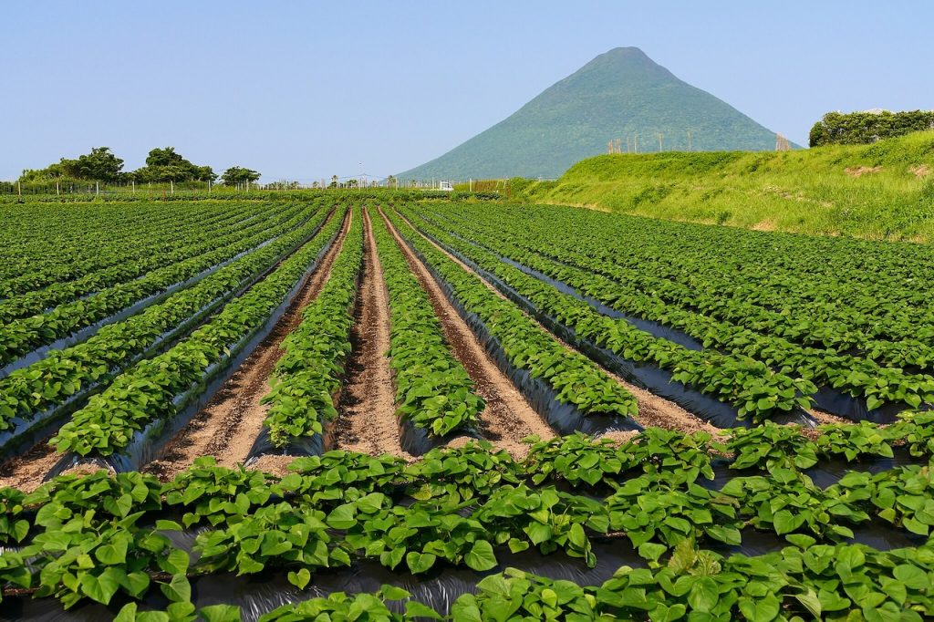
Kyushu, Japan’s third-largest island, is renowned for its diverse agricultural production. The region boasts unique crops such as sweet potatoes, strawberries, and high-quality beef like Kagoshima wagyu. Satellite data and remote sensing technologies are playing a crucial role in enhancing the sustainability, productivity, and climate resilience of Kyushu’s specialty agriculture. This article explores how farmers in Kyushu are integrating satellite technology to optimize production practices for their unique crops and improve overall agricultural efficiency.
Boosting Sweet Potato Production in Kagoshima with Remote Sensing
Kagoshima Prefecture is a major producer of sweet potatoes, particularly the satsumaimo variety, which is prized for its sweetness and texture. Sweet potatoes are a hardy crop, but they require precise irrigation management and monitoring of soil conditions to maintain high yields.
Satellite imagery provides essential insights into soil moisture levels, vegetation health, and temperature variations across large plots of land. By analyzing vegetation indices such as NDVI, farmers can assess the overall health of the crops and detect areas that need additional irrigation or nutrient inputs. This data-driven approach helps Kagoshima’s sweet potato farmers to optimize crop yield and quality while minimizing resource usage.
Supporting Strawberry Farming in Fukuoka with Satellite Data
Fukuoka Prefecture is famous for its high-quality strawberries, particularly the Amaou variety, which is known for its large size and sweet flavor. However, strawberry cultivation is labor-intensive and highly sensitive to environmental conditions, such as temperature and humidity.
By utilizing satellite-based weather forecasting, farmers can predict extreme weather events and adjust their cultivation practices accordingly. Remote sensing technologies also allow for monitoring of soil health and water content, enabling farmers to precisely manage irrigation schedules and reduce water wastage. The integration of these technologies ensures that Fukuoka’s strawberry farmers can produce top-tier fruit while enhancing sustainability.
Enhancing Kagoshima’s Wagyu Beef Production with Satellite Monitoring
Kagoshima is also known for its high-quality wagyu beef, including the renowned Kagoshima wagyu. The region’s cattle ranchers face the challenge of maintaining high-quality pastures and managing the herd’s health in a way that ensures optimal growth and marbling in the meat.
Satellite data helps farmers monitor pasture conditions, track vegetation growth, and assess the impact of weather conditions on grazing areas. With this data, ranchers can manage rotational grazing more effectively, ensuring that the pastures are not overused and that the cattle have access to nutritious forage throughout the year. Additionally, satellite monitoring assists in detecting signs of stress or disease in cattle, enabling early interventions to improve herd health.
Optimizing Rice Production in Miyazaki with Remote Sensing
Miyazaki Prefecture is well-known for its rice production, particularly the high-quality Koshihikari and Hitomebore varieties. Rice farming in Miyazaki benefits from the region’s abundant rainfall, but excessive water or inconsistent irrigation can lead to crop damage and reduced yields.
Remote sensing technologies enable farmers to monitor soil moisture levels, flooding conditions, and vegetation health in real-time. By combining satellite data with precision irrigation systems, farmers can optimize water usage and ensure that the rice paddies receive the right amount of water at the right time. This reduces the risk of waterlogging and promotes healthier, more resilient rice crops.
Managing Citrus Orchards in Kumamoto with Satellite Data
Kumamoto is another important citrus-growing region in Kyushu, known for its high-quality varieties such as sumo citrus and mikan. The region’s citrus farmers face challenges related to pest management, soil fertility, and weather variations, all of which impact the quality of their fruit.
Satellite data provides valuable insights into soil health, crop stress, and pest activity. With the help of multispectral imaging, farmers can identify areas of the orchard that may require attention, whether it be for pest control, irrigation adjustments, or soil amendments. Remote sensing also aids in predicting harvest times, helping farmers plan and execute harvesting strategies to achieve optimal fruit quality and minimize losses.
Addressing Climate Change Challenges in Kyushu’s Agriculture
Kyushu’s agriculture is highly susceptible to the effects of climate change, including typhoons, heatwaves, and droughts. Satellite data plays an essential role in helping farmers prepare for and respond to these climate challenges.
By providing real-time weather monitoring and long-term climate forecasts, satellite technology helps farmers make informed decisions about crop selection, irrigation schedules, and pest management. For example, the data can help predict extreme weather events, allowing farmers to take preventive measures, such as adjusting planting times or reinforcing crops against strong winds.
Conclusion
Satellite data is revolutionizing specialty agriculture in Kyushu, enabling farmers to improve crop yields, reduce resource usage, and increase sustainability. Whether it’s optimizing irrigation for sweet potatoes in Kagoshima, managing soil health for strawberries in Fukuoka, or enhancing the quality of rice and wagyu beef, the integration of remote sensing technologies is driving greater efficiency in agriculture.
As the region continues to face climate change challenges, the role of satellite data in enhancing agricultural resilience will become even more vital. By adopting these technologies, Kyushu’s agricultural sector can remain competitive and continue to produce some of Japan’s most beloved and high-quality specialty crops.
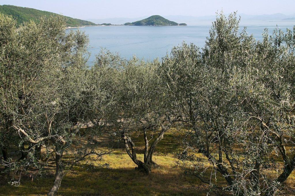
Shikoku, the smallest of Japan’s four main islands, is known for its diverse agricultural products, including citrus fruits, olives, and premium wagyu beef. The region’s mountainous terrain and coastal climate create both opportunities and challenges for farmers. By utilizing satellite data, agricultural producers in Shikoku can optimize cultivation practices, improve efficiency, and enhance climate resilience.
This article explores how remote sensing and satellite technology are transforming specialty agriculture across Shikoku.
Supporting Ehime’s Citrus Production with Remote Sensing
Ehime Prefecture is Japan’s leading producer of citrus fruits, particularly mikan (mandarin oranges) and iyokan. The region’s mild coastal climate is ideal for citrus farming, but fluctuating weather patterns and soil conditions can impact fruit quality.
Satellite-based monitoring allows farmers to track soil moisture levels, detect early signs of disease, and optimize irrigation. NDVI (Normalized Difference Vegetation Index) analysis helps identify areas of stress in citrus groves, enabling targeted interventions to maintain high yields.
By integrating satellite imagery with precision agriculture techniques, Ehime’s citrus industry can enhance sustainability while preserving its reputation for high-quality fruit.
Optimizing Kagawa’s Olive Farming with Satellite Data
Kagawa Prefecture is famous for its olive production, particularly in Shodoshima, where Japan’s first olive trees were planted. Olives require well-drained soil, ample sunlight, and careful water management to produce high-quality oil.
Remote sensing technology aids olive farmers by monitoring soil conditions, identifying pest infestations, and predicting optimal harvest times. Thermal imaging from satellites can detect water stress in olive groves, helping farmers adjust irrigation schedules to prevent yield losses.
Additionally, multispectral satellite data can be used to assess the oil content of olives before harvest, ensuring that the fruit is picked at peak quality.
Enhancing Tokushima’s Sudachi Cultivation with Precision Agriculture
Tokushima is known for producing sudachi, a small, aromatic citrus fruit widely used in Japanese cuisine. Sudachi thrives in Tokushima’s mountainous terrain, but sudden temperature changes and typhoons can affect production.
Satellite-based weather forecasting provides early warnings for extreme weather, allowing farmers to implement protective measures such as windbreaks and soil reinforcement. By using satellite data to monitor canopy health and soil conditions, farmers can optimize fertilization and reduce chemical inputs, leading to more sustainable farming practices.
Improving Kochi’s Yuzu and Ginger Production with Remote Sensing
Kochi Prefecture is a leading producer of yuzu and ginger, both of which require specific climate conditions for optimal growth. High humidity and frequent rainfall in the region make disease prevention a key challenge.
Satellite imagery can assist farmers in detecting disease outbreaks early by analyzing vegetation indices and temperature fluctuations. Remote sensing data also supports efficient land-use planning, ensuring that crops are grown in the most suitable locations to maximize yield and quality.
For ginger production, satellite monitoring of soil temperature helps determine the best planting and harvesting times, leading to improved consistency and marketability.
Managing Pastures for Shikoku Wagyu Production
Shikoku is home to high-quality wagyu breeds such as Awa Beef from Tokushima and Tosa Beef from Kochi. Maintaining lush, nutrient-rich pastures is essential for producing premium-grade beef.
Satellite data enables ranchers to assess pasture health, track seasonal vegetation changes, and plan rotational grazing strategies. By monitoring drought conditions and soil fertility levels from space, cattle farmers can ensure optimal grazing conditions while reducing reliance on supplemental feed.
Addressing Climate Challenges with Satellite Technology
Shikoku’s agriculture is highly vulnerable to climate change, including typhoons, heavy rainfall, and seasonal droughts. Satellite-based climate monitoring helps farmers adapt by providing real-time weather analysis and long-term climate projections.
With satellite-driven insights, farmers can make informed decisions about crop selection, irrigation, and soil conservation, reducing the risks associated with extreme weather.
Conclusion
From Ehime’s renowned citrus fruits to Kagawa’s olives and Tokushima’s prized sudachi, Shikoku’s specialty agriculture benefits significantly from satellite technology. By leveraging remote sensing for precision farming, farmers can enhance productivity, improve sustainability, and better withstand climate challenges.
As Japan’s agricultural sector continues to evolve, integrating satellite data into traditional farming practices will be key to maintaining high-quality production and ensuring the resilience of Shikoku’s unique crops.
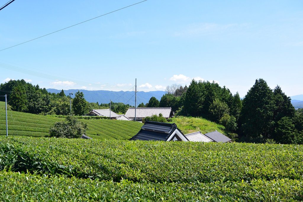
The Kinki region (also known as the Kansai region) is home to some of Japan’s most famous specialty agricultural products, including Kyoto’s high-quality green tea, Nara’s persimmons, Wakayama’s mandarin oranges, and Kobe’s premium beef. Given the region’s varied landscapes—ranging from fertile plains to mountainous areas—precision farming has become increasingly essential.
With the help of satellite data, farmers in the Kinki region can enhance production efficiency, maintain crop quality, and adapt to climate change. This article explores how satellite technology is revolutionizing the cultivation of Kinki’s specialty products.
Enhancing Kyoto’s Green Tea Cultivation with Remote Sensing
Kyoto’s Uji tea is world-renowned for its rich aroma and flavor. However, producing high-quality green tea requires careful soil management, precise climate control, and optimal shading techniques.
Satellite data can assist tea farmers by monitoring soil moisture and chlorophyll content, helping them determine the best times for irrigation and fertilization. Additionally, thermal imaging from satellites can detect temperature fluctuations that may affect tea leaf growth, allowing farmers to adjust shading strategies accordingly.
With satellite-based NDVI (Normalized Difference Vegetation Index) analysis, tea farmers can also identify areas of stress in their plantations and take corrective actions to ensure a consistent, high-quality yield.
Optimizing Wakayama’s Mandarin Orange Orchards
Wakayama Prefecture is Japan’s leading producer of mandarin oranges, known for their balance of sweetness and acidity. However, unpredictable weather patterns, including typhoons and droughts, pose challenges to maintaining fruit quality.
Satellite technology helps monitor orchard conditions by providing real-time data on soil moisture, plant health, and climate trends. By using satellite-based weather forecasting, farmers can take preemptive measures, such as reinforcing protective coverings during storms or adjusting irrigation schedules during dry periods.
Furthermore, remote sensing allows for early detection of citrus diseases, reducing reliance on chemical treatments and improving overall orchard sustainability.
Supporting Nara’s Persimmon Industry with Satellite Monitoring
Nara Prefecture is famous for its persimmons, particularly the seedless variety known as “Shibu-gaki” (astringent persimmon). These fruits require specific temperature and humidity conditions for optimal ripening and drying.
Satellite data plays a critical role in monitoring microclimates within persimmon orchards, ensuring that the drying process for sun-dried persimmons (hoshi-gaki) proceeds smoothly. Additionally, remote sensing can track leaf chlorophyll levels, allowing farmers to fine-tune fertilization practices and improve fruit quality.
By integrating satellite imagery with traditional cultivation methods, persimmon growers can increase yields while maintaining the signature taste and texture of Nara’s renowned fruit.
Improving Rice Farming in the Kinki Region
While the Kinki region is not Japan’s largest rice-producing area, high-quality rice is cultivated in regions such as Shiga and Hyogo. Satellite data is enhancing rice production by monitoring water levels, detecting nutrient deficiencies, and predicting harvest timing.
Synthetic-aperture radar (SAR) data from satellites like Sentinel-1 can help track water levels in flooded rice fields, ensuring proper growth conditions. Additionally, multispectral imaging enables early detection of pest infestations, reducing the need for excessive pesticide use.
By leveraging remote sensing, rice farmers in Kinki can optimize their harvest cycles and improve overall yield stability.
Monitoring Pastures for Kobe and Omi Beef Production
Kobe and Omi beef, among the most prized wagyu varieties, require meticulous cattle rearing conditions. High-quality pasture management is crucial for raising premium cattle, and satellite data is assisting in this area.
Using vegetation indices derived from satellite images, farmers can monitor pasture conditions, ensuring that grazing lands maintain optimal nutrient levels. Additionally, temperature and humidity monitoring help prevent heat stress in cattle, which can impact meat quality.
By integrating satellite technology with traditional cattle farming techniques, Kinki’s wagyu industry can maintain its global reputation for excellence.
Addressing Climate Challenges with Satellite Data
The Kinki region frequently experiences extreme weather events, including typhoons, heavy rainfall, and temperature fluctuations. These conditions threaten crop production and require advanced planning.
Satellite-based climate analysis helps farmers anticipate and mitigate risks by providing early warnings of droughts, storms, and temperature shifts. Long-term climate trend analysis also supports the selection of resilient crop varieties and improved land-use planning.
Conclusion
From Kyoto’s premium green tea to Wakayama’s citrus orchards and Kobe’s world-famous wagyu, Kinki’s agriculture benefits greatly from satellite data. By integrating remote sensing technology with traditional farming practices, producers can enhance efficiency, ensure sustainability, and adapt to changing environmental conditions.
As the challenges of climate change and resource limitations grow, precision agriculture powered by satellite data will play an increasingly vital role in preserving Kinki’s agricultural heritage while improving productivity and quality.
Would you like me to translate this article into Japanese?
The Kinki region, also known as the Kansai region, is one of Japan’s most diverse agricultural areas. Despite its urban development, Kinki is home to a wide range of specialty crops, including Uji tea, Kobe beef, Nara persimmons, and Kyoto vegetables. These crops require precise cultivation techniques to maintain their high quality and reputation.
With climate change and increasing pressure on resources, satellite data is becoming an essential tool for optimizing agricultural practices in the region. This article explores how satellite technology supports the production of Kinki’s specialty agricultural products.
Monitoring Tea Plantations in Uji
Uji, located in Kyoto Prefecture, is famous for producing some of the highest-quality green tea in Japan. The growth and quality of tea leaves depend on precise climate conditions, including temperature, humidity, and soil moisture.
Satellite data, particularly from multispectral sensors, is helping tea farmers monitor their fields with unprecedented accuracy. By analyzing vegetation indices such as NDVI (Normalized Difference Vegetation Index), farmers can assess the health of their tea plants and detect signs of stress before they become visible to the naked eye.
Additionally, thermal imaging from satellites can help track soil and air temperatures, allowing farmers to optimize shading techniques, irrigation schedules, and harvest times. This ensures that the tea retains its distinctive aroma and taste.
Precision Agriculture for Kyoto Vegetables (Kyo-Yasai)
Kyoto vegetables, known as Kyo-Yasai, are traditional heirloom varieties prized for their unique flavors and textures. These include Kamo eggplant, Mibuna, and Kujo green onions. Since these vegetables are cultivated using specialized techniques, they require precise environmental monitoring.
Satellite data helps in soil moisture analysis, nutrient distribution, and climate adaptation strategies. For instance, remote sensing technology can identify variations in soil composition across different fields, allowing farmers to apply fertilizers and water more efficiently.
Moreover, by combining satellite data with AI-driven predictive models, farmers can anticipate the effects of weather changes on their crops. This is particularly useful for planning planting and harvesting schedules, reducing the risk of crop loss due to unexpected weather conditions.
Supporting the Kobe Beef Industry
Kobe beef is one of Japan’s most famous agricultural products, known for its marbled texture and rich flavor. While satellite data is not directly used in cattle breeding, it plays a crucial role in managing pastures and forage production.
Grass quality and quantity are critical for raising healthy Tajima cattle, the breed used for Kobe beef. Satellite imagery helps monitor pasture conditions, identifying areas with nutrient deficiencies or signs of drought stress. Farmers can then adjust grazing patterns, supplement feeding strategies, and optimize land use.
Additionally, weather monitoring via satellite data assists in preventing heat stress in cattle, which can impact their growth and overall meat quality. By using satellite-based climate models, ranchers can predict temperature shifts and make adjustments to cattle management strategies.
Protecting Nara Persimmons from Climate Variability
Nara Prefecture is well known for its high-quality persimmons, particularly the seedless Fuyu variety. However, like many fruit crops, persimmons are sensitive to climate variations, particularly temperature fluctuations and drought conditions.
Satellite data aids in tracking seasonal temperature trends, which are crucial for flowering and fruit development. It also helps in managing water resources more effectively by detecting soil moisture levels. This ensures that farmers can implement precise irrigation strategies to prevent fruit cracking, which is a common issue in persimmon production.
Another advantage of satellite technology is its ability to detect pest outbreaks early. By analyzing vegetation health and temperature anomalies, farmers can take preventive actions against common threats such as aphids and fungal infections.
Adapting to Climate Change with Smart Farming
The Kinki region’s agriculture is increasingly affected by unpredictable weather patterns, including typhoons, heavy rains, and heatwaves. Satellite data plays a vital role in adapting to these challenges by providing accurate weather forecasts and early warnings.
For example, remote sensing technologies help monitor flooding risks in agricultural areas, allowing farmers to prepare drainage systems in advance. Similarly, long-term climate data analysis enables policymakers and farmers to develop more resilient agricultural practices, such as selecting drought-resistant crop varieties or adjusting planting schedules.
Conclusion
The use of satellite data in Kinki’s agricultural sector is transforming the way farmers manage their specialty crops. From monitoring Uji tea plantations and optimizing Kyoto vegetable farming to improving pasture management for Kobe beef and protecting Nara persimmons, satellite technology is making agriculture more precise, efficient, and sustainable.
As climate change and resource constraints continue to impact farming, adopting satellite-based precision agriculture will be crucial for preserving the region’s unique agricultural heritage. By integrating advanced satellite analytics with traditional knowledge, the Kinki region can continue to produce high-quality specialty crops while ensuring long-term agricultural sustainability.
The Chugoku region, located in western Honshu, is known for its diverse agricultural landscape, from the fertile plains of Okayama to the mountainous areas of Tottori and Shimane. The region is home to various specialty crops such as Okayama white peaches, Hiroshima oysters, Yamaguchi pufferfish, Tottori pears, and high-quality rice.
With the challenges of climate change, labor shortages, and the need for higher efficiency, satellite data is playing a crucial role in supporting sustainable and precision agriculture in the Chugoku region. This article explores how satellite technology is transforming the production of Chugoku’s specialty agricultural products.
Monitoring Okayama White Peaches for Quality Control
Okayama Prefecture is famous for its white peaches, which are highly valued for their sweetness and delicate texture. These peaches require specific growing conditions, including well-regulated soil moisture, optimal temperature, and protection from extreme weather events.
Satellite data is helping farmers monitor their orchards by analyzing soil moisture levels, vegetation health, and temperature variations. By using NDVI (Normalized Difference Vegetation Index) and thermal imaging, farmers can identify areas in need of irrigation or shade adjustments.
Additionally, early detection of heat stress or disease outbreaks through remote sensing allows for timely interventions, ensuring that the peaches maintain their premium quality.
Optimizing Tottori Pear Orchards with Remote Sensing
Tottori is known for its high-quality pears, particularly the Nijisseiki (20th Century) pear, which is a crisp and juicy variety. To maintain consistent fruit quality, precision agriculture techniques are being integrated with satellite data to monitor tree health and fruit development.
Satellite imagery helps track chlorophyll content in leaves, indicating nutrient levels and potential deficiencies. Additionally, multispectral data assists in optimizing irrigation schedules, preventing over- or under-watering, which can impact fruit size and sweetness.
By combining satellite data with on-the-ground sensors, farmers can better manage their orchards, reducing waste and improving harvest yields.
Enhancing Rice Production in the Chugoku Region
Rice farming is a significant part of agriculture in Chugoku, with areas like the San’in region producing high-quality rice varieties. With the increasing risk of climate variability, satellite technology is being used to monitor water availability and soil health in rice paddies.
Radar-based satellite imagery, such as from Sentinel-1, can track water levels in flooded rice fields, ensuring optimal conditions for growth. Additionally, remote sensing can detect early signs of pests and diseases, allowing for targeted pesticide applications that minimize environmental impact.
By utilizing real-time satellite monitoring, farmers can adapt to changing weather patterns and optimize their rice yields while maintaining sustainable farming practices.
Supporting Oyster Farming in Hiroshima Bay
While not a crop in the traditional sense, oyster farming in Hiroshima Bay is an important part of the region’s aquaculture industry. Satellite data is playing a role in monitoring sea surface temperatures, water quality, and algal bloom occurrences, all of which affect oyster growth and health.
Using satellite-based chlorophyll concentration maps, oyster farmers can predict when algae levels may become harmful. Additionally, real-time temperature tracking helps optimize harvesting times, ensuring the best flavor and texture for Hiroshima oysters.
By integrating satellite data with traditional aquaculture practices, Hiroshima’s oyster industry can maintain its high standards and sustainability.
Managing Climate Change Challenges with Satellite Data
The Chugoku region faces various climate-related challenges, including typhoons, heavy rainfall, and periods of drought. These weather events can severely impact specialty crops and agricultural productivity.
Satellite-based weather forecasting allows farmers to anticipate extreme weather and take preventive measures, such as reinforcing protective nets for fruit orchards or adjusting irrigation systems before drought conditions set in.
Additionally, long-term climate trend analysis using satellite data can help policymakers and farmers develop adaptation strategies, such as shifting planting seasons or selecting more resilient crop varieties.
Conclusion
The integration of satellite data into Chugoku’s agricultural sector is revolutionizing how specialty crops are cultivated. From optimizing Okayama’s white peach orchards and Tottori’s pear farms to improving rice production and supporting Hiroshima’s oyster industry, remote sensing technology is enhancing efficiency, sustainability, and resilience.
As climate challenges and resource constraints continue to impact farming, leveraging satellite-based precision agriculture will be key to ensuring the long-term success of Chugoku’s agricultural heritage. By combining traditional knowledge with cutting-edge satellite analytics, the region can continue to thrive in the modern agricultural landscape.
Manage Cookie Consent
We use technologies like cookies to store and/or access device information. We do this to improve browsing experience and to show personalized ads. Consenting to these technologies will allow us to process data such as browsing behavior or unique IDs on this site. Not consenting or withdrawing consent, may adversely affect certain features and functions.
Functional
Always active
The technical storage or access is strictly necessary for the legitimate purpose of enabling the use of a specific service explicitly requested by the subscriber or user, or for the sole purpose of carrying out the transmission of a communication over an electronic communications network.
Preferences
The technical storage or access is necessary for the legitimate purpose of storing preferences that are not requested by the subscriber or user.
Statistics
The technical storage or access that is used exclusively for statistical purposes.The technical storage or access that is used exclusively for anonymous statistical purposes. Without a subpoena, voluntary compliance on the part of your Internet Service Provider, or additional records from a third party, information stored or retrieved for this purpose alone cannot usually be used to identify you.
Marketing
The technical storage or access is required to create user profiles to send advertising, or to track the user on a website or across several websites for similar marketing purposes.