A Satellite Perspective: Elevating Marlborough’s Vineyards and Wines

A Satellite Perspective: Elevating Marlborough's Vineyards and Wines

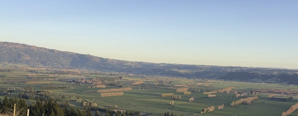
Nestled in the northeastern corner of New Zealand’s South Island, Marlborough is synonymous with world-class Sauvignon Blanc and picturesque vineyards. This iconic wine region is leveraging satellite technology to refine its viticultural practices, ensuring sustainability and maintaining its global reputation for excellence.

Revolutionizing Marlborough’s Vineyards with Satellite Insights

Marlborough’s sprawling vineyards, covering over 26,000 hectares, are uniquely suited to benefit from satellite innovations. These technologies provide invaluable data that address the region’s distinct challenges and opportunities:

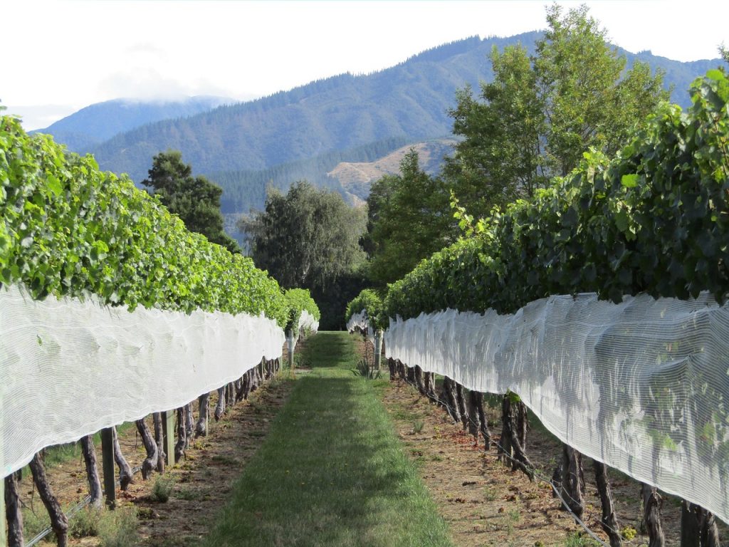
  1. Optimizing Irrigation for Sauvignon Blanc Marlborough’s dry climate and well-draining soils create ideal conditions for grape cultivation but also necessitate careful water management. Satellites like Sentinel-2 monitor soil moisture levels and vine stress in real time. This allows growers to implement precision irrigation, reducing water waste while enhancing grape quality.
  2. Monitoring Canopy Health for Consistent Quality The canopy—the leaves and shoots of grapevines—plays a crucial role in protecting grapes and influencing flavor profiles. Satellite imagery captures data on canopy density and chlorophyll content, enabling vintners to adjust pruning and canopy management practices for optimal grape ripening.
  3. Disease and Pest Management Early detection of diseases like powdery mildew or pest infestations is critical in viticulture. High-resolution satellite imagery identifies subtle changes in vine health, allowing vineyard managers to target treatments precisely and minimize chemical use.
  4. Enhancing Yield Predictions Accurate yield forecasting is essential for planning harvests and meeting market demands. Satellites track vine growth patterns and environmental conditions, helping growers predict yields with greater accuracy and allocate resources efficiently.
  5. Sustainability Through Land Management Marlborough’s commitment to sustainable winegrowing is supported by satellite data. By mapping erosion-prone areas and monitoring water bodies, vineyards can adopt practices that protect the environment while maintaining productivity.

Real-World Applications in Marlborough

  1. Iconic Sauvignon Blanc Vineyards Renowned wineries in the Wairau and Awatere Valleys are using satellite insights to refine their irrigation schedules and canopy management techniques. This precision approach has led to wines with more consistent flavor profiles, reinforcing Marlborough’s reputation on the global stage.
  2. Boutique Wineries Leading Innovation Smaller vineyards are also embracing satellite technology to gain a competitive edge. By analyzing microclimates and soil variations, boutique wineries can produce distinctive wines that highlight the unique characteristics of their terroir.
  3. Collaboration Across the Industry Industry groups like New Zealand Winegrowers are facilitating access to satellite data and training programs, ensuring that both large-scale producers and small growers benefit from technological advancements.

Addressing Challenges in Marlborough’s Viticulture

Despite its advantages, the integration of satellite technology comes with challenges:

  • High Initial Costs: Small-scale wineries may struggle to afford high-resolution satellite imagery and associated tools.
  • Data Literacy: Understanding and applying satellite data requires specialized knowledge, necessitating training programs for vineyard staff.
  • Integration with Traditional Practices: Combining satellite insights with traditional winemaking techniques requires careful adaptation.

Local initiatives and partnerships are addressing these barriers by providing financial support, accessible platforms, and educational resources tailored to Marlborough’s viticulture.

The Future of Satellite Technology in Marlborough’s Wine Industry

As satellite technology continues to advance, its impact on Marlborough’s vineyards will deepen. Emerging tools, such as AI-powered analytics and drone integration, promise even greater precision in vineyard management. These innovations will enable vintners to craft wines that reflect the unique essence of Marlborough while meeting the demands of a changing climate.

Marlborough’s embrace of satellite technology highlights the intersection of tradition and innovation. By leveraging cutting-edge tools, the region is ensuring its place as a global leader in winemaking, demonstrating that even the most storied wine regions can benefit from a high-tech touch.

A Satellite Perspective: Nurturing Agriculture in Otago

A Satellite Perspective: Nurturing Agriculture in Otago

Amidst the rugged beauty of Otago’s diverse landscapes, a quiet revolution is unfolding. Satellite technology, often associated with space exploration, is now a cornerstone of the region’s agricultural innovation. By providing precise, actionable insights, this technology is reshaping farming practices, driving sustainability, and preparing farmers for an uncertain future.

Unlocking Otago’s Agricultural Potential Through Satellites

Otago’s distinct agricultural identity is defined by its vineyards, rolling pastures, and thriving arable farms. Each of these areas benefits uniquely from satellite insights:

  1. Precision Irrigation for Vineyards and Pastures In Central Otago, where the world’s southernmost vineyards produce acclaimed Pinot Noir, managing water efficiently is a constant challenge. Satellite systems like Sentinel-2 deliver invaluable soil moisture data. This allows vintners to fine-tune irrigation, ensuring every drop enhances grape quality while minimizing waste.Livestock farmers also reap the benefits of satellite data. By identifying dry areas in sprawling pastures, they can target irrigation and maintain lush grazing lands even during drier seasons.
  2. Pasture Health Monitoring for Livestock High-country sheep and cattle farms in Otago face vast and often remote grazing areas. Satellite-derived vegetation indices like NDVI provide detailed pasture health maps, enabling farmers to allocate grazing zones efficiently, avoid overgrazing, and protect the fragile highland environment.
  3. Enhanced Crop Management in Arable Farming Near Dunedin, the fertile Taieri Plains host a variety of crops, from cereals to vegetables. Farmers leverage satellite imagery to monitor crop health, quickly detect pest outbreaks, and optimize fertilizer use. These practices not only boost yields but also reduce environmental impacts.
  4. Weather Resilience and Disaster Preparedness Otago’s agricultural sector is no stranger to extreme weather events. With satellite-based forecasting, farmers receive early warnings about incoming floods or droughts. For instance, flood-prone areas along rivers can be monitored, allowing timely interventions to minimize damage to crops and infrastructure.
  5. Sustainable Land Management The region’s dramatic landscapes, while stunning, pose unique challenges. High-resolution satellite imagery helps identify erosion hotspots, monitor changes in wetlands, and assess riverbank stability. These insights enable farmers and policymakers to balance agricultural productivity with environmental stewardship.

Local Success Stories in Otago

  1. Vineyards Thriving in Central Otago Bannockburn and Cromwell’s vineyards are embracing satellite technology to enhance grape production. By analyzing canopy density and vine stress through satellite imagery, vintners are improving both the quality and consistency of their harvests.
  2. Sustaining High-Country Livestock Farms In Otago’s highlands, satellite data ensures efficient use of vast grazing lands. By tracking vegetation growth, farmers maintain healthy livestock while preserving the delicate ecosystems that define this rugged terrain.
  3. Arable Farming Innovations in Taieri Plains Farmers in the Taieri Plains are leading the charge in using satellite imagery to refine their irrigation schedules. This targeted approach has reduced water usage while ensuring robust crop growth, particularly for high-demand crops like barley and vegetables.

Challenges and Opportunities

While satellite technology offers immense potential, certain barriers remain:

  • Accessibility for Small Farmers: High-resolution imagery and related tools can be costly, limiting adoption by smaller farms.
  • Training and Expertise: Farmers often require training to interpret satellite data and integrate it into their workflows.
  • System Integration: Combining satellite insights with traditional practices and IoT devices demands significant investment.

To address these issues, local initiatives are stepping in, offering subsidies, training programs, and user-friendly platforms that make satellite technology accessible to all farmers in the region.

Shaping the Future of Otago’s Agriculture

Otago stands at the forefront of a global agricultural transformation. Advances in machine learning and AI promise even greater precision in analyzing satellite data, delivering customized solutions to individual farms. Emerging technologies, such as drones working in tandem with satellites, will further refine precision agriculture.

For Otago’s farmers, the adoption of satellite technology isn’t just about productivity—it’s about resilience. By embracing these tools, they are safeguarding their livelihoods against climate variability, ensuring sustainability, and securing a prosperous future for generations to come. Otago’s story is a testament to how innovation and tradition can coexist, forging a path that others will surely follow.