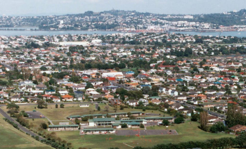
Satellite Data in Agriculture in the Chubu Region, Japan

Satellite Data in Agriculture in the Chubu Region, Japan
Mti, CC BY-SA 4.0, via Wikimedia Commons

The Chubu region of Japan, located in the central part of Honshu, is known for its diverse geography, ranging from coastal plains to mountainous terrains. This diversity allows for a wide variety of agricultural products, including rice, tea, fruit, and high-value crops such as wasabi. However, challenges such as climate variability, labor shortages, and sustainability concerns make it essential to adopt modern technological solutions. Satellite data is emerging as a powerful tool for improving agricultural efficiency and optimizing the production of Chubu’s regional specialties.

Optimizing Rice Cultivation in Niigata and Shizuoka

Niigata Prefecture is famous for producing some of the highest-quality rice in Japan, including Koshihikari. Shizuoka, while more known for tea, also has significant rice production. Satellite data can help farmers monitor rice fields by assessing soil moisture levels, identifying areas prone to flooding, and optimizing irrigation schedules.

Using Normalized Difference Vegetation Index (NDVI) data from satellites, farmers can track the growth stages of rice crops, detect pest infestations early, and predict yield more accurately. This allows for more efficient use of fertilizers and pesticides, leading to increased productivity and environmental sustainability.

Enhancing Tea Production in Shizuoka with Satellite Data

Shizuoka Prefecture accounts for about 40% of Japan’s total tea production. The quality of tea leaves is highly dependent on climate conditions such as temperature, humidity, and sunlight. Satellite data can provide real-time information on microclimate variations, helping farmers adjust shading techniques and irrigation practices to maintain optimal growth conditions.

Thermal imaging from satellites can also help detect water stress in tea plants, allowing for precise water management strategies that ensure high-quality yields while conserving water resources.

Improving Wasabi Cultivation in Nagano

Nagano Prefecture is renowned for its production of wasabi, a plant that requires pristine, cold, and clean flowing water to thrive. Climate change and water quality concerns pose challenges to wasabi farming. Satellite remote sensing can be used to monitor water sources, detect changes in river flow, and assess potential contamination risks.

Satellite imagery can also help predict the impact of seasonal temperature variations on wasabi growth, allowing farmers to take preventive measures to protect their crops from extreme weather conditions.

Boosting Fruit Production in Yamanashi and Aichi

Yamanashi is Japan’s leading producer of grapes and peaches, while Aichi is known for its strawberries. Precision agriculture techniques using satellite data can assist fruit farmers in several ways, such as:

  • Monitoring plant health through multispectral imaging
  • Predicting the best harvest time based on temperature and growth patterns
  • Detecting early signs of diseases and pest infestations

By integrating satellite data with automated irrigation systems, farmers can ensure that their crops receive the optimal amount of water, reducing waste and increasing fruit quality.

Supporting Vegetable Farming in Gifu and Ishikawa

Gifu and Ishikawa prefectures are known for their highland vegetable production, including lettuce, cabbage, and daikon radish. Given the topographical challenges of these areas, satellite data can provide valuable insights into soil conditions, temperature fluctuations, and precipitation levels.

Farmers can use this information to plan planting schedules, reduce soil erosion, and implement targeted fertilization strategies, improving overall crop yield and quality.

Addressing Climate Change and Sustainability

The Chubu region, with its diverse agricultural landscape, faces increasing challenges due to climate change. Rising temperatures, unpredictable rainfall, and extreme weather events can disrupt farming activities. Satellite data enables farmers to:

  • Predict and prepare for weather anomalies
  • Optimize resource usage to reduce environmental impact
  • Implement data-driven strategies for sustainable agriculture

By leveraging satellite technology, farmers in Chubu can adapt to changing climate conditions while ensuring the continued success of their regional specialties.

Conclusion

The use of satellite data in Chubu’s agriculture offers a promising future for optimizing rice, tea, fruit, wasabi, and vegetable farming. By integrating satellite-based monitoring systems, farmers can improve productivity, enhance sustainability, and maintain the high quality of their regional specialties. As satellite technology continues to advance, its role in precision agriculture will become even more essential, ensuring that Chubu remains a key agricultural hub in Japan.

中部地方における衛星データの活用:地域特産品の農業最適化

中部地方における衛星データの活用:地域特産品の農業最適化
Mti, CC BY-SA 4.0, via Wikimedia Commons

日本の本州中央部に位置する中部地方は、沿岸平野から山岳地帯まで多様な地理を有しています。この多様性により、米、茶、果物、わさびなどの高付加価値作物を含む幅広い農産物が生産されています。しかし、気候変動、人手不足、持続可能性の課題に直面しており、現代技術の活用が不可欠となっています。衛星データは、中部地方の特産品生産を最適化し、農業の効率を向上させる強力なツールとして注目されています。

新潟・静岡の稲作最適化

新潟県は、コシヒカリをはじめとする日本最高品質の米の産地として知られています。静岡県はお茶の産地として有名ですが、米の生産も盛んです。衛星データを活用することで、土壌水分の測定、洪水のリスク評価、最適な灌漑スケジュールの策定が可能になります。

正規化植生指数(NDVI)のデータを用いることで、稲の生育状況を把握し、病害虫の早期発見や収穫予測が正確に行えます。これにより、肥料や農薬の使用を最適化し、生産性向上と環境保全の両立が可能になります。

静岡のお茶生産の向上

静岡県は日本の総茶生産量の約40%を占めており、高品質な茶葉の生産には気温、湿度、日照条件が重要です。衛星データを活用することで、マイクロクライメート(微気候)の変動をリアルタイムで把握し、適切な遮光技術や灌漑管理を行うことができます。

また、衛星の熱画像技術を使用して茶葉の水分ストレスを検出し、精密な水管理を行うことで、品質を維持しながら水資源を効率的に利用できます。

衛星データによる長野のわさび栽培の改善

長野県は、清らかな冷水が必要なわさびの名産地です。しかし、気候変動や水質の問題がわさび栽培に影響を及ぼす可能性があります。衛星リモートセンシングを活用することで、水源の監視、河川流量の変化の検出、汚染リスクの評価が可能になります。

また、衛星画像を活用して気温変化がわさびの成長に及ぼす影響を予測し、異常気象から作物を守るための対策を講じることができます。

山梨・愛知の果樹生産の強化

山梨県はブドウや桃の生産が盛んであり、愛知県はイチゴの名産地です。精密農業技術と衛星データを組み合わせることで、果樹農家は以下のようなメリットを得られます。

  • マルチスペクトル画像を用いた植物の健康状態の監視
  • 気温と生育パターンに基づく最適な収穫時期の予測
  • 病害や害虫被害の早期発見

さらに、衛星データと自動灌漑システムを統合することで、最適な水量管理が可能になり、水資源の節約と果実品質の向上につながります。

岐阜・石川の野菜生産の支援

岐阜県や石川県では、レタス、キャベツ、大根などの高原野菜が生産されています。これらの地域では地形的な課題が多いため、衛星データを活用することで、土壌状況、気温変動、降水量のデータを取得し、精度の高い農業管理が可能となります。

このデータをもとに作付け計画を立てることで、土壌侵食を抑え、的確な施肥計画を実施し、収量と品質の向上が期待できます。

気候変動と持続可能性への対応

中部地方の多様な農業景観は、気候変動による影響を受けやすい地域でもあります。気温上昇、降雨の不規則化、異常気象は農業活動に大きな影響を与える可能性があります。衛星データを活用することで、

  • 気象異常の予測と事前対策
  • 資源の最適活用による環境負荷の軽減
  • データ駆動型の持続可能な農業戦略の実施

が可能になります。衛星技術を導入することで、農業従事者は気候変動に適応しながら、地域特産品の品質を維持・向上させることができます。

結論

中部地方における衛星データの活用は、米、茶、果物、わさび、野菜農業の最適化に大きく貢献します。衛星を活用したモニタリングシステムを導入することで、生産性の向上、持続可能性の確保、そして地域特産品の品質向上が実現可能です。今後、衛星技術の進化に伴い、精密農業の役割はますます重要になり、中部地方が日本の主要な農業拠点としての地位を維持するための鍵となるでしょう。

関東地方における衛星データを活用した農業:作物と酪農業の最適化

関東地方における衛星データを活用した農業:作物と酪農業の最適化

関東地方は、日本で最も人口が多く、経済的に重要な地域であり、稲作だけでなく、野菜、果物、穀物の栽培や酪農も盛んな地域です。都市化や気候変動、人口増加などの影響を受けて、農業は進化し続けています。衛星データ技術は、生産性の向上、持続可能性の確保、作業の効率化を実現するために、農業において重要な役割を果たしています。本記事では、関東地方における作物栽培と酪農業における衛星データの活用方法について探ります。

作物モニタリングによる収穫量の向上

関東地方では、トマトやキュウリ、葉物野菜などの野菜や、イチゴやリンゴなどの果物が多く栽培されています。農家は、衛星データを活用して作物の成長や健康状態をリアルタイムで監視し、投入物の最適化と収穫量の向上を目指しています。

衛星画像、特に植生指数(NDVI:正規化差植生指数)は、作物の健康状態を監視するために役立ちます。NDVIの値は、水不足、栄養不足、または害虫によるストレスを示すことがあります。これらの画像を分析することで、農家は灌漑、施肥、害虫駆除の計画を調整し、作物の成長を最適化し、資源の浪費を減らすことができます。

さらに、衛星データを活用すると、土壌の特性のばらつきが把握でき、肥料や水の使用をより正確に行うことができます。この精密農業により、作物の質と収穫量が向上し、環境への影響を最小限に抑えることができます。

野菜農業における精密農業の最適化

関東地方の野菜栽培は、衛星技術を活用することで、精密農業がさらに進化しています。野菜は成長周期の中で環境条件に非常に敏感であり、衛星データは温度、湿度、土壌水分などの微気候を監視し、最適な管理を行うために活用されています。

農家は衛星データを用いて、畑の異なる深さで土壌水分を追跡し、灌漑システムを調整して作物が必要とする水分を提供できます。これにより、水不足が敏感な作物(トマトや葉物野菜など)への水分ストレスを防ぐことができます。また、環境変化に迅速に対応できるため、干ばつや害虫の発生リスクを軽減することができます。

果樹園における水使用の最適化

イチゴ、リンゴ、ナシなどの果物は、関東地方で広く栽培されています。これらの果物は、成長段階ごとに異なる水の需要があるため、衛星データを活用して土壌水分量を監視し、水の需要を予測することで灌漑スケジュールを最適化できます。

衛星データにより、果樹園内の水分過不足のエリアを特定でき、適切な水分管理が可能になります。このような最適化により、水の浪費を防ぎ、病気の発生リスク(例えば、湿度によるカビ感染など)も抑えられます。また、衛星データを使って果樹のフェノロジー(開花や収穫のタイミング)を追跡することができ、最適な収穫時期を見逃さずに済みます。

精密施肥による栄養管理の向上

関東地方の農業において、肥料の使用は作物の健康と生産性に欠かせない要素です。しかし、過剰な肥料使用は土壌の劣化や環境汚染を引き起こす可能性があるため、正確な肥料管理が重要です。衛星データは、土壌の健康状態や作物の栄養ニーズをより精密に把握し、精密施肥をサポートします。

衛星画像を分析することで、農家は土壌の肥沃度のばらつきや作物の健康状態を把握し、必要な場所にのみ適切な量の肥料を施すことができます。これにより、過剰な肥料使用を避け、作物の生長を最適化し、環境への影響を最小限に抑えることができます。

酪農業における衛星データの活用:草地と家畜の健康管理

関東地方の酪農業においても、衛星データは草地管理と家畜の健康監視に役立っています。健康な草地は高品質な飼料を提供するため、草地の状態を衛星データで監視することは非常に重要です。

衛星画像を用いて、農家は草地のバイオマスや葉緑素含量を追跡し、草地の状態を評価できます。これにより、放牧パターンや肥料、灌漑の管理を最適化し、高品質な飼料を提供することができます。最適な草地管理により、補助飼料のコストを削減し、酪農家の経営を効率化することができます。

また、衛星データは家畜の健康監視にも使用され、温度や動きのデータを通じて、ストレスや病気の兆候を早期に発見することができます。これにより、農家は早期に介入し、病気の蔓延を防ぎ、熱ストレスの軽減に取り組むことができます。

酪農業における温室効果ガス排出量の削減

酪農業は、特に大規模な農場ではメタンガスの排出に関係しています。衛星データは、メタン排出を監視し、酪農業での温室効果ガス削減に貢献しています。

衛星データを使用することで、農家はメタン生成に影響を与える環境条件を追跡し、牛糞の管理方法や飼料の変更に関するデータを収集できます。この情報を基に、酪農業はメタンの排出を抑制するための管理方法を最適化することができます。これにより、温室効果ガスの排出量を削減し、酪農業の環境負荷を軽減することが可能になります。

気候変動への適応力強化

気候変動は農業に大きな影響を与えており、特に気温の上昇や降水パターンの変動、極端な気象事象(干ばつや豪雨など)が作物や家畜に影響を及ぼします。衛星データは、気候変動の影響を監視し、農家が気候変動に適応する手助けをするために非常に役立ちます。

衛星データを活用することで、農家は干ばつや豪雨の予測ができ、灌漑や植え付けのスケジュールを調整したり、家畜の管理方法を改善することができます。また、気候ストレスの影響を受けやすいエリアを特定し、ターゲットを絞った対策を講じることができます。これにより、気候変動の影響を軽減し、安定した農業生産を維持することが可能となります。

結論

衛星データは、関東地方における作物栽培と酪農業を革新し、農家に効率的で持続可能な農業実践のためのツールを提供しています。精密な灌漑、施肥、草地管理、家畜健康の監視など、衛星技術は農業生産性の向上と環境負荷の軽減に貢献しています。気候変動への対応や温室効果ガスの排出削減といった新たな課題に直面する中で、衛星データは今後ますます農業の未来を形作る重要な役割を果たすことが期待されます。

Satellite Data for Various Crops and Dairy Farming in the Kanto Region

Using Satellite Data for Various Crops and Dairy Farming in the Kanto Region, Japan
Miyuki Meinaka, CC BY-SA 4.0, via Wikimedia Commons

The Kanto region, with its diverse agricultural activities, is not only known for its rice production but also for the cultivation of various crops like vegetables, fruits, and grains, as well as for dairy farming. As farming in the region adapts to climate change, population growth, and urbanization, satellite data technology is playing an essential role in enhancing productivity, sustainability, and operational efficiency. This article explores how satellite data is being applied to the farming of different crops and dairy farming in the Kanto region.

Enhancing Crop Monitoring for Greater Yield

The Kanto region is home to a variety of crops, including vegetables like tomatoes, cucumbers, and leafy greens, as well as fruits like strawberries and apples. Farmers are increasingly turning to satellite data to monitor the growth and health of their crops, enabling them to optimize inputs and improve yield outcomes.

Satellite imagery, especially vegetation indices like NDVI (Normalized Difference Vegetation Index), allows farmers to monitor crop health in real-time. NDVI values can indicate whether crops are experiencing stress due to water scarcity, nutrient deficiencies, or pest infestations. By analyzing these images, farmers can adjust their irrigation, fertilization, and pest control strategies to optimize crop growth and reduce resource wastage.

Additionally, satellite data can help identify variations in soil properties across fields, enabling more precise application of fertilizers and water, which can lead to improved crop quality and yield while minimizing environmental impact.

Precision Agriculture for Sustainable Vegetable Farming

Vegetable farming, which is crucial in the Kanto region, benefits significantly from precision agriculture driven by satellite technology. Vegetables often require precise environmental conditions and care during their growing cycles. Satellite data allows farmers to monitor microclimates within their fields, including temperature, humidity, and soil moisture, enabling better management of these crops.

Farmers can use satellite data to track soil moisture at varying depths across their fields and adjust irrigation systems to ensure that each crop receives the right amount of water. This is especially important for crops that are sensitive to water stress, like tomatoes and leafy greens. Moreover, by monitoring these variables continuously, farmers can respond promptly to environmental changes and mitigate potential risks like drought or pest outbreaks.

Optimizing Water Usage in Fruit Orchards

Fruits such as strawberries, apples, and pears are commonly grown in the Kanto region. These crops have distinct water requirements depending on their growth stage. Satellite data is useful for monitoring soil moisture levels and predicting water demand, helping farmers optimize irrigation schedules and ensure their orchards are adequately hydrated.

Using satellite data, farmers can map out areas within their orchards that may be under-irrigated or over-irrigated and adjust water distribution accordingly. This not only conserves water but also helps prevent fruit diseases that may arise from poor water management, such as fungal infections. Additionally, farmers can use satellite imagery to track the phenological stages of fruit trees, ensuring timely harvesting and optimal fruit quality.

Precision Fertilization for Better Crop Nutrition

Fertilizer usage is critical for ensuring the health and productivity of crops in the Kanto region, but it is equally important to avoid over-fertilizing, which can lead to environmental damage and economic loss. Satellite data allows farmers to assess soil conditions and crop nutrient needs more accurately, enabling precision fertilization.

By analyzing satellite images and using algorithms that take soil health into account, farmers can create maps that show areas requiring more or less fertilizer. This reduces the excess application of fertilizers and ensures that crops receive the right nutrients at the right time, leading to better yields and less environmental pollution from runoff.

Satellite Data in Dairy Farming: Monitoring Grassland and Livestock Health

In addition to crop farming, dairy farming is also an integral part of the agricultural landscape in the Kanto region. Satellite data is helping dairy farmers optimize grassland management and livestock health monitoring. Grassland quality is essential for producing high-quality feed for dairy cows, and satellite data can assist in monitoring pasture health and growth.

Farmers can use satellite imagery to track the condition of grasslands, monitoring factors such as biomass, chlorophyll content, and overall pasture vigor. This information allows them to make decisions about grazing patterns, fertilization, and irrigation to ensure that their pastures are producing enough high-quality feed for their livestock. By optimizing pasture management, farmers can reduce costs associated with supplemental feed and improve the overall health of their dairy herds.

Furthermore, satellite data can also be used to monitor the health of livestock by detecting signs of stress or illness. For example, farmers can use temperature and movement data to identify cows that may be sick or experiencing heat stress, allowing them to intervene early and prevent the spread of disease or reduce the impact of environmental stressors.

Monitoring Greenhouse Gas Emissions in Dairy Farming

Dairy farming, particularly in areas where large-scale operations are common, is associated with methane emissions, which contribute to climate change. Satellite data can help farmers monitor and reduce methane emissions from dairy operations by providing insights into waste management practices, manure storage, and feed quality.

By utilizing satellite data, farmers can track environmental conditions and their relationship to methane production. This data can be used to optimize manure management, such as adjusting the timing and method of manure application or changing feed practices to reduce methane emissions. Satellite-based monitoring systems are helping dairy farmers in the Kanto region take steps to lower their carbon footprint while maintaining efficient and productive operations.

Climate Change Resilience for Crop and Dairy Farming

As climate change increasingly impacts agricultural activities, satellite data offers a tool to help farmers in the Kanto region adapt to shifting weather patterns and more extreme climate events. By tracking changes in temperature, precipitation, and soil moisture, farmers can anticipate potential disruptions to their crops and livestock and take action to mitigate risks.

For example, satellite data can help farmers predict periods of drought or extreme rainfall, enabling them to adjust planting schedules, irrigation systems, or even livestock management practices. By improving their ability to respond to climate-related changes, farmers can protect both crop and dairy production, ensuring a stable food supply for the region.

Conclusion

Satellite data is revolutionizing agriculture in the Kanto region by providing farmers with the tools they need to manage their crops and livestock more efficiently and sustainably. From precision irrigation and fertilization to monitoring pasture health and mitigating greenhouse gas emissions, satellite technology is enabling farmers to optimize their practices, increase productivity, and reduce their environmental footprint. As the Kanto region faces the challenges of climate change and increasing demand for agricultural production, satellite data will continue to play a vital role in shaping the future of farming in the region.

関東地方における稲作のための衛星データ活用

関東地方における稲作のための衛星データ活用

関東地方は、日本の中でも最も人口が多く、経済的に重要な地域であり、稲作も盛んな地域です。都市開発の進展や環境条件の変動が続く中、持続可能な稲作の実践を維持することが重要な課題となっています。衛星データ技術は、関東地方の農家が農業を最適化し、生産性を高め、環境への影響を最小限に抑えるための強力なツールとして登場しています。本記事では、関東地方における稲作の持続可能性と精密農業に焦点を当て、衛星データがどのように稲作を変革しているかを探ります。

衛星データを使った持続可能な灌漑のための水使用監視

灌漑は稲作にとって非常に重要であり、特に関東地方では都市開発が進むことで水資源への圧力が増しています。従来の灌漑方法は効果的ではありますが、過剰な水の使用を招き、浪費やコストの増加を引き起こすことがあります。しかし、衛星データは、土壌の水分量や田んぼ全体の水分分布をリアルタイムで監視することにより、水の使用を最適化する方法を提供します。

衛星を利用したセンサーにより、農家は田んぼの異なるエリアの土壌水分量を追跡できます。これにより、必要な場所と時間に水を適切に供給するために灌漑スケジュールを調整することが可能になります。この最適化された灌漑方法は、水の節約に貢献するだけでなく、コスト削減や水分過剰による稲の成長への影響を防ぐことにもつながります。さらに、水効率の良い灌漑は、稲作の持続可能性を高めるための重要な手段となります。

稲作における土壌の健康状態と肥料使用の監視

土壌の健康状態は稲作の成長と収量に大きく影響します。肥料の過剰使用は土壌の劣化や地域の水源の汚染を引き起こす可能性があるため、農家は肥料を適切に管理する必要があります。衛星データは、土壌の健康状態を監視し、肥料使用の最適化をサポートするため、より高い収量とより良い環境管理を促進します。

衛星画像を使用することで、農家は田んぼの中で土壌の質にばらつきがある場所を評価することができます。NDVI(正規化差植生指数)などの植生指数は、作物の活力を示し、土壌の肥沃度を示す指標となります。NDVIの低いエリアは、土壌が栄養不足であることを示唆しているかもしれません。このデータを活用することで、農家は肥料を必要な場所にだけ正確に供給し、過剰な肥料の使用を避けることができ、環境への負担を減らすことができます。

作物ストレスと害虫の早期発見

関東地方の稲作は、害虫や病気、気象条件(温度の急激な変化や干ばつなど)の影響を受けやすいです。これらの問題を早期に発見することは、作物の損失を防ぎ、農薬や除草剤の使用を最小限に抑えるために重要です。衛星データは、目視で気づく前に作物のストレスの兆候を特定するために非常に役立ちます。

衛星画像を解析することにより、農家は植生指数の微細な変化を検出でき、これが害虫や病気、あるいは環境要因によるストレスを示している可能性があります。例えば、NDVIの急激な低下は害虫の発生や水分ストレスの兆候かもしれません。早期発見により、農家は迅速に対処し、ターゲットを絞った処置を施すことができます。これにより、農薬の広範囲な使用を減らし、作物保護の環境影響を最小限に抑えることができます。

精密農業による収量の改善

精密農業は、農作物を詳細に監視し、管理する技術で、関東地方でも標準的な農業方法として広がりつつあります。衛星データは、このアプローチにおいて重要な役割を果たしており、農家に作物の成長、土壌の状態、環境要因に関する詳細なリアルタイム情報を提供します。この情報を基に、農家はデータに基づいた意思決定を行い、収量を改善しながらリソースの使用を減らすことができます。

衛星データを活用することで、農家は田んぼの特定のエリアを監視し、追加の灌漑や施肥、害虫管理が必要な場所を特定できます。こうしたエリアに対して正確に対処することで、作物全体の健康が改善され、より高い収量が得られます。このアプローチにより、資源の無駄遣いを減らしながら、生産性を向上させることができます。

温室効果ガス排出の削減

稲作は、特に水田でメタンを排出することが知られており、これは温室効果ガスの一因となります。気候変動への関心が高まる中で、関東地方の農家は農業の温室効果ガス排出量を削減する方法を模索しています。衛星データは、稲作のメタン排出量を追跡する手段を提供し、環境に優しい農業方法を採用する手助けをします。

衛星による監視を通じて、農家は水田の浸水状況やメタン生成に寄与する条件を観察できます。この情報を基に、農家は水管理方法を調整し、メタン排出量を削減するための方法を見つけることができます。例えば、浸水期間を短縮したり、間欠的灌漑を採用することで、メタンの排出を抑制することができます。衛星データを農業実践に統合することで、関東地方の農家は温室効果ガス削減に貢献し、持続可能な農業システムを維持することができます。

気候変動への適応力強化

気候変動は稲作に大きな影響を与えており、温度上昇や降水パターンの不規則化、極端な気象イベントの頻発などが収穫に影響を与えています。衛星データは、これらの気候変動を監視し、稲作への影響を評価するための強力なツールを提供します。温度、降水量、土壌水分の変化を追跡することで、農家は気候変動が作物に与える影響をより良く理解し、それに応じた実践を調整できます。

例えば、衛星データは干ばつや大雨の時期を予測し、農家が植え付けスケジュールや灌漑方法を事前に調整できるようにします。また、植生の健康の変化を監視することで、気候ストレスにより影響を受けやすいエリアを特定し、ターゲットを絞った介入を行うことができます。気候変動への適応力を強化することにより、関東地方の農家は変化する環境条件の中で引き続き高品質な米を生産することができます。

結論

衛星データは、関東地方における稲作を革命的に変えており、農家に持続可能で効率的な農業を実現するためのツールを提供しています。水使用、土壌の健康、作物のストレス、気候変動の影響に関するリアルタイム情報を提供することで、衛星技術は農家がデータに基づいた意思決定を行い、環境への影響を最小限に抑えながら収量を改善するのを可能にしています。気候変動や資源管理に関する新たな課題に直面する中で、衛星データは農家がこれらの変化に適応し、未来に向けて高品質な米を生産し続けるために重要な役割を果たします。

Using Satellite Data for Rice Farming in the Kanto Region, Japan

Using Satellite Data for Sustainable Rice Farming in the Kanto Region, Japan

The Kanto region, one of Japan’s most populous and economically vital areas, is also home to significant rice farming activities. As urban development expands and environmental conditions fluctuate, the challenge of maintaining sustainable rice farming practices has become increasingly important. Satellite data technology has emerged as a powerful tool to support farmers in the Kanto region, offering a way to optimize farming practices, enhance productivity, and minimize environmental impact. This article explores how satellite data is transforming rice farming in the Kanto region, with a focus on sustainability and precision agriculture.

Monitoring Water Usage for Sustainable Irrigation

Irrigation is crucial in rice farming, particularly in regions like Kanto, where the demands of urban development place additional pressure on water resources. Traditional irrigation methods, while effective, often lead to overuse of water, resulting in waste and increased costs. Satellite data, however, provides a way to monitor and optimize water usage by offering real-time insights into soil moisture levels and water distribution across rice fields.

By using satellite-based sensors, farmers can track the moisture content of the soil in different areas of their fields. This allows them to adjust irrigation schedules, ensuring that water is only applied where and when it is needed. The ability to optimize irrigation not only conserves water but also helps farmers reduce costs and prevent waterlogging, which can negatively affect rice growth. Furthermore, water-efficient irrigation practices contribute to more sustainable rice farming by reducing the environmental footprint of rice cultivation.

Monitoring Soil Health and Fertilizer Usage with Satellite Data

The health of the soil plays a pivotal role in the growth and yield of rice crops. Over-fertilization can lead to soil degradation and contamination of local water sources, making it essential for farmers to apply fertilizers in a controlled and precise manner. Satellite data can assist farmers in monitoring soil health and optimizing fertilizer use, promoting both higher yields and better environmental stewardship.

Using satellite imagery, farmers can assess variations in soil quality across their rice fields. Vegetation indices such as NDVI provide valuable information on crop vigor, which can be an indicator of soil fertility. Areas with lower NDVI values may indicate soil deficiencies that require targeted fertilization. This data enables farmers to apply fertilizers precisely where they are needed, minimizing excess application and preventing the negative environmental impacts of over-fertilization, such as nutrient runoff and groundwater contamination.

Early Detection of Crop Stress and Pest Infestations

Rice crops in the Kanto region are vulnerable to a variety of stresses, including pests, diseases, and environmental factors such as temperature extremes or drought. Early detection of these issues is crucial for preventing crop losses and minimizing the use of pesticides and herbicides. Satellite data plays a critical role in identifying signs of crop stress before they become visible to the naked eye.

By analyzing satellite imagery, farmers can detect subtle changes in the vegetation index that may indicate stress caused by pests, diseases, or environmental factors. For example, a sudden decline in NDVI values may signal the onset of a pest infestation or water stress. Early detection allows farmers to take prompt action, such as applying targeted treatments or adjusting irrigation schedules, thereby reducing the need for broad-spectrum pesticide use and minimizing the environmental impact of crop protection.

Precision Agriculture for Improved Yields

Precision agriculture, which involves using technology to monitor and manage crops on a granular level, is increasingly becoming a standard practice in the Kanto region. Satellite data plays a key role in this approach, providing farmers with detailed, real-time information about crop growth, soil conditions, and environmental factors. This information allows farmers to make data-driven decisions that can improve yields while reducing resource use.

Using satellite data, farmers can monitor specific areas of their rice fields to determine which zones require more attention. For example, they may identify areas that need additional irrigation, fertilization, or pest control. By precisely targeting these areas, farmers can improve the overall health of their crops, leading to higher yields with fewer resources. This approach not only enhances productivity but also reduces the environmental impact of farming by minimizing the overuse of water, fertilizers, and pesticides.

Reducing Greenhouse Gas Emissions in Rice Farming

Rice farming is associated with the release of greenhouse gases, particularly methane, which is produced in flooded paddy fields. As global awareness of climate change grows, farmers in the Kanto region are increasingly looking for ways to reduce the carbon footprint of their agricultural practices. Satellite data can help track methane emissions from rice paddies, enabling farmers to adopt more environmentally friendly farming practices.

Through satellite-based monitoring, farmers can observe the extent of flooded areas and the conditions that contribute to methane production. This information allows them to adjust water management practices, such as reducing the duration of flooding or adopting intermittent irrigation methods, which can help lower methane emissions. By integrating satellite data into their farming practices, rice farmers in the Kanto region can contribute to the global effort to mitigate climate change while maintaining a productive and sustainable farming system.

Enhancing Resilience to Climate Change

Climate change poses significant challenges to rice farming, with rising temperatures, unpredictable rainfall, and more frequent extreme weather events affecting crop growth and productivity. Satellite data offers a powerful tool for monitoring these climate variables and assessing their impact on rice fields. By tracking changes in temperature, rainfall, and soil moisture, farmers can gain a better understanding of how climate change is affecting their crops and adapt their practices accordingly.

For example, satellite data can help farmers anticipate periods of drought or heavy rainfall, allowing them to adjust planting schedules or irrigation practices in advance. Additionally, by monitoring changes in vegetation health, farmers can identify areas of the field that may be more vulnerable to climate stress, enabling them to implement targeted interventions to protect these areas. By enhancing their resilience to climate change, farmers in the Kanto region can continue to produce high-quality rice even in the face of changing environmental conditions.

Conclusion

Satellite data is revolutionizing rice farming in the Kanto region by enabling farmers to optimize their practices for greater sustainability and efficiency. By providing real-time insights into water usage, soil health, crop stress, and climate change impacts, satellite technology empowers farmers to make more informed decisions and improve yields while minimizing environmental harm. As the region faces growing challenges related to climate change and resource management, satellite data will play an increasingly vital role in helping farmers adapt to these changes and continue producing high-quality rice for the future.

衛星データを活用した東北地方の稲作

衛星データを活用した東北地方の稲作
国土交通省 東北地方整備局, CC BY 4.0, via Wikimedia Commons

東北地方は、日本の北東部に位置し、広大な田んぼが広がる風光明媚な地域として知られています。この地域の気候は、寒冷な冬と暑く湿った夏が特徴であり、稲作においては機会と課題の両方を提供しています。衛星データ技術の進展により、東北の農家は稲作の生産量を向上させ、作物の健康を管理し、農業実践を最適化するためにこれらのツールを活用しています。本記事では、東北地方の稲作における衛星データの活用方法について詳しく説明します。

衛星データを使用した作物の健康監視

東北地方の稲作は、気温の変動、降水パターン、土壌条件など、さまざまな環境要因によって大きな影響を受けます。衛星画像、特にNDVI(正規化差植生指数)などの植生指数を使用することで、農家は作物の健康状態をリアルタイムで監視できます。これらの指数は、稲の元気さを示し、病気、害虫の発生、または悪天候によるストレスの初期兆候を発見するのに役立ちます。

衛星画像を解析することにより、農家は畑の中で注意が必要な場所を特定できます。たとえば、ある地域のNDVI値が低い場合、作物の健康が悪化している可能性があります。これには、水分不足、栄養欠乏、または害虫の存在が考えられます。早期発見により、農家は適切な時期に農薬を散布したり、灌漑方法を調整したり、害虫駆除措置を講じたりして、稲作の健康を確保できます。

稲作における土壌水分データを活用した灌漑の最適化

水管理は稲作において非常に重要であり、特に東北地方では天候が予測できないため、適切な灌漑が求められます。稲作は一定の水分を必要としますが、過剰な灌漑は水の浪費を招き、コストを増加させる可能性があります。衛星データは、土壌水分データをリアルタイムで提供し、農家が灌漑スケジュールを最適化する手助けをします。衛星を活用したセンサーにより、農家は田んぼの土壌水分量を監視でき、天気予報だけに頼らず、実際の土壌状態に基づいて灌漑のタイミングを調整できます。

この精密な灌漑管理は、水の消費を減らすだけでなく、稲が成長段階ごとに適切な量の水を受け取ることを確保します。最適化された灌漑により、稲の収穫量が改善され、作物のストレスが軽減され、運営コストが低減します。これにより、より持続可能な農業が実現します。

東北地方における作物の成長段階の評価

稲作の成功はタイミングに大きく依存しており、植え付け時期や収穫時期が収量に直結します。衛星データを活用することで、農家は稲作の成長段階を評価でき、発芽から成熟に至るまでの作物の発展状況を把握することができます。植生指数の変化を時間軸で解析することで、農家は作物の進行具合を追跡し、施肥、灌漑、収穫などの農作業の最適なタイミングを特定できます。

たとえば、衛星データを使用して稲が適切な成長段階に達した時期を特定し、窒素肥料を施したり、害虫駆除を開始したりするタイミングを決定することができます。さらに、成長過程を監視することで、収穫の時期を予測し、作物が最高の品質を保つための適切な収穫タイミングを見極めることができます。

収穫量の予測と意思決定の強化

正確な収穫量の予測は、稲作において重要な要素であり、衛星データがその過程で重要な役割を果たします。衛星画像を用いて稲の成長を継続的に監視することで、農家は収穫前に作物の予想収穫量を予測できます。この情報は、供給チェーンの管理、貯蔵要求の決定、市場価格の最適化に役立ちます。

衛星データに基づいた収穫量予測モデルは、農家が実践をリアルタイムで調整するためにも利用されます。たとえば、衛星画像で畑の一部が予想よりも収量が少ないことが判明した場合、農家は施肥や灌漑を調整して収量を改善することができます。収穫量の予測が正確であれば、農家は収穫時期を適切に決定し、リソースの配分を効率的に行うことができます。

気候変動の影響の監視

東北地方は、温暖化、降水量の不規則さ、台風や洪水などの極端な天候イベントの増加など、気候変動の影響を受けています。これらは稲作に重大な影響を及ぼす可能性があります。衛星データは、気候に関連する変化を監視し、これらの影響が稲作に与える影響を評価するための手段となります。

温度の変動、降水パターン、植生の健康の変化を衛星画像で追跡することにより、農家は気候変動が稲作に与える影響をより良く理解できます。この情報をもとに、農家は植え付け時期を変更したり、気候に強い稲の品種を選択したりするなど、気候変動に適応するための農業実践を調整できます。また、衛星データを活用することで、農家は極端な天候イベントをリアルタイムで監視し、作物を守るための予防措置を講じることができます。

持続可能な農業実践の強化

持続可能性は農業における重要な課題となっており、衛星データは東北地方でのより持続可能な稲作の実践をサポートします。作物の健康、使用水量、環境条件に関する正確な情報を提供することで、衛星データは農家が廃棄物や環境への影響を減らすためにより情報に基づいた意思決定を行うのを可能にします。

たとえば、衛星データは肥料使用を最適化する手助けをします。特定の地域に栄養が不足している場合、その場所にだけ肥料を追加し、過剰な肥料の散布を避けることができます。さらに、水使用や土壌水分量を追跡することで、農家は水を効率的に使い、灌漑の環境影響を減らすことができます。

衛星データは、湿地や森林などの周辺生態系の健康を監視するのにも役立ちます。これらの生態系は、地域の生態的バランスを維持するために重要です。衛星データを農業実践に統合することで、東北地方の稲作農家は持続可能な農業の実現に貢献できます。

結論

衛星データは、東北地方の稲作を変革しています。農家は、この技術を活用して作物の健康、灌漑管理、収穫量予測、気候変動の影響などについて貴重な洞察を得ています。この技術を駆使することで、農家は情報に基づいた意思決定を行い、リソースの使用を最適化し、農業運営の持続可能性を高めることができます。気候変動や環境条件の変化による新たな課題に直面する中で、衛星データは東北地方の稲作農家がこれらの変化に適応し、未来の世代のために高品質な米を生産し続けるための重要な役割を果たします。

Using Satellite Data for Rice Farming in the Tohoku Region, Japan

Using Satellite Data for Rice Farming in the Tohoku Region, Japan
国土交通省 東北地方整備局, CC BY 4.0, via Wikimedia Commons

The Tohoku region, located in the northeastern part of Japan, is well-known for its rice farming, with vast paddy fields spread across its picturesque landscapes. The region’s climate, characterized by cold winters and hot, humid summers, offers both opportunities and challenges for rice cultivation. With the advent of satellite data technology, farmers in Tohoku are increasingly leveraging these tools to improve rice yields, manage crop health, and optimize farming practices. This article delves into how satellite data is transforming rice farming in the Tohoku region.

Monitoring Crop Health with Satellite Data

Rice farming in Tohoku can be significantly impacted by various environmental factors, including temperature fluctuations, precipitation patterns, and soil conditions. Satellite imagery, particularly using vegetation indices such as NDVI (Normalized Difference Vegetation Index), allows farmers to monitor crop health in real time. These indices provide insights into the vigor of the rice plants, helping farmers detect early signs of stress due to disease, pest infestation, or adverse weather conditions.

By analyzing satellite images, farmers can pinpoint areas of their fields that require attention. For example, a lower NDVI value in certain regions may indicate poor crop health, potentially due to water stress, nutrient deficiencies, or the presence of pests. Early detection enables farmers to take timely action, such as applying fertilizers, adjusting irrigation practices, or implementing pest control measures, to ensure healthy rice crops.

Optimizing Irrigation with Soil Moisture Data

Water management is a critical aspect of rice farming, particularly in regions like Tohoku, where the weather can be unpredictable. Rice fields require consistent moisture, but over-irrigation can lead to water wastage and increase costs. Satellite data can help farmers optimize irrigation practices by providing real-time soil moisture data. Using satellite-based sensors, farmers can monitor moisture levels in their rice paddies, allowing them to adjust irrigation schedules based on actual soil conditions rather than relying on weather forecasts alone.

This precise irrigation management not only reduces water consumption but also ensures that rice plants receive the right amount of water at each stage of growth. Optimized irrigation helps improve rice yields, reduce crop stress, and lower operational costs, all of which contribute to more sustainable farming practices.

Assessing Crop Development and Growth Stages for Rice Farming in the Tohoku Region, Japan

Rice cultivation in Tohoku is highly dependent on timing, with planting and harvest periods directly influencing crop yields. Satellite data helps farmers assess the growth stages of rice crops, providing valuable information on the development of the plants from germination to maturity. By analyzing changes in vegetation indices over time, farmers can track the progress of their crops and identify the optimal time for each agricultural operation, such as fertilization, irrigation, and harvesting.

For example, satellite data can help farmers determine when rice plants have reached the appropriate growth stage to apply nitrogen fertilizers or to initiate pest control treatments. Additionally, by monitoring the fields throughout the growing season, farmers can better anticipate the timing of the harvest, ensuring that the crop is harvested at its peak quality.

Predicting Yield and Enhancing Decision Making

Accurate yield prediction is a crucial aspect of rice farming, and satellite data plays a key role in this process. By continuously monitoring rice growth using satellite imagery, farmers can predict the likely yield of their crops well before the harvest. This information is especially valuable for managing supply chains, determining storage requirements, and optimizing market prices.

Yield prediction models based on satellite data can also help farmers adjust their practices in real time. For instance, if satellite imagery shows that certain areas of the field are underperforming, farmers can take corrective action, such as adjusting fertilization or irrigation, to improve yields. Additionally, accurate yield predictions help farmers make more informed decisions about when to harvest and how to allocate their resources effectively.

Monitoring Climate Change Impacts on Rice Farming

The Tohoku region, like many parts of Japan, is facing the impacts of climate change, which can affect rice farming in various ways. Warmer temperatures, irregular rainfall, and increased frequency of extreme weather events, such as typhoons and floods, pose significant challenges for farmers. Satellite data provides a means to monitor these climate-related changes and assess their impact on rice crops.

By using satellite imagery to track temperature variations, rainfall patterns, and changes in vegetation health over time, farmers can gain a better understanding of how climate change is affecting their fields. This information allows farmers to adjust their practices, such as altering planting schedules or selecting more resilient rice varieties, to mitigate the negative effects of climate change. Additionally, satellite data can help farmers monitor extreme weather events in real time, enabling them to take preventive measures to protect their crops.

Enhancing Sustainable Farming Practices

Sustainability is a growing concern in agriculture, and satellite data can support more sustainable rice farming practices in the Tohoku region. By providing precise information on crop health, water usage, and environmental conditions, satellite data enables farmers to make more informed decisions that reduce waste and environmental impact.

For example, satellite data can help farmers optimize fertilizer usage by identifying areas of the field that require more nutrients, while avoiding over-application in areas that are already sufficiently fertilized. Similarly, by tracking water usage and soil moisture levels, farmers can ensure that they are using water efficiently, reducing the environmental impact of irrigation.

Satellite data can also assist in preserving biodiversity by helping farmers monitor the health of surrounding ecosystems, such as wetlands and forests, which are vital for maintaining the ecological balance of the region. By integrating satellite data into their farming practices, rice farmers in Tohoku can contribute to the broader goal of sustainable agriculture.

Conclusion

Satellite data is transforming rice farming in the Tohoku region by providing farmers with valuable insights into crop health, irrigation management, yield prediction, and climate change impacts. By leveraging this technology, farmers can make more informed decisions, optimize resource use, and enhance the sustainability of their operations. As the region faces new challenges due to climate change and shifting environmental conditions, satellite data will play an increasingly important role in helping Tohoku’s rice farmers adapt to these changes and continue producing high-quality rice for future generations.

北海道の農業における衛星データの活用

北海道の農業における衛星データの活用

北海道は、日本の最北端に位置し、広大な農地で知られています。ここでは、稲作、小麦、トウモロコシ、ジャガイモなどの作物が栽培されており、地域の独特の気候が農業に影響を与えています。北海道の農業は、長く厳しい冬と短く涼しい夏という気候条件により、特別な挑戦を抱えています。これらの課題を克服するために、農家は衛星データを活用して作物の健康、土壌条件、環境要因を監視しています。本記事では、北海道の農業における衛星データの活用方法について探ります。

衛星データによる作物の監視と病気の発見

北海道の農家は、特に地域特有の気候条件を考慮すると、作物の健康管理に苦労しています。衛星データは、作物の健康状態を植え付けから収穫まで監視するために重要です。NDVI(正規化差植生指数)などの植生指数を使用することで、農家は作物の健康を評価し、病気や害虫の早期発見が可能になります。これは、短い成長期間を考慮すると、作物の回復の余地がほとんどない北海道の農業にとって特に重要です。問題を早期に発見することで、農家は農薬の散布や土壌の改良など、適切な対策を講じることができます。

北海道の土壌水分と温度データを用いた精密農業

土壌の水分量と温度は作物の成長に大きな影響を与える重要な要素であり、北海道の不安定な降水パターンでは特に重要です。衛星を用いたセンサーは、リアルタイムで土壌の水分量を提供し、農家が灌漑スケジュールを最適化するのをサポートします。これにより、水の無駄遣いを減らし、作物が適切な量の水を適切なタイミングで受け取ることができます。

また、温度データを利用することで、農家は畑内の微気候を追跡できます。北海道では、谷と山の間で温度差が大きく、作物の成長に大きな影響を与えるため、この情報は非常に貴重です。これにより、農家は地元の条件に合わせた農業実践を行い、各地域に最適な作物を選び、最適な植え付け時期を調整することができます。

季節の変化と作物のタイミングの監視

北海道の農業成功の鍵はタイミングにあり、特に短い成長期間を考慮する必要があります。衛星データは、春の解氷の時期や霜の到来など、重要な季節の変化を監視するために利用されます。衛星画像を分析することで、農家は土壌が十分に温まった時期を把握したり、ジャガイモやトウモロコシなどの感受性の高い作物に霜が影響を及ぼす時期を予測することができます。

さらに、衛星データにより、作物の成長過程を追跡し、収穫に最適な時期を判断できます。この情報を基に、農家は収穫のタイミングをより正確に決定でき、作物の品質と収量を最大化することができます。

収穫量の予測と供給チェーンの最適化

衛星データは、収穫量の予測にも重要です。衛星画像を用いて作物の成長を監視することで、農家は収穫前に予想される収穫量を正確に把握できます。この情報により、農家は作物管理の意思決定を行い、収穫時期や資源配分を最適化することができます。

正確な収穫量の予測は、農業の供給チェーン全体にとっても重要です。運搬や貯蔵、価格設定の計画に役立ちます。収穫量の予測に基づく計画は、生産過剰や不足を防ぎ、効率的な供給管理を促進します。

気候変動の影響の評価

北海道では、温暖化や天候の不安定化が農業に大きな影響を与えています。衛星データは、気候変動の影響を評価し、農業実践への影響を理解するために重要です。長期的な植生パターン、土壌水分、温度の変化を追跡することで、気候変動が作物成長や農業生産性に与える影響を把握できます。

農家はこの情報を活用して、植え付け時期の調整や灌漑スケジュールの変更、新しい作物の選択など、農業実践を適応させることができます。また、衛星データを用いることで、洪水や干ばつなどの極端な天候イベントを監視し、早期警戒システムとして機能します。

Using Satellite Data for Agriculture in Hokkaido, Japan

Using Satellite Data for Agriculture in Hokkaido, Japan

Hokkaido, Japan’s northernmost island, is known for its vast agricultural lands, where crops such as rice, wheat, corn, and potatoes are cultivated. The region experiences a distinct climate, with long, cold winters and short, cool summers, which influence farming practices. To optimize agricultural output in this challenging environment, farmers in Hokkaido are increasingly turning to satellite data to monitor crop health, soil conditions, and environmental factors. In this article, we explore how satellite data is used to enhance farming practices in Hokkaido.

Crop Monitoring and Disease Detection with Satellite Data

Hokkaido’s farmers face challenges in managing crop health, particularly given the region’s unique climatic conditions. Satellite data helps monitor crop conditions from planting to harvest by providing high-resolution imagery. Using vegetation indices such as NDVI (Normalized Difference Vegetation Index), farmers can assess the health of their crops and detect early signs of disease or pest infestations. This is particularly important in Hokkaido, where the short growing season leaves little room for crop recovery. By detecting problems early, farmers can implement targeted interventions, such as pesticide applications or soil amendments, to mitigate the impact of pests or diseases on crop yields.

Precision Farming with Soil Moisture and Temperature Data

Soil moisture and temperature are critical factors influencing crop growth, especially in Hokkaido, where variations in weather conditions can lead to inconsistent rainfall patterns. Satellite-based sensors can provide real-time data on soil moisture levels, helping farmers optimize irrigation schedules and prevent water waste. This precision farming technique ensures that crops receive the right amount of water at the right time, leading to better crop performance and resource management.

Additionally, temperature data from satellites helps farmers track the microclimates within their fields. This is important in Hokkaido, where temperature differences between valleys and mountains can significantly affect crop growth. By understanding these variations, farmers can adapt their farming practices to local conditions, selecting the best crops for each area and adjusting planting times to maximize yields.

Monitoring Seasonal Changes and Crop Timing

Hokkaido’s agricultural success depends heavily on timing, especially considering its short growing season. Satellite data helps farmers track seasonal changes, including the onset of spring thaw and the arrival of frost, which are crucial for determining planting and harvest times. For example, by analyzing satellite images, farmers can determine when the soil has warmed sufficiently for planting or when frost is likely to affect sensitive crops like potatoes or corn.

Additionally, satellite data enables farmers to track the development of crops over time, providing insights into the optimal harvesting period. With this information, farmers can make more accurate decisions regarding the timing of their harvest, which is crucial for maximizing crop quality and yield.

Yield Prediction and Supply Chain Optimization

Satellite data is also valuable for predicting crop yields, a crucial aspect of farm management in Hokkaido. By using satellite imagery to monitor crop growth and development, farmers can estimate the expected yield for different crops well before harvest. This information helps farmers make informed decisions about crop management, such as when to start harvesting or how to allocate resources.

Accurate yield predictions also benefit the broader agricultural supply chain, from transportation and storage to market pricing. By providing advance insights into expected harvests, satellite data helps farmers, cooperatives, and distributors plan more efficiently, reducing the risk of overproduction or shortages.

Assessing the Impact of Climate Change on Agriculture

Hokkaido is experiencing changes in climate patterns, such as warmer winters and more unpredictable weather, which can have significant impacts on agriculture. Satellite data is crucial for assessing these changes and understanding their impact on farming practices. By tracking long-term changes in vegetation patterns, soil moisture, and temperature, satellite data provides valuable insights into how climate change is affecting crop growth and agricultural productivity in Hokkaido.

Farmers can use this information to adapt their farming practices, such as adjusting planting dates, changing irrigation schedules, or selecting new crop varieties that are better suited to the changing climate. Additionally, satellite data allows for monitoring of extreme weather events such as floods or droughts, which can have devastating effects on crops. By providing early warnings, satellite data helps farmers prepare for and mitigate the impacts of these events.

Conclusion

In Hokkaido, satellite data is revolutionizing agriculture by providing farmers with valuable insights into crop health, soil conditions, climate changes, and yield predictions. By harnessing this technology, farmers can make data-driven decisions that improve productivity, optimize resource use, and enhance sustainability. As climate change and environmental factors continue to influence agriculture in the region, satellite data will play an increasingly important role in helping Hokkaido’s farmers adapt to these challenges and ensure food security for the future.