Farmland: https://otani.co/o2/-/Farmland/
We are excited to announce a new enhancement to our agricultural data service, which provides instant access to crucial farmland indices, including Farmland Surface Temperature, Farmland Vegetation Index (NDVI), and Farmland Moisture Index. Our latest feature addition enables users to calculate shadow and sunlight exposure hours for specific farmland locations worldwide.
Key Features of the Service:
- Global Coverage: Benefiting farmers, agronomists, researchers, and businesses in agriculture.
- Instant Insights: Retrieve detailed information with just one click.
- Multilingual Support: Available in English, Japanese, Spanish, French, and Chinese.
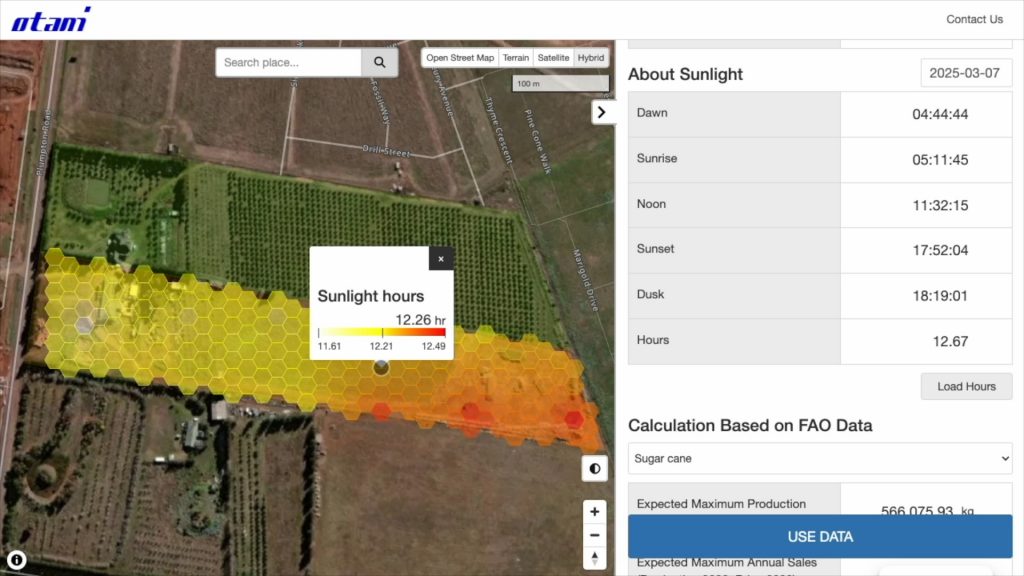
New Feature: Shadow and Sunlight Hour Calculation
Shadow Analysis:
- Users can define a specific date and hour to view the shadow distribution on farmland.
- Shadows are calculated with consideration of buildings’ shapes, heights, and positions.
- Available globally, making it useful for farming, greenhouse management, and urban agriculture.
Sunlight Exposure:
- Provides key solar timing information (dawn, sunrise, noon, sunset, and dusk for farmland locations).
- Calculates total sunlight exposure time to assist in optimizing crop growth and land management.
- Globally covered, offering insights for agriculture across various climatic conditions.
Future Development: Soil Data and Crop Harvest Simulation
Looking ahead, we are planning to integrate soil data into our service. This enhancement will pave the way for the development of a crop harvest simulation feature, allowing users to estimate potential yields for the upcoming year based on soil conditions, weather trends, and farmland indices.
Our commitment remains in providing cutting-edge, accessible, and data-driven solutions for the agricultural industry. With the introduction of shadow and sunlight analysis, and our upcoming soil data integration, we continue to empower farmers, researchers, and agribusiness professionals with innovative tools for better decision-making.