Spring wheat is cultivated in several regions around the world, each with distinct climatic conditions and challenges that influence crop growth. Leveraging satellite data for regional spring wheat cultivation offers valuable insights into soil health, crop performance, and resource management. In this article, we will focus on the regions where spring wheat is primarily cultivated and explore how satellite technology is being used to optimize practices specific to those areas.
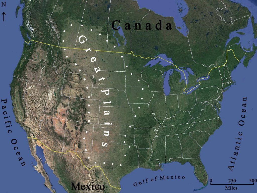
North America: The U.S. Great Plains
The Great Plains of the United States is one of the most significant regions for spring wheat production, stretching across states like North Dakota, South Dakota, and Montana. This area is known for its vast, flat landscapes and semi-arid climate, which presents both challenges and opportunities for spring wheat farming.
Satellite Applications in the Great Plains
In this region, water availability is a critical factor for successful wheat farming, and the use of satellite data to manage irrigation is especially important. Remote sensing technology helps farmers monitor soil moisture levels across vast fields, enabling precision irrigation that conserves water while ensuring optimal crop growth.
Moreover, the Great Plains often experience temperature extremes, including late frosts in the spring and intense heat during the summer. Satellite imagery allows farmers to track temperature patterns and anticipate climate shifts that could affect spring wheat. For instance, farmers can use satellite data to monitor frost risks and adjust sowing dates accordingly.
NDVI and other vegetation indices are essential for assessing crop health, identifying areas of stress, and detecting pest or disease outbreaks early, allowing for more effective management. Satellite data also provides yield forecasting tools, which are critical for both farmers and grain markets.
Canada: The Prairie Provinces
Canada’s Prairie Provinces, including Saskatchewan, Alberta, and Manitoba, are another major producer of spring wheat. This region shares many similarities with the U.S. Great Plains in terms of climate, with cold winters and short growing seasons. However, it also faces challenges like soil salinity and high winds, which can lead to soil erosion.
Satellite Data Use in Canada’s Prairie Provinces
Satellite data plays a crucial role in soil monitoring in the Prairie Provinces. By using satellite imagery and remote sensing technology, farmers can assess soil health and detect salinity levels that might negatively impact spring wheat growth. Monitoring soil conditions allows farmers to make more informed decisions about fertilization and irrigation practices, ensuring better crop performance.
Additionally, the threat of extreme weather, including droughts and unpredictable rainfall, is a concern for farmers in the Prairie Provinces. Satellite-based weather forecasts and real-time monitoring of precipitation patterns help farmers plan for weather risks and adjust their farming practices accordingly.
Satellite imagery also supports pest and disease management in this region. Wheat diseases like fusarium head blight can significantly reduce yields, and early detection through satellite data helps farmers apply treatments before widespread damage occurs.
Russia: Siberia and the Russian Steppe
Russia is one of the largest producers of spring wheat, particularly in regions like Siberia and the Russian Steppe. These areas are known for their cold winters and relatively short growing seasons, making the timing of planting and harvesting essential for successful yields.
Satellite Data in Russian Spring Wheat Cultivation
In Russia, one of the key challenges for spring wheat farming is the late planting season, which is often a result of long winters and late frosts. Satellite data plays a crucial role in determining the optimal planting window by analyzing soil temperature and moisture content. By monitoring these factors, satellite technology helps farmers identify the best planting time, which is essential for achieving high yields.
Soil health is another concern in the Russian Steppe, where vast expanses of land are used for wheat cultivation. Satellite imagery provides data on soil moisture and texture, allowing farmers to assess whether additional irrigation or soil treatments are needed. Given the region’s vast land area, satellite monitoring is far more efficient than traditional ground-based methods.
Satellite-based systems also offer yield forecasting capabilities, helping farmers and supply chain actors predict crop outcomes months in advance. This is particularly valuable for managing logistics and ensuring that harvests align with market demand.
Australia: The Wheat Belt
Australia’s Wheat Belt, stretching across the eastern and western parts of the country, is one of the major wheat-producing regions. The climate here is characterized by hot, dry summers and mild winters, which significantly impact crop water needs and growth patterns.
Satellite Data Use in Australian Wheat Production
In Australia, managing water resources is a priority due to the region’s frequent droughts. Satellite-based soil moisture monitoring plays a critical role in irrigation management. By tracking moisture levels across fields, farmers can optimize irrigation schedules, ensuring that water is applied precisely where and when it is needed.
Satellite data also aids in managing the region’s unique challenges, such as heat stress during the summer months. By monitoring temperature patterns and NDVI, satellite technology helps farmers track crop health and detect early signs of heat damage or water stress. Early intervention can help mitigate the effects of extreme weather conditions, preserving wheat yields.
In addition, satellite imagery provides valuable insights into land use and crop rotation practices, which are essential for soil health and long-term sustainability. By identifying areas of the field that may require rest or soil amendments, satellite data helps ensure that the Wheat Belt continues to produce wheat efficiently year after year.
Europe: The European Union and Ukraine
In Europe, spring wheat is cultivated in various regions, including France, Germany, Poland, and Ukraine. These areas experience a temperate climate, with adequate rainfall and relatively mild winters, making them ideal for wheat farming. However, challenges like irregular rainfall, pests, and soil erosion can impact productivity.
Satellite Technology for European Spring Wheat Farming
Satellite data is increasingly being used across Europe to address water management challenges and optimize irrigation practices. In regions with irregular rainfall patterns, satellite-based soil moisture and weather data enable farmers to track water availability and adjust irrigation schedules as needed.
In Ukraine, where wheat is a staple crop, satellite imagery assists farmers with early pest detection. Pest infestations, such as aphids or wheat rust, can be detected through subtle changes in crop color and density, which are picked up by satellite sensors. Early intervention ensures that pesticides are applied only when necessary, reducing the environmental impact of farming.
Furthermore, satellite-based vegetation indices provide valuable insights into crop health and yield prediction, helping European farmers plan for harvests and manage logistics. By combining satellite data with ground-based observations, farmers can improve their decision-making processes and increase spring wheat productivity.
Conclusion
Satellite data has proven to be an invaluable tool for optimizing spring wheat cultivation across various regions, from North America and Canada to Russia, Australia, and Europe. The ability to monitor crop health, soil conditions, irrigation needs, and pest management with satellite technology allows farmers to make informed decisions that enhance productivity, conserve resources, and reduce environmental impact.
As climate change and unpredictable weather patterns continue to challenge wheat farming, satellite data will play an even more important role in helping farmers adapt and thrive. By harnessing the power of remote sensing and satellite-based technologies, the global wheat industry can ensure that it meets the demands of a growing population while maintaining sustainable farming practices.