New Zealand, with its temperate climate and fertile soils, is known for producing a wide range of agricultural products, including wheat. While wheat production in New Zealand is not as large-scale as in some other countries, it remains a vital crop for the domestic market, particularly for making bread and other wheat-based products. As climate variability, soil health, and efficient resource management continue to present challenges to wheat farmers, satellite data has emerged as a valuable tool to help optimize production and ensure sustainability in wheat farming. This article explores how satellite technology is enhancing wheat cultivation in New Zealand.
Unique Challenges for Wheat Production in New Zealand
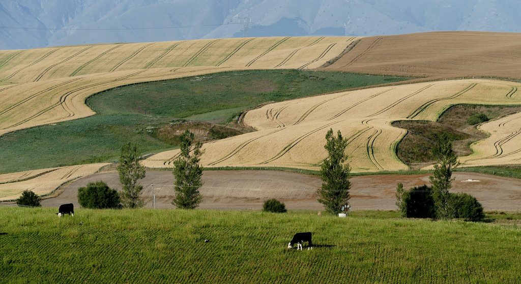
Wheat farming in New Zealand faces several unique challenges that vary depending on the region. The country’s climate is influenced by its geographical features, including its proximity to the Pacific Ocean, the Southern Alps, and the Tasman Sea. While some areas experience mild, wet conditions, others, particularly in the central and eastern regions, can be drier with significant temperature fluctuations.
Key challenges include:
- Unpredictable Weather: New Zealand’s weather can be highly variable, with periods of drought, heavy rainfall, and frosts. These extremes can affect the timing of planting and harvesting, as well as overall crop health.
- Water Management: Although New Zealand is known for its rainfall, managing irrigation during drier periods is essential, especially in areas where droughts are more frequent.
- Soil Erosion: In some regions, especially in the South Island, wheat farmers face challenges with soil erosion, which can reduce soil fertility and impact crop yields.
- Disease and Pest Control: Wheat is susceptible to various diseases, such as wheat rust, and pests, such as aphids, which can affect yields and crop health.
Satellite data is helping New Zealand’s wheat farmers address these challenges more effectively, leading to more informed decision-making and improved productivity.
Satellite Data for Weather Monitoring and Risk Management
In New Zealand, where weather patterns can be unpredictable, having access to real-time weather data is critical for managing risks during the growing season. Satellite-based weather systems provide valuable information about temperature fluctuations, precipitation patterns, and extreme weather events, helping farmers prepare for potential disruptions in their crops.
By using satellite data, farmers can:
- Monitor Climate Variability: Satellite-based weather monitoring allows farmers to track changing climatic conditions, including temperature anomalies and rainfall patterns. This helps them anticipate potential frost events or droughts, enabling them to adjust planting schedules or prepare for irrigation needs in advance.
- Track Rainfall: In some parts of New Zealand, rainfall can be highly variable. By tracking rainfall through satellite systems, farmers can gauge how much water their crops have received and adjust irrigation practices accordingly.
- Predict Extreme Weather Events: Satellite weather data can help predict extreme events such as storms or heatwaves. Early warning systems based on satellite technology enable farmers to take precautionary measures, such as delaying planting or applying protective treatments.
With this information, wheat farmers can mitigate the risks associated with unpredictable weather, improving the resilience of their crops and maintaining consistent yields.
Precision Irrigation Using Satellite Data
Water management is an essential component of successful wheat farming, particularly during periods of drought or low rainfall. While New Zealand is generally well-watered, there are regions where water availability can be scarce during certain times of the year, especially in the central and eastern parts of the country.
Satellite data plays a critical role in precision irrigation, enabling farmers to optimize water usage across their wheat fields. By using satellite-based monitoring tools, farmers can:
- Monitor Soil Moisture: Satellite imagery can provide valuable data on soil moisture levels, helping farmers understand how much water their wheat crops need. This allows for targeted irrigation, ensuring that water is applied where it is most needed and avoiding over-irrigation.
- Optimize Irrigation Timing: With satellite data, farmers can track when their crops need water the most, ensuring that irrigation schedules are aligned with the crop’s growth stages. This not only conserves water but also helps reduce costs associated with excessive irrigation.
- Water Conservation: Satellite-based monitoring can identify areas of the field that are drier or wetter than others, helping farmers optimize their irrigation systems. By targeting specific areas that need more or less water, they can conserve valuable resources and increase efficiency.
Precision irrigation supported by satellite technology helps New Zealand wheat farmers reduce water waste, conserve resources, and ensure that crops receive the right amount of moisture for optimal growth.
Monitoring Wheat Crop Health and Yield Estimation
One of the most powerful applications of satellite technology in wheat farming is its ability to monitor crop health in real-time. Satellite imagery, particularly through the use of vegetation indices such as the Normalized Difference Vegetation Index (NDVI), allows farmers to assess the health of their wheat crops throughout the growing season.
By analyzing satellite data, farmers can:
- Identify Areas of Stress: NDVI can identify areas within wheat fields that are experiencing stress due to factors such as water scarcity, nutrient deficiencies, or pest damage. By detecting these issues early, farmers can take corrective actions, such as adjusting irrigation, applying fertilizers, or treating for pests.
- Assess Crop Density: Satellite imagery helps farmers track crop density and overall biomass, which are key indicators of wheat health. By comparing NDVI readings across different stages of growth, farmers can detect potential issues and make necessary adjustments to improve yields.
- Predict Harvest Timing: Satellite data can also be used to predict the timing of the wheat harvest. By monitoring the crop’s growth stages and estimating its biomass accumulation, farmers can estimate when the wheat will reach its peak maturity and plan for harvesting accordingly.
These insights help farmers optimize inputs, reduce costs, and ensure a healthy crop, ultimately leading to better yields and higher-quality wheat production.
Disease and Pest Management in Wheat Crops
Wheat is susceptible to a variety of diseases and pests, including wheat rust, aphids, and fungal infections like Fusarium head blight. Timely detection and intervention are crucial for preventing significant yield loss.
Satellite imagery is particularly useful in detecting early signs of disease and pest infestations, as it can monitor subtle changes in the crop’s color and health. For example:
- Early Detection of Wheat Rust: Wheat rust typically causes yellowing and necrosis of leaves. Satellite sensors can detect these color changes, enabling farmers to identify infected areas before the disease spreads.
- Monitoring Pest Infestations: Pest infestations, such as aphids, often result in changes in crop canopy structure or color. By monitoring vegetation indices, farmers can detect these infestations early and apply targeted pest control measures.
- Fungus Detection: Fungal infections like Fusarium head blight can be detected using satellite data by monitoring crop health during flowering and grain development stages. Early detection of fungal diseases enables farmers to apply fungicides effectively, reducing crop loss.
By using satellite data for pest and disease management, farmers can take a more proactive approach, minimizing the impact of these threats while reducing the need for blanket pesticide applications.
Yield Forecasting for Better Market Planning
Yield forecasting is essential for farmers to plan their harvests, manage labor, and estimate potential income. Traditional methods of estimating yields can be inaccurate and time-consuming. Satellite data, however, provides a more reliable and scalable approach to predicting yields.
By using satellite imagery to monitor crop health, growth stages, and biomass accumulation, farmers can create more accurate yield forecasts. These forecasts not only benefit farmers in terms of harvest planning but also help traders, processors, and policymakers understand supply levels and market trends.
In New Zealand, where wheat is a significant crop for both local consumption and export, accurate yield forecasting using satellite data is crucial for managing supply chains and ensuring market stability.
Conclusion
Satellite data has become an indispensable tool for wheat farmers in New Zealand, helping them optimize planting, irrigation, crop health monitoring, and pest management. By leveraging satellite technology, farmers can reduce risks associated with unpredictable weather, improve water efficiency, detect pests and diseases early, and predict harvest outcomes with greater accuracy.
As the agriculture industry in New Zealand faces increasing pressure from climate change and the need for sustainable farming practices, satellite data will continue to play a key role in enhancing wheat production. By harnessing the power of remote sensing and satellite technologies, New Zealand’s wheat farmers can improve productivity, conserve resources, and contribute to the long-term sustainability of the industry.