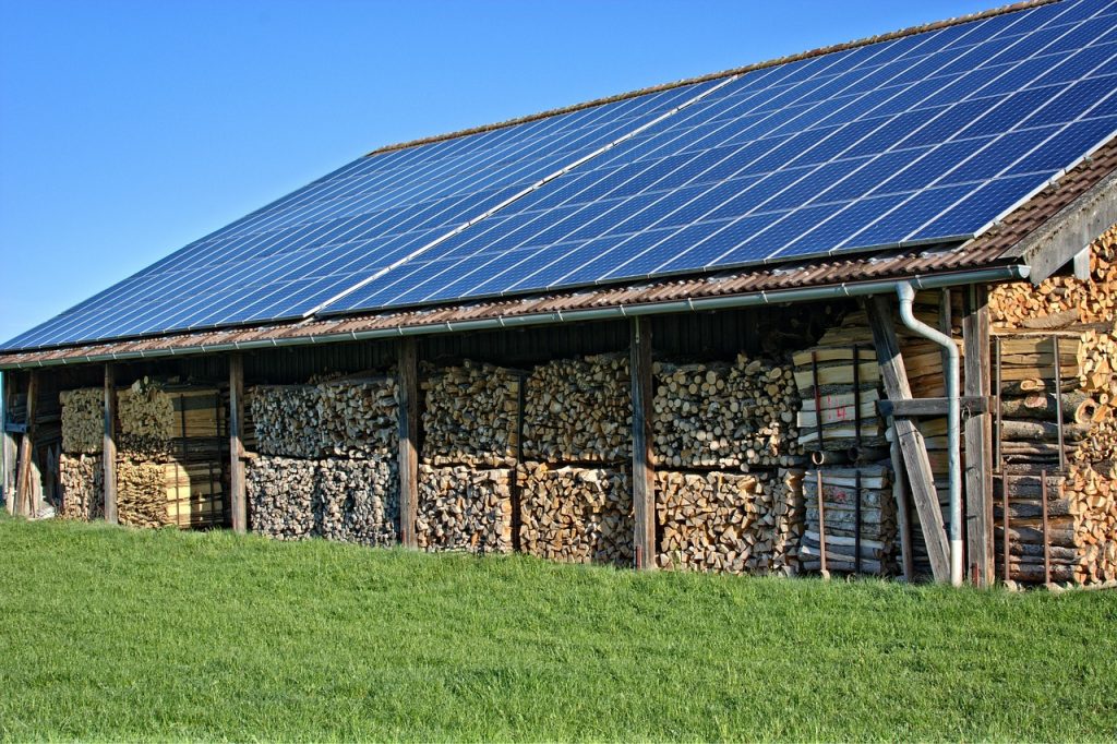
Australia is one of the best places on Earth to invest in residential solar power. Thanks to its vast sunshine, government incentives, and rising electricity prices, more homeowners are turning to solar energy not just for sustainability but also for cost savings. This article explores what makes a solar panel ideal for Australian homes by considering local climate, installation costs, and financial returns.
Abundant Sunshine: A Natural Advantage
Australia boasts some of the highest solar radiation levels globally, making it incredibly favorable for solar power generation:
Northern regions (Queensland, NT): Enjoy over 3,000 hours of sunshine annually.
Southern regions (Victoria, Tasmania): Receive slightly less but still significant solar exposure.
Outback and inland areas: Often exceed 5.5–6.0 kWh/m²/day of solar radiation.
This wide availability of sunlight means solar panels in Australia perform very efficiently, particularly in summer months.
Popular Solar Panel Types in Australia
Due to the high irradiance and large roof spaces in many Australian homes, the focus is often on high-efficiency and heat-resistant panels:
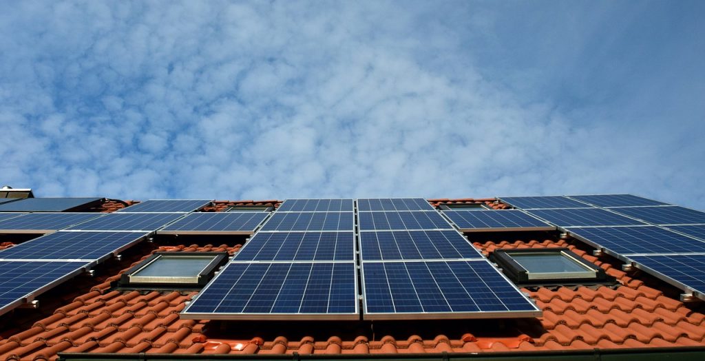
Monocrystalline Panels: Most common and efficient (19–22%). Ideal for cities like Sydney or Melbourne with standard roof sizes.
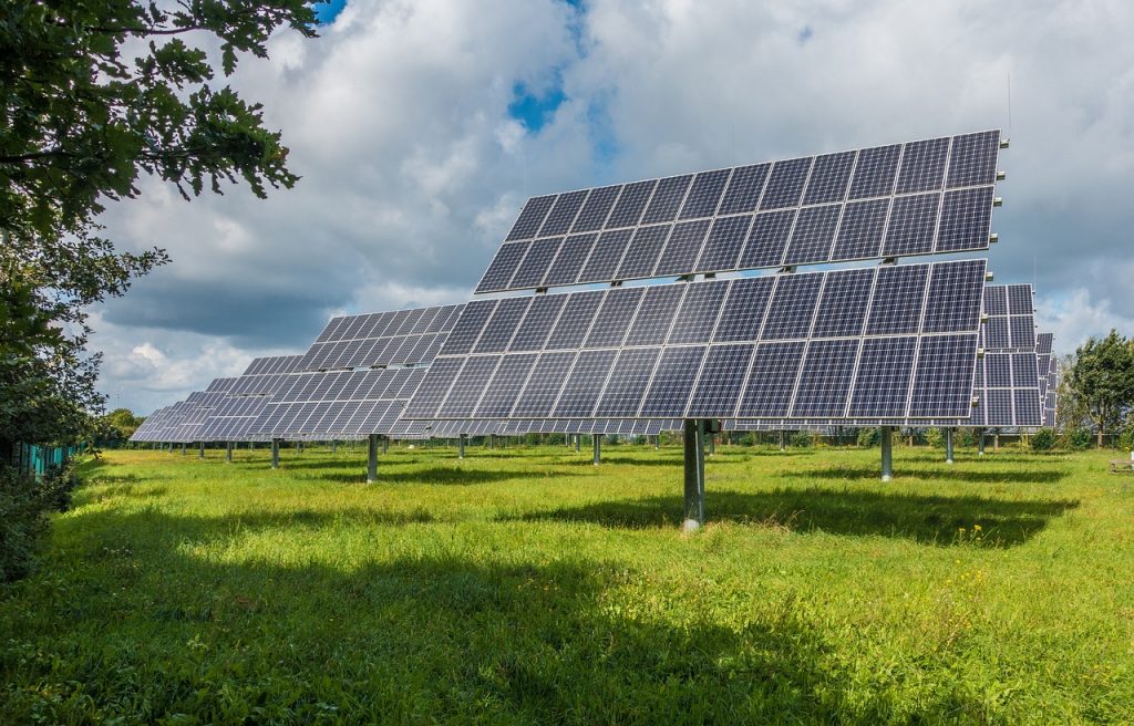
Bifacial Panels: Gaining popularity for large installations due to their ability to capture reflected light.
Tier 1 Brands: Australians typically prefer brands like Q CELLS, JinkoSolar, REC, Trina Solar, and SunPower, all offering excellent warranties and heat tolerance.
Installation Costs and Incentives
Thanks to economies of scale and strong competition, Australia has some of the lowest solar installation costs globally.
Average system size: 6.6 kW (for a 3–4 bedroom house)
Feed-in Tariffs: Vary by state, ranging from AUD $0.05 to $0.20/kWh depending on your provider and plan
Cost Benefits and Payback Period
Annual savings: Around AUD $800–$1,500 depending on location and consumption
Payback period: Typically 3–6 years, one of the fastest in the world
Return on Investment (ROI): Often exceeds 15% annually
Battery integration: While battery systems (e.g., Tesla Powerwall) add cost, they provide more energy independence and lower nighttime electricity reliance
Recommendations for Homeowners
When selecting a solar panel system in Australia:
Choose high-efficiency monocrystalline or Tier 1 panels
Consider future-proofing your system by preparing for battery storage
Use government calculators (like Solar Victoria’s) to estimate savings and incentives
Work with a Clean Energy Council (CEC)-accredited installer
Solar in Australia is a Smart Investment
With strong sunlight, affordable systems, and supportive policies, Australia presents a nearly ideal environment for residential solar. For most homeowners, the decision is less about “should I go solar?” and more about “when and with whom?” Whether you’re trying to cut your electricity bills or make your home greener, solar panels are a practical, profitable, and sustainable step for Australian households.
New Zealanders are increasingly turning to solar energy to lower power bills and reduce carbon footprints. However, New Zealand’s unique mix of climate zones, electricity pricing, and housing stock means solar adoption must be approached thoughtfully. In this article, we’ll explore what makes a solar panel system ideal for homes in New Zealand and how homeowners can maximize both environmental and financial returns.
Sunshine and Regional Suitability
New Zealand receives moderate solar radiation levels compared to Australia, but still enough to justify home solar investment in most regions:
Auckland and Northland: ~4.5–5.0 kWh/m²/day
Wellington and Christchurch: ~3.8–4.5 kWh/m²/day
Southern regions (e.g., Dunedin): Lower sunshine, but still viable
North Island regions tend to offer the best solar yields year-round due to higher sunshine hours.
Types of Solar Panels Best for NZ
Due to the generally cooler and cloudier climate in parts of the country, solar panels with good low-light and temperature performance are recommended:
Monocrystalline Panels: Best efficiency (19–21%) and compact — ideal for urban rooftops
Brands commonly used: JA Solar, Canadian Solar, LONGi, REC, and Trina Solar
Inverters: Reliable brands like Fronius and Enphase are preferred for grid-tied systems
High-quality panels with excellent warranties (at least 25 years on performance) are key in the damp and often windy New Zealand climate.
Installation Costs and Financial Incentives
Unlike Australia, New Zealand does not offer national solar rebates, though some regions and electricity providers offer incentives or low-interest loans.
Average cost for 3–5kW system: NZD $8,000–$12,000
Battery storage (e.g., Tesla Powerwall): Adds NZD $12,000–$15,000
No national FIT (Feed-in Tariff): Buy-back rates vary widely (e.g., $0.07–$0.15/kWh)
Cost Savings and Payback
Annual savings: Around NZD $600–$1,200 depending on household usage and self-consumption
Payback period: Typically 7–10 years
Best savings occur when power is used during sunlight hours (e.g., daytime laundry, EV charging)
For rural areas or lifestyle blocks, off-grid systems are also becoming popular, especially where connecting to the grid is expensive.
Practical Recommendations for Homeowners
Size your system to match your daytime electricity usage
Consider adding a battery later once system is paid off
Look for warranties and aftercare service — especially with growing second-hand or imported panels on the market
Use tools like SolarQuotes NZ to compare installers and pricing
Solar for Sustainability and Savings
While solar in New Zealand may not deliver the ultra-fast ROI of Australia, it still provides a solid long-term benefit for most homeowners, particularly in northern regions. With increasing energy costs and a national push toward decarbonization, solar power is a strong step forward.
Not just a tool for energy savings, solar is becoming part of a broader movement toward energy resilience, sustainability, and smarter living in New Zealand homes.
With the U.S. seeing rapid growth in solar energy adoption, homeowners across the country are looking to install photovoltaic systems that reduce electricity bills, boost property value, and shrink carbon footprints. But given the vast differences in sunlight, utility rates, and state-level incentives, the best solar solution varies widely depending on where you live.
This article breaks down what U.S. homeowners should consider when choosing solar panels for their home—region by region.
Solar Potential Across the U.S.
The U.S. enjoys strong solar radiation in many areas:
Southwest (e.g., Arizona, Nevada, California): Among the world’s best, ~6.5–7.5 kWh/m²/day
Northeast & Midwest: Lower, but still viable at ~3.5–4.5 kWh/m²/day
Even in cloudy states like Oregon or New York, solar is viable thanks to state incentives and high electricity rates.
Recommended Solar Panel Types & Brands
Given the U.S.’s large and varied housing stock, options range widely. But the most trusted panels usually offer a mix of high efficiency, strong warranties, and solid brand support.
Top brands: SunPower (USA), Qcells, REC, Canadian Solar, JinkoSolar
Panel types:
Monocrystalline: Best efficiency (19–22%) and sleek appearance
Bifacial panels: Increasingly used in ground-mounted installations
Look for 25-year performance warranties and high-temperature coefficient ratings if you live in a hot climate.
Installation Costs and Incentives
Average system cost (before incentives): $15,000–$25,000 for 6–8kW
Federal Investment Tax Credit (ITC): 30% tax credit available through 2032
State and local incentives:
California: Net metering (NEM 3.0), battery incentives
Massachusetts, New York: Solar Renewable Energy Credits (SRECs)
Texas, Arizona: Property tax exemptions and rebates in some areas
Battery storage (e.g., Tesla Powerwall, Enphase IQ Battery) adds another $10,000–$15,000 but is incentivized in some regions.
Financial Returns and Payback
Annual savings: $1,000–$2,000 depending on usage and state
Payback period: Typically 6–10 years
Home value increase: On average, homes with solar sell for ~4% more
Solar is particularly cost-effective in high-rate states like Hawaii, California, and Connecticut.
Practical Advice for U.S. Homeowners
Use tools like EnergySage or Solar.com to compare multiple quotes
Prioritize net metering eligibility and local solar policies
If you plan to move in 5–7 years, ensure the system is transferable
Battery storage can provide backup power and increase self-consumption
Smart Investment with Long-Term Rewards
For many American homeowners, solar energy is now a mainstream investment. With robust tax credits, rising electricity rates, and growing consumer awareness, solar is more accessible and valuable than ever before.
From sunny California rooftops to suburban homes in the Northeast, the right solar system delivers long-term savings, greater energy independence, and added real estate appeal.
While Canada may not be the first country that comes to mind for solar energy, it has become an increasingly viable and attractive option for homeowners in recent years. Thanks to falling panel costs, rising electricity prices, and federal and provincial incentives, solar systems are popping up from British Columbia to Nova Scotia.
This guide helps Canadian homeowners understand how solar panels work in Canada’s unique climate and economic context—and which options offer the best long-term value.
Solar Potential Across Canada
Canada receives a surprising amount of sunlight, especially in the Prairie Provinces:
Alberta & Saskatchewan: 4.5–5.5 kWh/m²/day (comparable to parts of Germany)
Ontario & Quebec: ~3.5–4.5 kWh/m²/day
British Columbia: Variable, with cloudier winters
Atlantic Canada: Lower solar radiation but steady growth
Solar panels work well even in cold temperatures, often more efficiently due to reduced heat loss.
Recommended Solar Panel Types & Brands
Top brands: Canadian Solar, Qcells, REC, LONGi, Panasonic
Monocrystalline panels are best for Canadian climates due to higher efficiency and smaller space requirements
Bifacial panels can be useful in snowy areas due to ground-reflected light
Microinverters (e.g., Enphase) are popular for maximizing efficiency in shady or snowy conditions
Look for certified cold-weather durability and performance warranties of 25 years.
Installation Costs and Incentives
Average system cost (before incentives): CAD $15,000–$25,000 for 6–8kW
Federal incentives: Canada Greener Homes Grant (up to CAD $5,000) + interest-free loan (up to CAD $40,000)
Provincial incentives:
Alberta: Strong support through municipal programs (e.g., Edmonton, Calgary)
Nova Scotia: SolarHomes rebate program
Quebec & Ontario: Net metering is the main benefit
Some utilities offer net billing or net metering options, allowing you to sell back excess electricity
Financial Returns and Payback
Electricity prices vary, but solar helps hedge against rising utility costs
Annual savings: CAD $800–$1,500 depending on province and usage
Payback period: 8–12 years
Home value boost: Homes with solar are increasingly attractive in competitive real estate markets, especially in eco-conscious cities
Practical Advice for Canadian Homeowners
Installers should assess roof pitch and snow load tolerance
Ensure your system qualifies for the Greener Homes Program
Consider battery storage for energy resilience in rural areas (e.g., Tesla Powerwall)
Monitor your system with smart apps to track production vs. consumption
A Sustainable Investment for the Long Winter
In Canada, solar panels aren’t just for summer—they’re a smart, year-round investment. With the right system, homeowners can reduce bills, cut carbon emissions, and make their homes more resilient in the face of grid outages and rising energy costs.
Whether you’re in sunny Alberta or coastal Nova Scotia, now is a great time to go solar—and start reaping long-term rewards for both your wallet and the planet.
As more Australians consider switching to renewable energy, understanding how solar panels work can help homeowners make informed choices. In this article, we’ll break down the science behind solar power, explain why Australia is one of the best countries for solar energy, and discuss which solar panel materials perform best in the Australian climate.
The Science: Sunlight and Electrons
At the core of every solar panel is the photovoltaic (PV) effect, a process where sunlight is converted into electricity.
When sunlight (photons) hits the panel’s surface, it energizes electrons in the silicon cells, knocking them free.
These freed electrons flow through the circuit, creating direct current (DC) electricity.
An inverter then converts this DC power into alternating current (AC), which powers your home appliances.
This is a clean, silent, and scalable method of generating electricity.
Australia’s Solar Advantage: Abundant Sunlight
Australia is a global leader in solar potential, thanks to its:
High solar irradiance levels – most parts of Australia receive over 2,000 kWh/m²/year.
Long hours of daily sunshine – averaging 5 to 7 hours of peak sun across major cities like Brisbane, Perth, Adelaide, and Sydney.
This makes Australia not just ideal for solar energy, but one of the most cost-effective regions for solar system investments.
Best Solar Panel Materials for Australia’s Climate
Australia’s environment presents both opportunities and challenges: intense heat, strong UV radiation, and coastal humidity. The right material can improve durability and performance.
Monocrystalline Silicon
High efficiency and compact
Performs well under direct, intense sunlight
Best for urban homes with limited roof space
Polycrystalline Silicon
Slightly less efficient but more affordable
Suitable for larger rooftops or regional properties
Thin-Film (CIGS/CIS) Panels
More tolerant to high temperatures and shading
Ideal for hot regions or non-standard roof shapes
Heterojunction (HJT) and TOPCon Technologies
Premium options that maintain efficiency even in extreme heat
Resilient in high UV areas like Northern Territory and Western Australia
Real-Life Performance and Return
A 6.6kW system in Sydney can generate around 9,500–10,500 kWh annually, translating into significant electricity bill savings of around $1,200 to $1,500 per year, depending on usage and feed-in tariffs.
Matching Technology with Sunshine
Australia’s solar-rich environment offers homeowners a real opportunity to reduce energy costs, increase home value, and cut carbon emissions. Understanding how solar panels work and selecting the right technology for your region ensures long-term returns and system reliability.
Whether you’re in sun-drenched Darwin, windy Melbourne, or humid Brisbane, there’s a solar solution tailored to your climate—and now is the best time to tap into that endless Australian sunshine.
As more New Zealanders look to reduce their electricity bills and carbon footprint, solar energy has become an increasingly attractive solution. But how exactly do solar panels work, and which types are best suited to Aotearoa’s unique weather and sunlight conditions? This article explains the basics of solar technology and what to consider when choosing a solar panel system for your Kiwi home.
The Basics: How Solar Panels Turn Sunlight into Electricity
Solar panels generate electricity through the photovoltaic (PV) effect:
Sunlight (composed of particles called photons) strikes the solar panel surface.
This energy knocks electrons loose from atoms in the panel’s semiconducting material (usually silicon).
The movement of these electrons generates direct current (DC) electricity.
An inverter then converts DC to alternating current (AC), which powers your home.
It’s a clean, silent, and renewable process—ideal for homeowners looking to take control of their power usage.
Sunshine in New Zealand: Is It Enough?
Though not as sun-drenched as Australia, New Zealand still has plenty of solar potential, especially in areas like:
Nelson, Blenheim, and Bay of Plenty, which receive more than 2,000 sunshine hours annually.
Even in Wellington or Auckland, solar systems can be effective year-round, especially during summer and spring.
Cloud cover and shorter winter days do affect output, but modern panels are efficient enough to generate power even on overcast days.
Best Solar Panel Materials for New Zealand’s Climate
New Zealand’s environment is diverse—coastal air, frequent rain, and UV exposure all play a role in solar performance and system longevity.
Monocrystalline Panels
High efficiency and ideal for urban areas like Auckland and Christchurch with limited roof space.
Perform well in direct sunlight and offer good returns over 25+ years.
Polycrystalline Panels
Lower cost and decent efficiency.
Suitable for larger roof areas or rural properties where budget is a concern.
Glass-Glass Panels
Double glass layers provide extra durability against NZ’s coastal humidity and frequent storms.
Recommended in regions with high winds and salt-laden air, like Wellington or Dunedin.
Panels with Strong Warranties
Choose brands that offer at least 25-year performance guarantees, ensuring protection against New Zealand’s often unpredictable climate.
Output and Financial Return in New Zealand
A standard 5kW system in New Zealand can generate around 6,000–7,500 kWh per year, depending on location. This could translate to savings of $1,000–$1,500 NZD annually, especially with net metering or battery storage to increase self-consumption.
Tailoring Solar to Kiwi Conditions
Solar panels are a smart, long-term investment for New Zealanders seeking energy independence, lower electricity bills, and a smaller carbon footprint. While the sunlight is more moderate than in Australia, with the right choice of materials and system size, New Zealand homes can still enjoy excellent solar performance.
As utility prices rise and sustainability becomes a household priority, more Americans are turning to solar energy. But how do solar panels actually work? And which panel types are best suited for different parts of the country—from sunny Arizona to rainy Seattle? This article walks through the basics of solar technology and the best choices for U.S. homeowners.
The Science: Turning Sunlight into Electricity
Solar panels generate electricity through the photovoltaic (PV) effect:
When sunlight hits a solar panel, energy from the light particles (photons) dislodges electrons in the silicon-based cells.
This movement creates direct current (DC) electricity.
A solar inverter converts DC to alternating current (AC), which your household appliances use.
This process is clean, quiet, and generates no emissions—making it a powerful tool in the shift toward renewable energy.
Sunlight in the U.S.: Diverse, but Promising
The United States has one of the most diverse solar landscapes in the world:
Southwest states (California, Arizona, Nevada) get over 3,000 hours of sunshine annually—perfect for high-efficiency panels.
Northeast and Midwest regions see fewer sunny days, but still receive enough sunlight for profitable solar returns with the right technology.
Even cloudy or snowy regions like Oregon or upstate New York benefit from solar, as panels still produce electricity during indirect sunlight.
Best Solar Panel Materials for Different U.S. Climates
Due to the variety of climate conditions, the best choice of panel depends on where you live:
Monocrystalline Panels
Best for high heat and strong sun, e.g., in California, Texas, Florida.
More efficient in small spaces—great for urban homes or tight rooftops.
Polycrystalline Panels
Slightly less efficient but lower cost.
Good for larger roof areas in rural parts of Midwest or South.
Bifacial and PERC Panels
These cutting-edge models absorb sunlight from both sides or enhance low-light performance.
Ideal for snow-prone areas or northern states, like Minnesota or Massachusetts.
Glass-Glass Panels
Offer higher durability and are well-suited for coastal regions (e.g., Florida, Carolinas) where humidity, salt, or storms are frequent.
Electricity Output and Cost Savings in the U.S.
A typical 6kW residential system in the U.S. can produce 7,000–10,000 kWh/year, depending on location. That can mean $800 to $2,000 in annual savings on electricity bills.
Incentives vary by state, but key programs include:
Federal Solar Tax Credit (ITC): Up to 30% off installation cost.
State rebates in places like New York, New Jersey, and California.
Net metering, which allows homeowners to sell excess energy back to the grid.
Smart Choices for a Big Country
Solar panels are a smart long-term investment for most American homeowners, but success depends on choosing the right panel type for your region’s climate and roof structure. Whether you live in the sun-drenched Southwest or the cloudy Pacific Northwest, modern solar technology has advanced enough to make solar a viable option in nearly every U.S. state.
Evaluate your location, compare panel warranties and performance, and talk to local installers who understand your area’s needs. Clean energy—and long-term savings—may be right on your roof.
With energy costs rising and climate concerns growing, more Canadians are considering solar energy. But how exactly do solar panels work, and are they effective in Canada’s often cold and snowy climate? Let’s explore the science behind solar power and how to choose the best panels for your region.
The Basics: From Sunlight to Electricity
Solar panels convert sunlight into usable power through the photovoltaic (PV) effect:
Photons (light particles) from the sun hit the solar panel and dislodge electrons in the cells.
This generates direct current (DC) electricity.
An inverter converts DC into alternating current (AC) electricity for household use.
This entire process happens silently, without moving parts, and produces no emissions.
How Much Sun Does Canada Get?
Although Canada is known for its cold winters, many regions receive enough sunlight to make solar worthwhile:
Southern Alberta, Saskatchewan, and Ontario receive over 2,000 hours of sunshine per year—comparable to parts of Germany, a solar leader.
British Columbia and Atlantic Canada receive less sunlight annually, but solar still works effectively with the right panel choice.
Importantly, solar panels still generate electricity on cloudy or snowy days, just at lower efficiency.
Best Solar Panel Types for Canada’s Climate
Given Canada’s long winters, cold temperatures, and snowfall, panel durability and low-light efficiency are crucial:
Monocrystalline Panels
Highly efficient and space-saving.
Perform well in cold, sunny climates, such as Alberta or southern Ontario.
PERC Panels (Passivated Emitter Rear Contact)
Ideal for low-light or variable weather.
Great in British Columbia, Quebec, or Maritime provinces.
Glass-Glass Panels
Extremely durable and resist snow, hail, and freezing temperatures.
Suitable for coastal and northern regions, including Atlantic Canada and parts of Manitoba.
Bifacial Panels
Absorb light from both sides—especially useful when sunlight reflects off snow-covered ground.
Best for open areas or ground-mounted systems in central and western Canada.
Output and Savings for Canadian Homeowners
A typical 6kW system in Canada can produce 6,500–9,000 kWh per year, depending on location. That could lead to $600–$1,200 in annual savings, especially if electricity rates continue to rise.
Financial support is available:
Canada Greener Homes Grant: Up to $5,000 in rebates for solar installations.
Greener Homes Loan: Up to $40,000 interest-free over 10 years.
Net metering in most provinces allows you to receive credit for sending unused solar energy back to the grid.
Final Thoughts: Solar Power in the Great White North
Even in a cold, snowy country like Canada, solar power is absolutely viable. In fact, solar panels often perform better in cooler temperatures, provided there is enough sunlight.
By choosing the right panel type—whether monocrystalline for efficiency or bifacial for snow-heavy regions—Canadian homeowners can take a big step toward energy independence, environmental sustainability, and long-term cost savings.
Now is the time to explore solar energy, especially with national incentives supporting your investment.
Manage Cookie Consent
We use technologies like cookies to store and/or access device information. We do this to improve browsing experience and to show personalized ads. Consenting to these technologies will allow us to process data such as browsing behavior or unique IDs on this site. Not consenting or withdrawing consent, may adversely affect certain features and functions.
Functional
Always active
The technical storage or access is strictly necessary for the legitimate purpose of enabling the use of a specific service explicitly requested by the subscriber or user, or for the sole purpose of carrying out the transmission of a communication over an electronic communications network.
Preferences
The technical storage or access is necessary for the legitimate purpose of storing preferences that are not requested by the subscriber or user.
Statistics
The technical storage or access that is used exclusively for statistical purposes.The technical storage or access that is used exclusively for anonymous statistical purposes. Without a subpoena, voluntary compliance on the part of your Internet Service Provider, or additional records from a third party, information stored or retrieved for this purpose alone cannot usually be used to identify you.
Marketing
The technical storage or access is required to create user profiles to send advertising, or to track the user on a website or across several websites for similar marketing purposes.