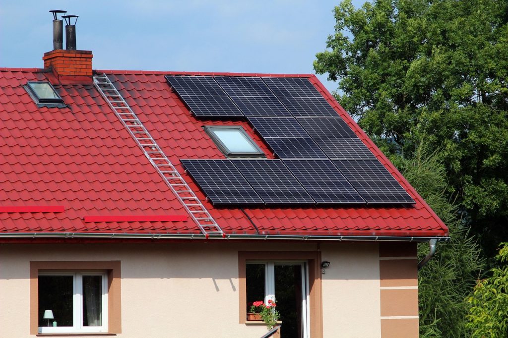
When it comes to installing a solar power system for your home in Australia, most homeowners focus on sunlight availability and the cost of the system. However, Land Surface Temperature (LST) — the temperature of the ground and surfaces that solar panels are mounted on — is often overlooked, despite playing a critical role in the performance and lifespan of solar technology.
Let’s explore why understanding LST is essential in Australia, a country known for its intense sun and diverse climate zones.
The Relationship Between Heat and Solar Panel Efficiency
Solar panels are powered by light, but their efficiency drops as their surface temperature rises. This is due to the temperature coefficient — a percentage that tells you how much power the panel loses for every degree above 25°C. On average:
For every 1°C increase, a panel may lose 0.3% to 0.5% efficiency.
If a panel reaches 45°C — which is common on rooftops in Australia — efficiency loss can be 6-10% or more.
So while high sunshine is great, high surface heat can seriously affect your energy yields.
Australia’s Climate Zones and Surface Temperatures
Australia spans a range of climates, and with them, major differences in land surface temperatures:
Region
Climate Type
LST Characteristics
Northern Australia (NT, QLD)
Tropical
Very high LST year-round, often exceeding 45–50°C
Central Australia
Arid/Desert
Extremely high LST, low humidity, sharp day-night contrast
Eastern Seaboard (NSW, VIC)
Temperate/Subtropical
High summer LST, mild winters
Tasmania
Oceanic
Moderate LST, less thermal stress on panels
Perth & WA
Mediterranean
High solar radiation and summer LST
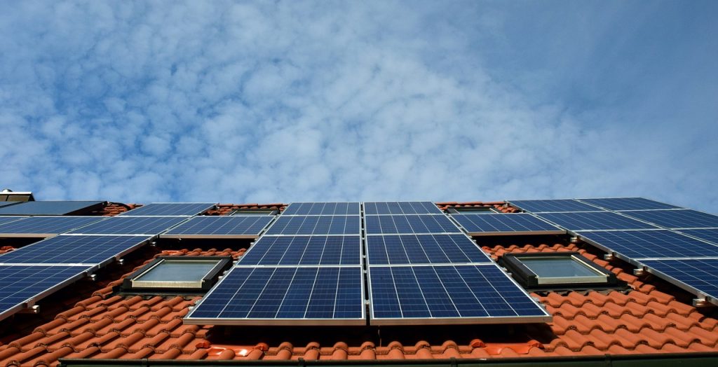
Even in cooler cities like Melbourne or Hobart, summer rooftop temperatures can exceed 60°C, especially on metal roofs.
Choosing the Right Panels Based on Heat Resilience
When evaluating solar panels in Australia, consider the temperature coefficient and thermal durability:
Recommended Features:
Low temperature coefficient (e.g., –0.26%/°C or better)
Example: Panasonic HIT, REC Alpha, or SunPower Maxeon panels
High efficiency under heat: Look for panels that use heterojunction (HJT) or IBC technology.
Frameless or dual-glass modules: These often dissipate heat better.
Elevated racking systems: Allow for better airflow and cooling.
Accessing LST Data in Australia
You can check historical and real-time LST data for your location through:
Copernicus Climate Data Store
NASA MODIS LST datasets
Australian Bureau of Meteorology (BOM) for surface temps and solar radiation maps
Some solar providers offer LST-adjusted estimates for your rooftop
Using LST maps in combination with solar exposure data allows you to simulate realistic performance and ROI of solar panels under local heat conditions.
More Than Just Sunlight
In a country like Australia, where solar radiation is abundant but surface temperatures are extreme, choosing the right solar panel isn’t just about watts — it’s about thermal resilience.
To maximise your solar investment:
Check your region’s land surface temperature patterns.
Choose panels designed to perform well in heat.
Work with an installer who understands how to mount and space panels for heat dissipation.
Smart solar decisions start with understanding your roof’s environment — and LST is a big part of that picture.
In New Zealand, the landscape varies widely, from temperate rainforests to more arid regions. Because of these differences, understanding Land Surface Temperature (LST) is just as important as considering sunlight when selecting the best solar panels for your home. New Zealand’s climate affects the efficiency and performance of your solar system, making it essential to select panels that are well-suited for the local conditions.
Here’s why LST matters in New Zealand, and how it impacts your solar panel choices.
How Temperature Affects Solar Panel Efficiency
Like all solar panels worldwide, New Zealand’s solar panels are subject to a phenomenon where heat increases panel resistance and lowers efficiency. This happens due to the temperature coefficient, which is a percentage showing the reduction in output for each degree above 25°C. Generally, for every degree increase in temperature, you may lose between 0.3% to 0.5% of your solar panel’s efficiency.
While New Zealand does not experience the extreme heat seen in countries like Australia, excessive heat can still reduce energy output, especially in regions with long sunny days and summer temperatures reaching 35°C or more.
New Zealand’s Climate Zones and Surface Temperatures
New Zealand’s climate is more temperate and mild than that of Australia, but it still has distinct variations in surface temperatures. The overall LST tends to be lower compared to hotter regions, but summer peaks can still lead to significant temperature increases.
Here’s a breakdown of how the LST can vary across New Zealand:
Region
Climate Type
LST Characteristics
North Island (Auckland, Wellington)
Subtropical/Temperate
Mild, high LST in summer (30°C–40°C)
Central North Island (Rotorua, Taupo)
Temperate/Marine
Moderate LST, occasional heat waves (35°C)
South Island (Christchurch, Dunedin)
Temperate/Mountain
Cooler LST, with occasional peaks (30°C–35°C)
Fiordland (Southern Alps)
Oceanic/Alpine
Low LST, very few heat stress concerns
Choosing Solar Panels for New Zealand’s Climate
While the extreme heat of deserts or tropical climates may not be a concern in New Zealand, thermal resilience remains important in ensuring long-term solar efficiency. Solar panels for New Zealand should be able to handle high sunlight exposure, while maintaining performance despite mild but frequent fluctuations in temperature.
Recommended Panel Features for New Zealand:
Low Temperature Coefficient: Aim for panels with temperature coefficients as low as –0.3%/°C. Panels with low temperature coefficients are especially crucial in the warmer regions.
Example: Panasonic HIT and REC Alpha panels are known for their strong performance in moderate heat.
Glass-Backed or Dual-Glass Panels: These are more resistant to temperature changes and are highly durable.
Heterojunction (HJT) Technology: Solar panels with HJT technology, such as SunPower Maxeon, perform well under both mild and high heat conditions.
Accessing LST Data in New Zealand
You can use several resources to get LST data for your specific location in New Zealand:
NIWA (National Institute of Water and Atmospheric Research) provides climate data and temperature maps.
BOM (Australian Bureau of Meteorology) also offers insights on broader regional temperatures that impact the southern parts of New Zealand.
Copernicus Climate Data Store offers global temperature data, including LST values.
By checking LST data, homeowners can make more informed decisions about how solar panels will perform based on their local environment.
Understanding New Zealand’s Climate for Solar Efficiency
New Zealand’s moderate but variable climate, combined with its temperate to subtropical zones, presents unique challenges for solar energy. Even in areas where extreme heat isn’t a problem, surface temperature still affects solar panel performance, and understanding LST will help you choose the right panel for your region.
To make the most of your solar investment:
Consider panels with low temperature coefficients.
Choose high-efficiency models that can tolerate moderate heat.
Work with installers who are familiar with local climate data to ensure the system is designed for your specific needs.
In New Zealand, knowing your local surface temperature conditions is key to maximizing your solar energy production and ensuring a long-lasting, efficient system.
In the United States, the climate varies significantly from region to region, ranging from tropical areas to arid deserts, and from temperate zones to colder regions. Understanding Land Surface Temperature (LST) is crucial in choosing the best solar panels for your home, as the efficiency of solar energy production is influenced by the temperature and the local environmental conditions. Different regions of the U.S. have different solar energy potential, and LST plays a vital role in ensuring your solar panel system operates optimally.
Let’s explore why LST is essential in choosing solar panels for homeowners across the United States and how it affects your choice of solar system.
The Impact of Temperature on Solar Panel Efficiency
Solar panels are known to generate less power as temperatures rise, due to the temperature coefficient, which indicates the percentage decrease in efficiency for every degree above 25°C. The typical loss in efficiency can be around 0.3% to 0.5% per degree of temperature increase.
In the United States, certain areas experience extreme temperatures, and high LST values in sunny regions can impact solar panel performance. For example, in desert regions where temperatures soar over 40°C (104°F), panels may lose up to 20% of their efficiency on hot days compared to cooler, more temperate areas.
Regional Climate and LST Variations in the U.S.
The United States features diverse climates, from the heat of the Southwest to the cold, snowy climates of the North. Here’s how LST varies by region:
Region
Climate Type
LST Characteristics
Southwest (Arizona, Nevada, California)
Desert/Arid
High LST in summer, often exceeding 40°C (104°F)
Southeast (Florida, Texas)
Humid/Subtropical
High humidity, high LST, around 30°C–38°C (86°F–100°F)
Northeast (New York, Massachusetts)
Temperate
Moderate LST, with some peaks in summer (30°C–35°C)
Northwest (Washington, Oregon)
Oceanic/Temperate
Lower LST, with mild temperatures (20°C–30°C)
Midwest (Illinois, Michigan)
Continental/Cold
Cooler LST with occasional spikes (25°C–35°C)
How LST Affects Solar Panel Performance Across the U.S.
The LST and overall temperature of a region will directly affect the efficiency of solar panels. In hotter regions, solar panels should have lower temperature coefficients to minimize performance degradation during high heat.
Southwest (Arizona, Nevada, California): These regions can experience intense sunlight and high temperatures, especially in the summer months. To maximize solar energy production in these areas, it’s important to choose panels with lower temperature coefficients, such as SunPower Maxeon or Panasonic HIT.
Southeast (Florida, Texas): The combination of high temperatures and humidity can cause performance drops in solar panels, making it essential to choose high-efficiency panels that can operate effectively in humid climates. Panels with glass-back technology, such as LG NeON R or REC Alpha, perform better in these conditions.
Northeast and Northwest (New York, Washington, Oregon): In these regions, LSTs are moderate, so panels with slightly higher temperature coefficients may still perform well. Solar systems should focus on maximizing energy production with moderate solar panel options such as Canadian Solar or Q CELLS.
Midwest and Cold Regions (Illinois, Michigan): Even in colder climates, surface temperature variations can influence solar production. Choose panels that are robust in diverse conditions, like Trina Solar or LONGi Solar.
Selecting the Right Solar Panels Based on LST Data
Understanding LST data helps homeowners in the U.S. select the appropriate solar panels for their regions. LST data is available through several resources:
NOAA (National Oceanic and Atmospheric Administration): Offers weather and climate data for different regions across the U.S.
USGS (United States Geological Survey): Provides global and regional land surface temperature data, accessible via satellite and remote sensing.
Copernicus Climate Data Store: Offers global satellite data that can give insights into local temperature changes and help determine the best solar panel options for your region.
Recommendations for Solar Panels in Different U.S. Regions
Given the significant variation in LST, it’s essential to pick solar panels that can withstand the temperature and environmental conditions of your region. Here are some recommended solar panels for different climates in the U.S.:
Desert and Hot Regions (e.g., Arizona, Nevada): SunPower Maxeon, Panasonic HIT, and REC Alpha offer high efficiency and lower temperature coefficients to perform well in extreme heat.
Humid and Hot Regions (e.g., Florida, Texas): LG NeON R and Panasonic HIT panels provide higher efficiency, moisture resistance, and reliable performance in humid conditions.
Temperate and Mild Regions (e.g., Washington, Oregon, New York): Q CELLS, Canadian Solar, and LONGi Solar offer robust performance under moderate temperatures, ideal for these climates.
Optimizing Solar Panel Performance Based on LST in the U.S.
Understanding Land Surface Temperature (LST) is crucial when choosing solar panels in the United States. Different regions have distinct climates, with varying temperatures that can significantly affect the efficiency of solar energy systems. By factoring in your region’s LST data, you can choose panels that offer optimal performance and energy production for your home.
To maximize your solar investment:
Focus on low-temperature coefficient panels for hot regions.
Consider glass-back technology or high-efficiency models for humid climates.
Select robust, all-weather panels for regions with moderate or cold climates.
By choosing the right solar panels based on your location’s LST, you can ensure optimal energy production and make the most of your solar investment.
Canada’s vast landscape encompasses a wide range of climates—from the frigid Arctic tundra to temperate coastal regions and sunny inland plains. Despite its reputation for cold weather, solar power adoption in Canada is growing steadily, thanks to long daylight hours in summer and falling installation costs. But when choosing solar panels for Canadian homes, one critical but often overlooked factor is Land Surface Temperature (LST).
This article explores why understanding LST is essential for Canadian homeowners investing in solar panels, how climate differences across the country affect solar panel performance, and how to choose the best panels for long-term efficiency and reliability.
Why Land Surface Temperature Affects Solar Panel Performance
Although solar panels work better in sunlight, extreme heat can reduce their efficiency. Most panels lose a small percentage of efficiency (usually between 0.3% and 0.5% per °C) when temperatures exceed 25°C. LST reflects the actual heat of the ground surface—often higher than ambient air temperature—making it a useful indicator when evaluating long-term solar panel performance.
In Canada, while heatwaves are less common, certain regions can still reach temperatures above 30°C in summer. In contrast, very cold winters and snow cover raise questions about durability, energy yield during winter, and panel cleaning or snow shedding ability.
Climate and LST Differences Across Canadian Regions
Region
Climate Type
Typical Summer LST
Considerations
British Columbia (BC)
Coastal Temperate
20°C–30°C
Mild climate, moderate LST, frequent rain
Alberta, Saskatchewan
Continental Prairie
25°C–35°C (hot summers)
High solar potential, dry heat
Ontario, Quebec
Humid Continental
22°C–32°C
Humid summers, cold snowy winters
Atlantic Canada
Coastal Oceanic
20°C–28°C
Cooler summers, foggy, shorter sunny periods
Northern Territories
Subarctic/Arctic
10°C–20°C (brief summer)
Long daylight in summer, extreme cold in winter
In general, southern Alberta and Saskatchewan are Canada’s solar sweet spots due to abundant sunshine and dry air. Coastal BC sees less sunlight but benefits from moderate temperatures year-round.
Choosing the Right Solar Panels for Canadian Conditions
Canadian homeowners must consider:
Temperature tolerance: Panels must work efficiently during the rare hot spells in summer.
Cold durability: Panels should be built to withstand snow load, hail, and freezing temperatures.
Energy yield in diffuse light: In cloudy or foggy areas like coastal BC or the Maritimes, high-performance panels that work in low-light conditions are ideal.
Recommended solar panels for Canadian conditions:
Panasonic HIT and SunPower Maxeon: Excellent in both high and low temperatures; good for cold and snowy areas.
REC Alpha: Durable and efficient, performs well in variable lighting.
Canadian Solar HiKu: Locally produced, cost-effective, and built for Canadian winters.
Using LST Data to Optimize System Design
Homeowners can access LST data via:
Environment and Climate Change Canada (ECCC): For climate and temperature records.
NASA or Copernicus Earth Observation platforms: Satellite data on solar radiation and surface temperature.
Provincial solar maps: Some provinces like Alberta and Ontario provide solar potential maps with integrated temperature data.
This data helps:
Determine whether roof-mounted or ground-mounted systems are better (e.g., rooftops heat more than ground).
Design panel layout for maximal cooling airflow.
Select microinverters or optimizers to reduce the impact of temperature variance on system output.
LST and Long-Term Cost Benefits
In colder climates, some heat loss is actually beneficial—solar panels operate more efficiently in cooler air, as long as there’s enough sunlight. With the increased summer daylight in northern areas, homeowners can still achieve high annual output.
Example: In Calgary (Alberta), average yearly solar irradiance can support a 6 kW system producing around 8,000 kWh/year. Even with occasional summer heat, the LST stays moderate enough to keep efficiency losses low. Over a 25-year lifespan, this can result in savings exceeding $25,000 CAD, even with the cost of installation (~$15,000–$20,000 CAD after incentives).
Tailoring Solar Panel Choices to Canadian Climate and LST
Canada’s climate diversity means there’s no one-size-fits-all solar panel. Land Surface Temperature plays a critical role in selecting systems that will perform efficiently across hot summers and cold winters. Whether you live in sun-soaked Alberta or rainy Vancouver, paying attention to LST and environmental data ensures your solar panels deliver optimal energy output and cost savings over the long term.
By aligning panel technology with local LST trends, Canadian homeowners can make smart, sustainable investments in solar energy—reducing bills, increasing property value, and contributing to a cleaner environment.
Photovoltaic (PV) energy represents one of the most promising and scalable forms of renewable energy in the global transition toward carbon neutrality. By converting sunlight directly into electricity, PV systems offer a clean, sustainable, and increasingly cost-effective alternative to fossil fuel-based power generation. This article provides an overview of how PV energy is produced, its economic advantages, and a method for estimating its generation potential based on geographical and physical parameters.
How Photovoltaic Energy is Produced
At the core of PV technology are solar panels composed of semiconductor materials, typically silicon, which exhibit the photovoltaic effect: the ability to generate an electric current when exposed to sunlight. When solar radiation strikes the PV cells, it dislodges electrons within the semiconductor, generating direct current (DC) electricity. This current is then converted to alternating current (AC) via an inverter, making it usable for homes, businesses, or feeding into the electrical grid.
Photovoltaic systems can be installed at various scales—ranging from small residential rooftop systems to utility-scale solar farms—and can operate in both grid-connected and off-grid configurations.
Cost Benefits of PV Energy
The cost competitiveness of PV energy has improved dramatically in the past two decades. Key advantages include:
Low Operating Costs: Once installed, PV systems require minimal maintenance and no fuel input, resulting in very low operational expenditures.
Scalability and Modularity: Systems can be tailored to match demand, reducing the need for overcapacity.
Long-Term Savings: Though initial installation costs remain a consideration, decreasing prices of solar modules and supportive incentives (such as tax credits, feed-in tariffs, or net metering) enhance return on investment (ROI).
Energy Independence: Residential and commercial users can reduce dependency on external power providers, offering protection from price volatility.
Levelized cost of electricity (LCOE) for PV has reached or even fallen below grid parity in many regions, meaning it is now equal to or cheaper than conventional electricity prices.
Estimating Solar Power Generation
The potential electricity output of a photovoltaic system depends on several factors, including geographic location, panel efficiency, and available surface area. A simplified calculation can be used to estimate the expected energy yield:
This value can be compared to household or business consumption to determine system sizing or financial feasibility.
Conclusion
Photovoltaic energy continues to gain traction as a cornerstone of the renewable energy landscape. It offers a clean and economical solution to the global energy challenge, particularly when supported by well-designed policy frameworks and technological innovation. With its modularity, declining costs, and predictable generation profile, PV systems are not only environmentally sound but also economically compelling for a wide range of users.
For stakeholders in energy planning, construction, real estate, or sustainability initiatives, understanding the fundamentals and potential of photovoltaic energy is essential for strategic decision-making.
Con el creciente interés en las energías renovables, los paneles solares se han convertido en una opción clave para hogares, empresas e industrias que buscan reducir su huella de carbono y ahorrar en costes energéticos. A medida que la energía solar gana popularidad, una variedad de marcas ofrecen módulos con diferentes tecnologías, eficiencias y precios, brindando numerosas opciones a los consumidores.
Para ayudarte a elegir el panel solar adecuado según tus necesidades, hemos recopilado una tabla comparativa con las marcas más reconocidas y sus modelos principales. En esta tabla encontrarás información sobre la eficiencia de conversión, la potencia, los años de garantía, y el tipo de tecnología empleada. Esto facilitará tu decisión, tanto si buscas paneles para uso residencial como para instalaciones a gran escala.
Resumen de Marcas Principales de Paneles Solares
Canadian Solar: Fabricante global que ofrece productos eficientes y confiables, como las series HiKu7 y KuMax.
JA Solar: Con presencia internacional, destacan modelos como DeepBlue 3.0 y JAM72S01.
Trina Solar: Sus módulos Vertex S y Tallmax son adecuados incluso para instalaciones a gran escala.
REC: Modelos como Alpha Pure y TwinPeak 4 tienen alta eficiencia, especialmente populares en Europa.
SunPower: La serie Maxeon ofrece una eficiencia líder en el sector, ideal para clientes exigentes.
First Solar: Especialista en tecnología de película delgada, con enfoque en plantas solares a gran escala.
LONGi: Su serie Hi-MO destaca por su eficiencia y versatilidad.
JinkoSolar: Uno de los mayores fabricantes del mundo, con modelos como Tiger Pro y Eagle PERC.
Panasonic: Los modelos EverVolt con tecnología HIT ofrecen excelente rendimiento y durabilidad.
Qcells: La serie Q.PEAK DUO es confiable y versátil para múltiples aplicaciones.
Silfab Solar: Con sede en Canadá y EE. UU., ofrece las series Elite y Prime para uso residencial.
Complete Solaria: Su serie PowerXT combina diseño elegante con alta eficiencia.
LG: Las series NeON R y NeON 2 son conocidas por su calidad y garantía extendida.
Sunrun: Proporciona paneles mediante leasing o financiación, facilitando el acceso sin gran inversión inicial.
Adani Solar: Marca india con buena relación costo-beneficio.
Amerisolar: Fabricante con precios accesibles y modelos variados.
EnergyPal: Empresa energética estadounidense con diversas opciones de instalación.
Enphase Energy: Conocido por sus microinversores IQ, ofrece generación solar optimizada.
Maxeon Solar Technologies: Produce los paneles Maxeon, líderes en eficiencia.
Sunnova: Enfocada en soluciones solares para viviendas.
AE Solar: Marca alemana que ofrece una buena relación entre durabilidad y rendimiento.
Shanghai Aiko Solar: Fabricante chino que desarrolla paneles de alta eficiencia.
Jinko Solar: Líder global con modelos competitivos como Tiger Pro.
Comparativa de Principales Marcas y Modelos de Paneles Solares
Marca
Modelo
Eficiencia (%)
Potencia (W)
Garantía (años)
Tipo de Tecnología
Canadian Solar
HiKu7, KuMax
Canada, Global
19.81
400 – 450
12-25
JA Solar Holdings
DeepBlue 3.0, JAM72S01
China, Global
20.30
375 – 455
12-25
Trina Solar
Vertex S, Tallmax
China, Global
20.60
380 – 670
12-25
REC
Alpha Pure, TwinPeak 4
Singapore, Europe
21.7
355 – 380
20-25
SunPower
Maxeon 3, Maxeon 5
USA, Global
22.7
370 – 400
25
First Solar
Series 6
USA, Global
18.6
420 – 450
25
LONGi
Hi-MO 5, Hi-MO 6
China, Global
21.3
375 – 600
12-25
JinkoSolar
Tiger Pro, Eagle PERC
China, Global
20.3
370 – 580
10-25
Panasonic
EverVolt, HIT
Japan, Global
21.7
330 – 375
25
Qcells
Q.PEAK DUO-G10, Q.PEAK DUO L
South Korea, Global
20.9
330 – 400
12-25
Silfab Solar Inc.
Silfab Elite, Silfab Prime
Canada, USA, Europe
20.7
350 – 380
12-25
Complete Solaria
PowerXT 370W
USA, Global
20.3
370
25
LG
NeON R, NeON 2
South Korea, Global
21.4
370 – 400
25
Sunrun
Sunrun Solar Panels
USA
Varies
Varies
10-25
Adani Solar
Adani Solar Panels
India, Global
18.9 – 19.7
350 – 400
10-25
Amerisolar
AS-6P, AS-4P
USA, Global
18.5 – 19.5
330 – 375
10-25
EnergyPal
EnergyPal Solar Panels
USA
Varies
Varies
10-25
Enphase Energy
Enphase IQ 7, Enphase IQ 8
USA, Global
19.8
340 – 370
25
Maxeon Solar Technologies
Maxeon 3, Maxeon 5
USA, Global
22.7
370 – 400
25
Sunnova
Sunnova Solar Panels
USA
Varies
Varies
10-25
AE Solar
AE 350W, AE 375W
Germany, Global
19.5
350 – 375
12-25
Shanghai Aiko Solar
Aiko Solar Panels
China, Global
20.3
375 – 400
12-25
Jinko Solar
Tiger Pro, Eagle PERC
China, Global
20.3
370 – 580
10-25
Conclusión
A la hora de elegir un panel solar, es fundamental tener en cuenta aspectos como la eficiencia, la potencia nominal, la duración de la garantía y la tecnología utilizada. Las marcas mencionadas anteriormente destacan por su innovación, calidad y compromiso con la sostenibilidad, ofreciendo productos adecuados para distintas necesidades y regiones.
Invertir en energía solar no solo contribuye al medio ambiente, sino que también representa una forma inteligente de reducir costos energéticos a largo plazo. Con los avances tecnológicos actuales, cada vez es más fácil acceder a soluciones solares eficientes y adaptadas a todo tipo de usuarios.
With the increasing demand for renewable energy, solar panels have become a popular choice for homeowners, businesses, and industries seeking to reduce their carbon footprint and electricity costs. As solar energy continues to grow in popularity, the market is flooded with a variety of solar panel options from different brands, each offering unique features in terms of efficiency, power output, and technology.
To help navigate this wide array of options, we’ve compiled a list of well-known solar panel brands and some of their top models. The table below provides an overview of these brands, their solar panel models, and important specifications such as efficiency, power output, warranty, and technology type. Whether you’re considering residential or commercial installations, understanding these specifications can help you make an informed decision based on your energy needs and budget.
Overview of the Solar Panel Brands
Canadian Solar: Known for offering high-efficiency panels with a solid warranty, Canadian Solar is one of the leading solar panel manufacturers globally. Their models, such as the HiKu7 and KuMax, provide great performance, especially in residential and commercial applications.
JA Solar Holdings: With a strong presence worldwide, JA Solar offers a range of high-efficiency modules like the DeepBlue 3.0 and JAM72S01. These panels are renowned for their excellent performance in diverse climates.
Trina Solar: As a major player in the solar market, Trina Solar offers the Vertex S and Tallmax series, featuring excellent power outputs and efficiency, making them ideal for large-scale installations.
REC: REC’s Alpha Pure and TwinPeak 4 models are known for their high efficiency, making them ideal for residential solar systems in Europe and beyond.
SunPower: Offering some of the highest efficiency panels in the market, SunPower’s Maxeon series is a top choice for those looking for premium performance in both residential and commercial installations.
First Solar: Specializing in thin-film technology, First Solar’s Series 6 panels are known for their durability and efficiency, particularly in utility-scale projects.
LONGi: LONGi’s Hi-MO series offers exceptional efficiency and high power output, making them suitable for various applications, from residential to commercial.
JinkoSolar: As one of the largest manufacturers in the world, JinkoSolar’s Tiger Pro and Eagle PERC panels combine high power output and efficiency for a variety of installation needs.
Panasonic: Known for its HIT (Heterojunction with Intrinsic Thin layer) technology, Panasonic’s EverVolt panels are designed to deliver superior performance in challenging environments.
Qcells: With models like the Q.PEAK DUO-G10 and Q.PEAK DUO L, Qcells provides high-quality, high-efficiency solar panels that are widely recognized for their reliability.
Silfab Solar Inc.: Based in Canada, Silfab Solar’s Elite and Prime panels are known for their efficiency and are popular in the North American market.
Complete Solaria: Complete Solaria’s PowerXT panels are ideal for residential solar systems and are recognized for their high efficiency and aesthetic design.
LG: LG’s NeON series, including NeON R and NeON 2, is well-regarded for its high efficiency, durability, and long warranty period, making it a top choice for homeowners.
Sunrun: Sunrun offers a range of solar panels, often paired with financing options, making it an attractive option for those looking to install solar systems with minimal upfront costs.
Adani Solar: Based in India, Adani Solar is quickly gaining popularity with affordable and efficient panels, including the Adani Solar Panels series.
Amerisolar: Amerisolar offers a variety of polycrystalline and monocrystalline panels, with models like the AS-6P and AS-4P providing solid performance at competitive prices.
EnergyPal: EnergyPal offers various solar panel options, providing flexibility for both residential and commercial systems.
Enphase Energy: Enphase’s IQ series provides high-quality microinverters that are paired with their solar panels, ensuring excellent performance and reliability.
Maxeon Solar Technologies: Maxeon is known for their high-performance panels, with the Maxeon 3 and 5 series offering some of the best efficiency in the industry.
Sunnova: Sunnova provides solar energy solutions for residential customers, often with integrated financing and monitoring services.
AE Solar: AE Solar is a German company that offers polycrystalline and monocrystalline panels suitable for various residential and commercial installations.
Shanghai Aiko Solar: This Chinese brand is gaining attention for offering high-efficiency panels at competitive prices.
Jinko Solar: Jinko Solar offers the Tiger Pro and Eagle PERC models, which are widely used across global markets due to their reliability and high efficiency.
Comparison of Leading Solar Panel Brands and Models
Brand
Model Name
Region
Efficiency (%)
Power Output (W)
Warranty (Years)
Technology Type
Canadian Solar
HiKu7, KuMax
Canada, Global
19.81
400 – 450
12-25
Monocrystalline
JA Solar Holdings
DeepBlue 3.0, JAM72S01
China, Global
20.30
375 – 455
12-25
Monocrystalline
Trina Solar
Vertex S, Tallmax
China, Global
20.60
380 – 670
12-25
Monocrystalline
REC
Alpha Pure, TwinPeak 4
Singapore, Europe
21.7
355 – 380
20-25
Monocrystalline
SunPower
Maxeon 3, Maxeon 5
USA, Global
22.7
370 – 400
25
Monocrystalline
First Solar
Series 6
USA, Global
18.6
420 – 450
25
Thin-film
LONGi
Hi-MO 5, Hi-MO 6
China, Global
21.3
375 – 600
12-25
Monocrystalline
JinkoSolar
Tiger Pro, Eagle PERC
China, Global
20.3
370 – 580
10-25
Monocrystalline
Panasonic
EverVolt, HIT
Japan, Global
21.7
330 – 375
25
Monocrystalline
Qcells
Q.PEAK DUO-G10, Q.PEAK DUO L
South Korea, Global
20.9
330 – 400
12-25
Monocrystalline
Silfab Solar Inc.
Silfab Elite, Silfab Prime
Canada, USA, Europe
20.7
350 – 380
12-25
Monocrystalline
Complete Solaria
PowerXT 370W
USA, Global
20.3
370
25
Monocrystalline
LG
NeON R, NeON 2
South Korea, Global
21.4
370 – 400
25
Monocrystalline
Sunrun
Sunrun Solar Panels
USA
Varies
Varies
10-25
Monocrystalline
Adani Solar
Adani Solar Panels
India, Global
18.9 – 19.7
350 – 400
10-25
Monocrystalline
Amerisolar
AS-6P, AS-4P
USA, Global
18.5 – 19.5
330 – 375
10-25
Polycrystalline
EnergyPal
EnergyPal Solar Panels
USA
Varies
Varies
10-25
Monocrystalline
Enphase Energy
Enphase IQ 7, Enphase IQ 8
USA, Global
19.8
340 – 370
25
Monocrystalline
Maxeon Solar Technologies
Maxeon 3, Maxeon 5
USA, Global
22.7
370 – 400
25
Monocrystalline
Sunnova
Sunnova Solar Panels
USA
Varies
Varies
10-25
Monocrystalline
AE Solar
AE 350W, AE 375W
Germany, Global
19.5
350 – 375
12-25
Polycrystalline
Shanghai Aiko Solar
Aiko Solar Panels
China, Global
20.3
375 – 400
12-25
Monocrystalline
Jinko Solar
Tiger Pro, Eagle PERC
China, Global
20.3
370 – 580
10-25
Monocrystalline
Conclusion
The table below offers detailed information about each of these brands, their models, and their respective specifications. It’s important to evaluate your specific needs (such as power output, efficiency, and warranty) to determine the best solar panel option for your home or business. As the solar market continues to evolve, these brands are committed to advancing technology and providing consumers with reliable, efficient, and sustainable energy solutions.
We use technologies like cookies to store and/or access device information. We do this to improve browsing experience and to show personalized ads. Consenting to these technologies will allow us to process data such as browsing behavior or unique IDs on this site. Not consenting or withdrawing consent, may adversely affect certain features and functions.
Functional
Always active
The technical storage or access is strictly necessary for the legitimate purpose of enabling the use of a specific service explicitly requested by the subscriber or user, or for the sole purpose of carrying out the transmission of a communication over an electronic communications network.
Preferences
The technical storage or access is necessary for the legitimate purpose of storing preferences that are not requested by the subscriber or user.
Statistics
The technical storage or access that is used exclusively for statistical purposes.The technical storage or access that is used exclusively for anonymous statistical purposes. Without a subpoena, voluntary compliance on the part of your Internet Service Provider, or additional records from a third party, information stored or retrieved for this purpose alone cannot usually be used to identify you.
Marketing
The technical storage or access is required to create user profiles to send advertising, or to track the user on a website or across several websites for similar marketing purposes.