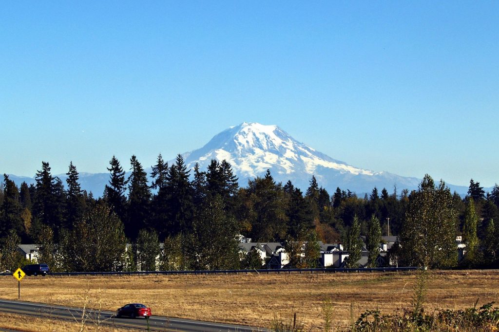
Australia is a land of extraordinary ecological diversity—from the Great Barrier Reef to the eucalyptus-dominated bushlands, from arid deserts to tropical rainforests. It is home to thousands of endemic species found nowhere else on Earth. As climate change and human activity threaten these delicate ecosystems, solar energy stands out not only as a clean alternative to fossil fuels but also as a way to protect and enhance Australia’s environmental health. Here’s how:
Reducing Greenhouse Gas Emissions and Air Pollution
Australia has historically relied on coal-fired power plants, which are among the most carbon-intensive energy sources. Installing solar systems helps reduce greenhouse gas emissions significantly. This reduction in emissions contributes to slowing down climate change, which is essential for protecting ecosystems like the Great Barrier Reef, whose coral is highly sensitive to rising sea temperatures.
Moreover, air quality benefits from the reduction in particulate matter and sulfur dioxide, which can harm both humans and wildlife—especially species like koalas and gliders that rely on clean, tree-filled environments for survival.
Mitigating Climate Change Effects on Iconic Wildlife
Australia’s unique fauna—including kangaroos, wombats, echidnas, and more—is extremely sensitive to changing environmental conditions. Rising temperatures, longer droughts, and more intense bushfires threaten the survival of many species.
Solar power contributes to mitigating these threats by reducing reliance on fossil fuels. For example, the Eucalyptus forests, vital for koalas, are under increasing stress from heat and erratic rainfall. By helping to stabilize climate patterns, solar energy indirectly supports the preservation of these habitats.
Protecting Water Resources and Aquatic Ecosystems
Unlike coal and gas plants, solar panels do not consume water for cooling purposes. This is especially significant in Australia, where water is a scarce resource and many rivers and wetlands are under threat from overuse and climate stress.
By reducing water demand, solar systems help protect fragile aquatic habitats like the Murray-Darling Basin, home to species such as the Murray cod, platypus, and numerous water birds. Healthier water systems also support agriculture and regional biodiversity.
Opportunities for Eco-Friendly Land Use
There are growing movements toward dual-use solar farms, such as agrivoltaics, which allow both electricity generation and agricultural activities on the same land. This approach benefits Australia’s rural regions, where land productivity and biodiversity conservation can go hand in hand.
Solar installations on rooftops, carports, or degraded lands prevent the need to clear native bushland, helping maintain ecosystems and preventing habitat fragmentation—an ongoing concern in Australia due to urban expansion and mining.
Combating Bushfires Through Solar Energy
Australia’s bushfires have intensified in recent years, in part due to hotter and drier conditions. Solar energy systems, especially those integrated with battery storage, support decentralised power generation. This reduces reliance on long-distance power lines, which have sometimes been implicated in fire outbreaks.
Moreover, homes and buildings equipped with solar-plus-storage systems can stay powered during grid outages, providing critical resilience in fire-prone areas.
A Path Forward for Australia’s Nature and Energy Future
The adoption of solar energy is more than a financial or technological decision in Australia—it is an ecological necessity. With its rich and delicate biodiversity, the country faces significant environmental challenges that renewable energy can help address.
From protecting the habitats of iconic marsupials to safeguarding critical water systems and reducing the frequency of devastating bushfires, solar power represents a vital tool in Australia’s path to environmental resilience. Every rooftop panel and solar farm not only cuts carbon but helps shield the very essence of what makes Australia unique.
New Zealand is world-renowned for its pristine landscapes, rugged mountains, native forests, and unique wildlife. From the kea and kiwi birds to the ancient kauri trees and glowworm-lit caves, the country’s ecosystems are both diverse and fragile. In the face of rising climate risks, habitat loss, and pollution, transitioning to clean energy sources like solar power offers New Zealand an important opportunity to protect its natural heritage.
Cutting Carbon Emissions to Preserve Native Ecosystems
New Zealand has set bold climate goals, including reaching net-zero carbon emissions by 2050. Although the country already benefits from a high share of renewable energy (mainly hydropower and geothermal), solar energy is gaining traction as a key supplement.
By installing solar panels at the residential, commercial, and farm levels, the country can reduce dependence on fossil fuels—particularly during peak hours when backup generators often rely on gas or diesel. This reduction in emissions helps slow climate change, which threatens sensitive alpine zones, coastal ecosystems, and forests like those in Fiordland and Tongariro.
Protecting Unique Wildlife from Environmental Stress
New Zealand is home to some of the world’s rarest species, such as the kiwi, takahe, and tuatara. Many of these species have no natural predators and are extremely sensitive to changes in habitat, temperature, and food availability.
Rising temperatures and shifting weather patterns caused by global emissions can impact breeding seasons, food chains, and forest health. Solar energy helps reduce these pressures, giving wildlife sanctuaries and conservation zones a better chance of maintaining stable conditions.
Reducing Pollution and Habitat Degradation
Unlike fossil fuel plants, solar installations emit no air or water pollutants. This is critical for protecting wetlands, estuaries, and river ecosystems, such as those in the Waikato and Canterbury regions, which are under stress from agricultural runoff and urban growth.
Additionally, rooftop solar allows homeowners to generate clean energy without requiring land-use change. This means native bushlands and farmlands don’t need to be cleared, helping to prevent habitat fragmentation—a key driver of biodiversity loss in New Zealand.
Supporting Eco-Friendly Farming and Rural Sustainability
New Zealand’s economy is closely tied to agriculture and rural living. Solar energy can support farmers in reducing their operational costs and carbon footprints through installations on barn rooftops, irrigation systems, or in conjunction with pasture land.
By integrating solar with regenerative farming practices, rural communities can preserve soil health and biodiversity while remaining energy-resilient—especially in remote regions with less reliable grid access.
Empowering Local Conservation through Solar Energy
Many of New Zealand’s wildlife reserves and predator-free islands are in isolated locations. Solar systems offer a sustainable energy solution for off-grid conservation efforts, such as powering field stations, cameras, and electric fences designed to keep out invasive species.
This self-sufficiency is not only more environmentally friendly but also reduces the need for diesel generators, further minimizing the environmental footprint of conservation operations.
Powering a Cleaner Future for Aotearoa
New Zealand’s ecological treasures—from ancient rainforests to rare native birds—are deeply intertwined with its cultural identity and national pride. Solar energy offers a practical and impactful way to help protect these natural assets.
By harnessing the sun, Kiwis can reduce carbon emissions, support sustainable land use, and ensure that future generations experience the same awe-inspiring nature that defines Aotearoa. Whether on a family home in Auckland, a sheep station in Otago, or a conservation site on Stewart Island, solar power is helping to secure a greener, more biodiverse New Zealand.
The United States spans a vast range of ecosystems—from the alpine forests of the Rockies and the Great Plains grasslands, to coastal marshes, arid deserts, and subtropical wetlands. Each of these regions is home to unique flora and fauna, many of which are under pressure from climate change, pollution, and habitat fragmentation. Solar energy plays a key role in mitigating these pressures, supporting a cleaner environment and healthier ecosystems.
Lowering Greenhouse Gas Emissions to Protect Regional Ecosystems
The U.S. remains one of the largest emitters of greenhouse gases globally. Although progress is being made with federal and state-level decarbonization efforts, coal and natural gas still make up a significant portion of electricity generation in several regions.
Wider adoption of residential, commercial, and utility-scale solar power reduces dependence on fossil fuels. This helps mitigate climate-driven threats such as:
Rising sea levels affecting the East Coast and Gulf Coast wetlands.
Prolonged droughts and wildfires in the western U.S., harming forests and species like the spotted owl and sage grouse.
Temperature shifts threatening alpine habitats in the Sierra Nevada and Rocky Mountains.
Reducing Air and Water Pollution
Fossil fuel plants are major contributors to smog, acid rain, and water contamination. These pollutants affect both human health and biodiversity—impacting amphibians, pollinators, and aquatic species.
Solar panels produce electricity without emitting sulfur dioxide, nitrogen oxides, mercury, or particulate matter. This makes them an essential solution for improving air and water quality in both urban and rural areas. For example:
Solar adoption in Los Angeles or Houston can reduce urban smog, benefitting respiratory health and nearby ecosystems.
In the Appalachians, solar reduces reliance on coal mining, protecting streams from toxic runoff.
Supporting Habitat Conservation and Low-Impact Land Use
Large-scale solar installations, when well-planned, can be integrated into agricultural lands, brownfields, or rooftops to avoid habitat destruction. Moreover, some solar farms now implement “pollinator-friendly” designs, seeding native plants beneath panels to support bees, butterflies, and birds.
In states like Minnesota and New York, dual-use solar initiatives (agrivoltaics) allow landowners to combine solar generation with livestock grazing or native plant restoration, minimizing ecological trade-offs.
Enabling Sustainable Living and Local Resilience
Off-grid and community solar systems are increasingly used in rural and tribal communities, empowering local energy independence while reducing the need for infrastructure that may disrupt ecosystems.
Solar-powered buildings and electric vehicle (EV) infrastructure also contribute to reduced fossil fuel consumption, helping protect landscapes like:
The Everglades, home to alligators and endangered panthers.
The Sonoran Desert, a delicate ecosystem for species like the saguaro cactus and Gila monster.
Coastal estuaries like the Chesapeake Bay, critical for fish, birds, and shellfish.
Preparing for a Climate-Stable Future by Solar Energy
By helping to curb emissions, solar energy slows global warming—a vital step to preserving sensitive species and ecological cycles.
This is especially important in climate-vulnerable areas such as:
Alaska, where melting permafrost is affecting wildlife migration and forest stability.
The Pacific Northwest, where salmon populations rely on cold, clean rivers.
The Great Lakes, where changing water temperatures impact fish and wetland systems.
Harnessing the Sun to Protect American Nature
Whether in the pine forests of Maine or the mesas of New Mexico, the U.S. is home to some of the world’s most remarkable natural environments. But these ecosystems face growing threats. Investing in solar energy is not only a climate solution—it’s a conservation strategy.
By transitioning homes, businesses, and farms to solar, Americans can contribute directly to cleaner air, healthier wildlife habitats, and more resilient communities. With smart policy and public engagement, solar energy can help ensure the country’s natural beauty and biodiversity endure for generations to come.
Canada, home to some of the world’s most pristine wilderness areas and diverse ecosystems, is uniquely positioned to benefit from a shift toward clean, renewable energy. From the boreal forests and arctic tundra to prairie grasslands and coastal temperate rainforests, each region supports fragile ecological systems increasingly threatened by climate change and pollution. Solar energy offers an opportunity to reduce environmental harm while enhancing biodiversity protection and long-term sustainability.
Reducing Emissions to Protect Vulnerable Ecosystems
Canada’s energy system is already relatively clean, especially in provinces like British Columbia and Quebec where hydroelectric power dominates. However, provinces like Alberta, Saskatchewan, and Nova Scotia still rely heavily on fossil fuels—primarily natural gas and coal—for electricity.
Expanding the use of solar panels, especially in carbon-intensive regions, helps reduce greenhouse gas emissions that contribute to:
Melting permafrost in the North, altering habitats for caribou, polar bears, and Arctic foxes.
Forest fires in British Columbia and Alberta, intensified by climate change, endangering boreal forest species like moose, lynx, and woodpeckers.
Temperature changes that affect aquatic ecosystems in the Great Lakes, harming fish populations like lake trout and walleye.
Cleaner Air and Water for Wildlife and Humans
Fossil fuel extraction and burning contribute to airborne pollutants and water contamination, especially near oil sands operations and industrial zones.
Solar power, by contrast, generates electricity without air or water pollution, leading to:
Improved air quality in urban areas such as Toronto, Edmonton, and Montreal, reducing respiratory stress on both people and animals.
Protection of freshwater ecosystems like those in Ontario and Manitoba, where acid rain and runoff currently threaten amphibians, birds, and beavers.
Encouraging Sustainable Land Use and Biodiversity
Rooftop solar and dual-use solar farms (agrivoltaics) minimize land disruption. In rural Canada, solar panels can be installed on existing structures, farm buildings, or degraded lands.
Some solar installations are designed to support pollinator habitats by incorporating native wildflowers and grasses beneath the panels, benefitting bees, butterflies, and birds—crucial for Canada’s agricultural productivity and ecosystem health.
Supporting Indigenous Communities and Remote Regions
Many First Nations and Inuit communities in Canada’s North and remote areas still rely on diesel generators, which are expensive and harmful to the environment. Solar microgrids are increasingly being deployed to:
Reduce reliance on diesel imports.
Lower health risks from air pollution.
Provide stable, autonomous energy that respects and preserves the natural environment and traditional ways of life.
Projects like those in Yukon and Northern Ontario show the transformative power of solar in strengthening community resilience and environmental stewardship.
Climate Adaptation and Biodiversity Preservation
Solar energy helps reduce Canada’s carbon footprint, slowing the pace of warming that threatens habitats for species such as:
The North Atlantic right whale along the East Coast.
The grizzly bear and mountain caribou in western Canada.
Migratory birds dependent on stable wetland and forest environments across provinces.
By mitigating climate change, solar also reduces risks of ecosystem collapse and species migration that could destabilize Canada’s biodiversity.
Solar Energy as a Stewardship Tool for Canada’s Natural Legacy
Canada’s environmental identity is deeply tied to its rich landscapes and diverse wildlife. As climate change intensifies, solar power stands out as a clean, scalable solution that not only reduces pollution and emissions but also supports ecological integrity and sustainable development.
Whether it’s an urban homeowner installing rooftop panels in Vancouver or a rural farmer in Saskatchewan participating in a community solar project, every action contributes to preserving Canada’s natural heritage. By investing in solar, Canadians can ensure a healthier, more biodiverse future for the generations to come.
Australia is one of the sunniest continents on Earth, making it an ideal location for harnessing solar energy. With government incentives and rising electricity prices, many Australians see solar as a smart long-term investment. However, like any major home upgrade, installing a solar power system isn’t without its challenges. Before jumping into solar, homeowners should be aware of the potential disadvantages, particularly those unique to the Australian context.
High Upfront Costs Despite Subsidies
Even with generous government rebates like the Small-scale Renewable Energy Scheme (SRES), the initial investment for a solar system can be substantial. A typical 6.6 kW system with a battery can cost anywhere from AUD 8,000 to AUD 15,000. While financing and green loans are available, they still add to household debt and require careful budgeting—especially for families already managing a mortgage and rising cost of living.
Grid Limitations in Regional and Remote Areas
In many rural or remote parts of Australia, the local grid infrastructure is weak or outdated. This can lead to issues with feed-in tariffs being capped or refused entirely. Some networks even limit the amount of energy that homeowners can export, which can reduce the financial return on investment for larger systems.
Performance Drops in High Heat
It’s a common misconception that hotter weather equals more solar power. In fact, excessive heat can reduce panel efficiency. In areas like Western Australia, Northern Territory, or inland Queensland, extreme temperatures can cause noticeable drops in performance during peak summer months—precisely when power is needed most.
Maintenance Challenges from Harsh Weather
While Australia enjoys abundant sun, it also contends with extreme weather: bushfires, hailstorms, cyclones, and dust storms. Solar panels may suffer damage from hail or flying debris, and salt corrosion is a risk for homes near the coast. Insurance can cover some of these issues, but premiums may rise with a solar installation.
Batteries Are Still Expensive and Complex
Home battery storage, such as the Tesla Powerwall or LG Chem, allows homeowners to store solar energy for nighttime use. However, batteries add thousands of dollars to the system and come with their own lifespans, efficiency concerns, and warranty limitations. For some households, the payback period may be too long to justify the additional cost.
Uncertain Government Policies and Feed-in Tariffs
Australian states and territories have different policies regarding solar incentives, and they change frequently. Feed-in tariffs have declined significantly over the past decade, and homeowners can no longer rely on high returns from selling excess power back to the grid. These shifts make it harder to forecast long-term savings.
Solar Energy is A Smart Choice, But Not for Everyone
For many Australian households, especially those with high daytime energy use, solar can still be a wise investment. But the benefits depend on location, roof orientation, grid access, household usage patterns, and financial flexibility. It’s crucial for prospective solar users to assess their situation carefully and speak with qualified solar installers, electricians, or financial advisors.
Before investing in solar, think beyond the sunshine and evaluate whether the long-term savings and sustainability align with your home’s characteristics and your family’s financial goals.
New Zealanders are increasingly turning to solar energy to reduce their electricity bills and embrace a more sustainable lifestyle. With a growing focus on renewable energy and energy independence, solar panels are becoming more common across Kiwi rooftops. However, there are several key considerations and disadvantages unique to the New Zealand context that homeowners should be aware of before making the investment.
High Upfront Costs and Long Payback Periods
Installing a standard residential solar system in New Zealand typically costs between NZD 8,000 and NZD 15,000. Without a nationwide subsidy scheme or feed-in tariff like those in Australia or the UK, the financial return can be slower. Depending on usage and system size, the payback period can range from 10 to 15 years, which may be longer than some homeowners expect or prefer.
Limited Government Support for Solar Energy
Unlike many countries, New Zealand does not offer a national solar incentive or rebate programme. Some local councils may provide low-interest loans or sustainability grants, but they are not widely available. This lack of policy support means homeowners must shoulder most of the initial financial burden on their own.
Weather Variability and Less Sunlight in Winter
While New Zealand receives a decent amount of sunshine annually, the weather can be highly variable. In areas like Wellington or the West Coast of the South Island, frequent cloud cover, rain, and shorter winter days significantly reduce solar output. Seasonal variability can make solar systems less effective at offsetting winter electricity bills.
Low Buy-Back Rates for Excess Power
Most New Zealand energy retailers offer buy-back rates for surplus electricity exported to the grid, but the rates are low—often between 7 and 12 cents per kWh. This is much lower than the retail rate for electricity (25–35 cents/kWh), meaning the financial return on exporting power is minimal. This discourages over-sizing systems and makes battery storage less appealing from a cost perspective.
Roof Orientation and Shading Challenges
Many older New Zealand homes were not built with solar in mind. Roofs may not be ideally oriented to the north (in the southern hemisphere), or may have multiple pitches and obstructions like chimneys and trees, which limit panel placement and reduce efficiency. Retrofitting solar onto these homes can be more complex and costly.
Battery Storage Still Expensive
While interest in home batteries is growing—especially among off-grid or semi-rural households—storage systems are still expensive and can double the cost of a solar setup. Battery technology is also rapidly evolving, meaning today’s investment may become outdated within a few years.
Weighing the Long-Term Benefits Against the Costs
Solar power in New Zealand holds promise, especially for environmentally conscious homeowners looking to reduce grid reliance and carbon footprints. However, without strong government incentives and due to specific climatic and structural challenges, solar is not a one-size-fits-all solution. Homeowners should carry out detailed cost-benefit analyses, consider long-term electricity usage patterns, and consult with qualified installers to determine whether solar energy is a wise investment for their property and lifestyle.
Solar energy is widely promoted across the United States as a clean, cost-saving solution for homeowners. Federal tax credits, state incentives, and decreasing panel costs have contributed to a rapid rise in solar adoption. Yet, the picture isn’t entirely sunny. Homeowners should be aware of several disadvantages that vary depending on location, financial situation, and housing type.
High Upfront Costs and Financing Complexities
While prices for solar panels have dropped significantly over the last decade, the average upfront cost of a residential system still ranges from $12,000 to $25,000 before incentives. Even with federal tax credits (currently 30%), many households—especially in lower income brackets—struggle to manage the initial outlay. Financing options exist, but some involve complex lease or Power Purchase Agreements (PPAs) that can limit long-term savings or affect home resale.
Policy Patchwork and Incentive Uncertainty
Solar adoption in the U.S. is heavily influenced by state and local policies, which can vary drastically. States like California and Massachusetts have strong incentives, while others like Alabama or West Virginia offer little to no support. Additionally, some incentives, such as net metering programs, are under political threat or being rolled back, causing uncertainty for future savings.
Sunlight Variability by Region
Solar energy performance depends heavily on geographic location. States in the Southwest like Arizona or Nevada enjoy abundant sun and short payback periods. However, states in the Northeast or Pacific Northwest face frequent cloud cover and long winters, reducing solar efficiency. Even within sunny states, microclimates and local shading can limit output.
Grid Limitations and Export Compensation Issues
Utilities in some states are pushing back on net metering, reducing the amount homeowners are credited for exporting excess energy. For instance, California’s NEM 3.0 policy significantly cut daytime export rates, decreasing expected savings. In other regions, technical constraints on the grid can delay or limit new solar installations.
Installation Barriers in Rental Units and Apartments
Around 35% of Americans live in rental housing or multi-unit dwellings, where installing solar panels is not a feasible option. Community solar programs are expanding, but access and enrollment are limited and often regionally constrained.
Maintenance, Roof Suitability, and Insurance for Solar Energy
While solar systems require minimal maintenance, issues such as roof repairs, inverter replacements, or storm damage can be costly. Some homes, especially older ones, may not have suitable roof angles or space. In certain states, insurance policies may require additional coverage or have specific stipulations for homes with rooftop solar.
Proceed with Eyes Wide Open
Solar power remains a strong long-term investment for many American homeowners, especially in regions with supportive policies and high electricity rates. However, the financial and practical downsides—like high initial costs, uneven policy environments, and location-based efficiency—should not be underestimated. Homeowners are encouraged to evaluate their personal energy usage, local incentives, and home structure before making the leap.
While Canada is known for its cold winters and vast landscapes, solar energy adoption is on the rise, particularly in provinces like Ontario and British Columbia. The potential for solar energy in Canada is significant due to the country’s vast land area and exposure to sunlight during summer months. However, there are several challenges to consider, especially when it comes to the colder climates, economic realities, and regional policies.
High Upfront Costs and Long Payback Periods
Despite the global reduction in solar panel prices, the initial investment for solar systems in Canada can still be high. The cost for an average residential system can range between CAD $10,000 to CAD $20,000, which can be burdensome for homeowners, especially considering the relatively long payback periods—often 15 to 25 years—due to Canada’s lower average energy prices compared to other countries. Even though federal and provincial incentives are available, the initial financial commitment remains substantial for many Canadians.
Solar Energy Production in Winter
One of the biggest challenges for Canadians considering solar power is the severe winter weather. In provinces with long, harsh winters like Alberta, Manitoba, and parts of Quebec, solar panels may be covered by snow for weeks or even months at a time. During these months, solar energy production can drop dramatically. Even though Canada benefits from long daylight hours in summer, the short days and low sunlight during winter can offset the energy generation potential, especially in northern regions.
Geographic and Climatic Variability
Canada’s geographic diversity poses challenges for solar energy. While provinces like Ontario, British Columbia, and Nova Scotia have considerable solar potential due to moderate climates and higher sun exposure, northern territories and parts of Quebec have limited solar viability. In these areas, the amount of sunlight available to solar panels, especially in winter, is significantly reduced. This creates uneven access to solar energy based on location.
Slow Adoption of Net Metering and Low Compensation for Excess Energy
In Canada, the compensation for excess solar energy fed back into the grid can be limited. Some provinces like Ontario have strong net metering programs, but these can vary widely across regions. For example, Alberta does not have a strong net metering policy, which can affect the financial returns of solar system owners. In provinces where compensation for exported energy is low, homeowners may not see the anticipated returns on their investment. In some cases, homeowners may end up paying more for their solar systems than they save through energy export.
Roof Space Limitations in Urban Areas
In densely populated cities like Toronto and Vancouver, many homes are located in urban environments where roof space is limited, and buildings are often too close together. For these homeowners, installing solar panels on the roof might not be an option. Although community solar programs are growing in popularity, they are not yet widespread, and access to shared solar installations can be limited.
Installation and Maintenance Costs in Remote Areas
For homeowners in remote or rural parts of Canada, installation and maintenance costs can be higher due to the logistics involved. Shipping and installing solar systems in remote locations add additional expenses, making the upfront costs even higher. Moreover, if systems require maintenance or repairs, the distance from major service centers can result in higher service fees and longer wait times for repairs.
Weighing the Pros and Cons
While solar energy offers a promising alternative in Canada, especially for environmentally-conscious homeowners, it’s crucial to weigh the potential benefits against the financial, geographic, and climatic challenges. The high initial costs, regional variability in energy production, and limited compensation for excess energy can impact the financial feasibility for many Canadians. However, in areas with ample sunlight and strong incentives, solar systems can still provide substantial long-term savings and environmental benefits.
Manage Cookie Consent
We use technologies like cookies to store and/or access device information. We do this to improve browsing experience and to show personalized ads. Consenting to these technologies will allow us to process data such as browsing behavior or unique IDs on this site. Not consenting or withdrawing consent, may adversely affect certain features and functions.
Functional
Always active
The technical storage or access is strictly necessary for the legitimate purpose of enabling the use of a specific service explicitly requested by the subscriber or user, or for the sole purpose of carrying out the transmission of a communication over an electronic communications network.
Preferences
The technical storage or access is necessary for the legitimate purpose of storing preferences that are not requested by the subscriber or user.
Statistics
The technical storage or access that is used exclusively for statistical purposes.The technical storage or access that is used exclusively for anonymous statistical purposes. Without a subpoena, voluntary compliance on the part of your Internet Service Provider, or additional records from a third party, information stored or retrieved for this purpose alone cannot usually be used to identify you.
Marketing
The technical storage or access is required to create user profiles to send advertising, or to track the user on a website or across several websites for similar marketing purposes.